Introduction
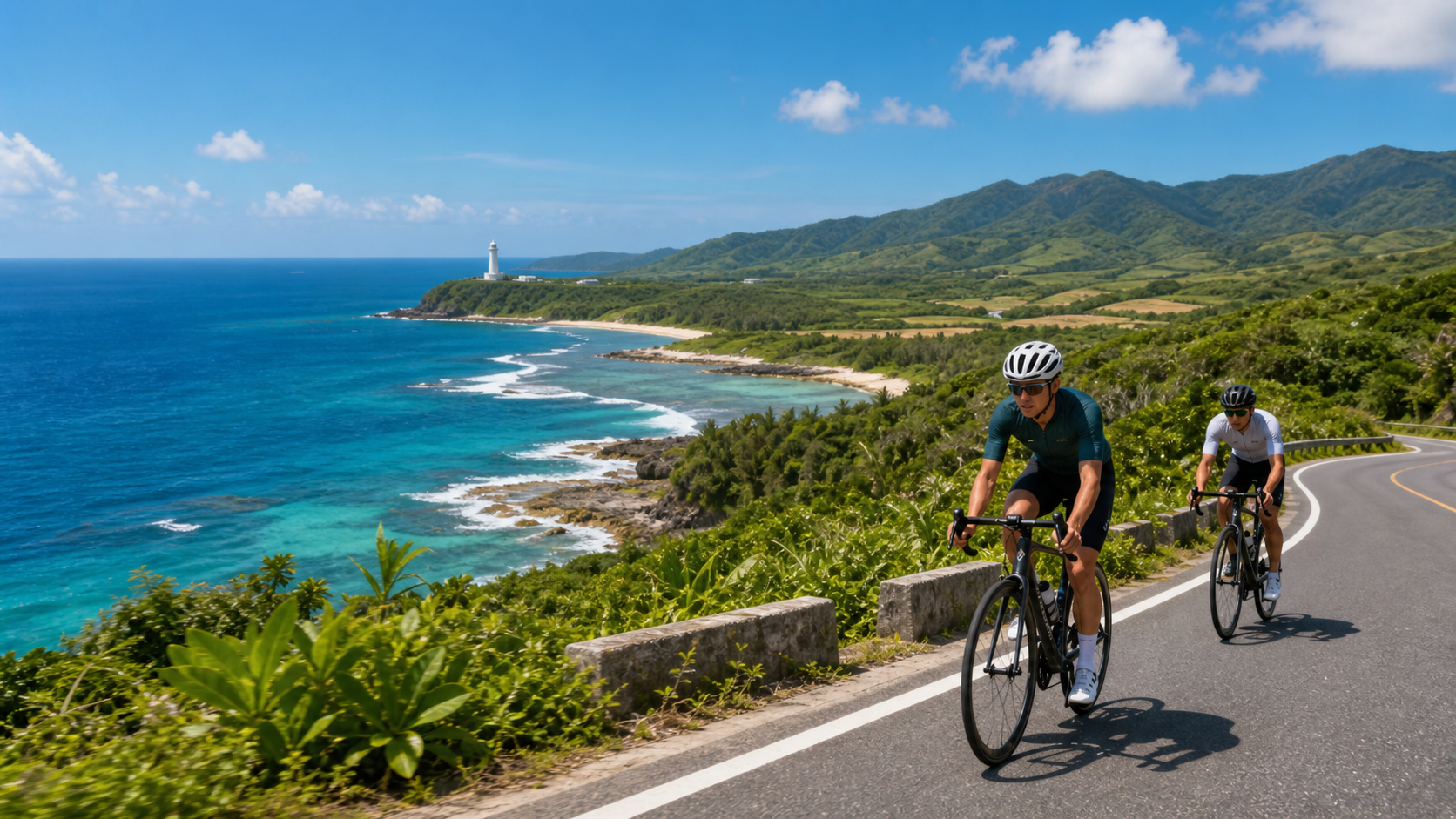
The Hengchun Peninsula at Taiwan’s southernmost tip boasts a tropical monsoon climate rarely seen on the main island. From October to March each year, while the wet and chilly winter blankets northern Taiwan, Kenting remains bathed in sunshine with pleasant temperatures. For cyclists, this isn’t just a tropical resort destination—it’s a coastal cycling paradise where you can stretch your legs under the open sun.
Peninsula Loop Route Planning
| Section | Distance | Terrain | Key Landmarks |
|---|---|---|---|
| Checheng → Hengchun City | Approx. 10 km | Flat | Hengchun Old City, Zhukeng |
| Hengchun → Kenting Street | Approx. 8 km | Gentle climb | Kenting National Forest Recreation Area |
| Kenting → Eluanbi | Approx. 6 km | Gentle | Eluanbi Lighthouse (Taiwan’s southernmost point) |
| Eluanbi → Jialeshui | Approx. 10 km | Rolling hills | East coast reef rock formations |
| Jialeshui → Fengchuisha → Checheng | Approx. 20 km | Flat / gently rolling | Longluan Lake, Fengchuisha sand dunes |
| Full Loop | Approx. 54 km | Mixed terrain | Approx. 350 m elevation gain |
Hengchun Old City: A Dose of History Before Departure
Hengchun is home to one of Taiwan’s best-preserved Qing Dynasty walled cities. All four city gates still stand intact, and cycling the loop around the old city walls takes just ten minutes—yet it feels like traveling through a century of history. Inside the old city, you’ll find a morning market and local snacks. The film Cape No. 7 put Hengchun back in the national spotlight, and the former home of the protagonist Aga has become a pilgrimage site for movie fans.
The Hengchun market offers a rich selection of breakfast options. It’s recommended to fuel up here before setting off toward Kenting.
Kenting Street to Eluanbi: Sunshine and Reef Rocks
Kenting Street is the busiest tourist commercial district in southern Taiwan. Traffic is heavy during the day, so it’s best to pass through quickly outside peak hours and head straight for Eluanbi. Inside Eluanbi Park stands Taiwan’s southernmost lighthouse—a white lighthouse built in 1882, standing 21 meters tall and still in operation today. Along the reef coast beside the lighthouse, you can watch the waves where the Bashi Channel meets the Pacific Ocean—a spectacular view.
Continuing east, turn onto the east coast along Provincial Highway 26. The road begins to roll, but the coral reef terrain, azure waters, and sparse traffic make this stretch the most beautiful riding experience of the entire loop.
Jialeshui: A Hidden Reef Gem on the East Coast
The Jialeshui Scenic Area is renowned for its “water-eroded rock” formations. The honeycomb cavities and sea stacks carved into the reef by years of wave action are a textbook-level display of Taiwan’s coastal geology. Allow about thirty minutes to park and stroll the reef boardwalk; it’s also a good spot to refill water (there’s a shop at the entrance).
Longluan Lake and Fengchuisha: Natural Surprises on the Return
Heading north from Jialeshui along Provincial Highway 26 and onto County Road 153, you’ll pass the Longluan Lake Nature Reserve—an important habitat for migratory birds. Every winter, large numbers of migratory birds stop over here, and as you ride through slowly, you’ll often spot egrets and grey herons foraging leisurely by the water’s edge. About five kilometers further north, Fengchuisha features one of Taiwan’s rare dune terrains. Strong downslope winds blow fine sand into the sea, creating a unique natural landscape. This is also the section of the entire loop with the most intense “luoshan wind” (falling wind), so be mindful of the wind direction when riding.
Practical Tips
Wind Considerations
- During winter (November to March), the Hengchun Peninsula frequently experiences strong downslope winds, with gusts reaching over 10 m/s. You’ll need to significantly reduce speed on headwind sections. It’s recommended to ride clockwise (north → east → south → west) to make the most of tailwind stretches.
Supply Points
- Supplies are available in Hengchun City, Kenting Street, the Eluanbi Park entrance, and the Jialeshui entrance.
- Supply points are scarce between Longluan Lake and Checheng, so it’s advisable to stock up on water at Jialeshui.
Best Season
- November through April offers abundant sunshine and stable weather—the golden season for cycling in southern Taiwan.
- Summer (June–September) is hot and sweltering; set off at 5–6 AM to avoid the midday heat.
Gear Reminders
- Sun protection: UV rays in Kenting are intense. A long-sleeve cycling jersey and SPF 50+ sunscreen are absolutely essential.
- Wind protection: Winter downslope winds are strong, so pack a windbreaker.
Conclusion
The Kenting Peninsula Loop is the island-end journey most worth planning for Taiwan’s road cyclists. Pedaling past the old city, through the jungle, around the lighthouse, and into the sea breeze—every facet of the peninsula offers riders a different emotional gift. When the sunset paints the west coast in shades of orange-red, that’s Kenting’s most tender farewell to every cyclist who visits.
Related Reading
- Kenting Peninsula Cycling Loop: Sunshine, Sea Breeze, and Slow Riding in Southern Taiwan
- Kenting Peninsula Loop: The Complete Guide to Southern Taiwan’s Wind and Coastline
- Kenting Peninsula Bike Route: A Coastal Ride Around Taiwan’s Southernmost Point
- Pingtung Hengchun Peninsula Loop: A Coastal Cycling Route from Eluanbi Lighthouse to Kenting
大武山後門26%歡樂陡坡!JJSC南台灣單車行Day2 / 被颱風追著跑 / 公路車 / CT Yeh
2 年前
#墾丁 #單車 微蜜月旅行 | 社頂公園絕景 | 恆春 鵝鑾鼻公園
6 年前
山道猴出沒!? JJSC屏東單車行 Day1 一直催 / 皮卡丘來了!/ 墾丁 旭海 恆春 社頂 / 公路車 / CT Yeh
2 年前
微東進 太魯閣 蘇花 單車兩日遊 ! 颱風過後路況超刺激 行程大亂 | 最狂的鹹酥雞訂單 | CT Yeh | 4K 高畫質空拍絕景!
4 年前
觀霧 變好騎了! | 北高車友爆笑大會師 | 公路車 | 單車旅遊 Taiwan Cycling Route GuanWu
6 年前
單車 一日北高 ( 雙城 ) 肥宅雙人瘋狂行 紀錄片 REACTO
10 年前
大武山20%魔王陡坡【JJSC南台灣遊騎Day2】!屁股真的要裂開了...凡士林抹滿也沒用?神秘金教堂還有超便宜夜市
3 個月前
半日 小台灣 極限單車路線挑戰實錄
7 年前