Introduction
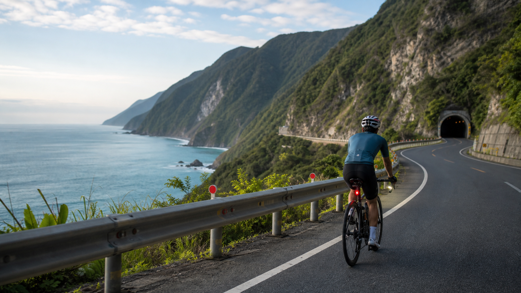
The Suhua Highway runs from Su’ao in the north to Hualien in the south, stretching approximately 118 kilometers. Along the way, sheer cliffs hug the Pacific Ocean, and the majestic coastal views leave every rider with an unforgettable impression. However, behind this route’s beauty lie considerable challenges: high-speed vehicles, narrow tunnels, steep climbs, and the risk of falling rocks make the Suhua Highway one of the routes on Taiwan’s cycling map that demands the most careful planning.
In recent years, the Taiwanese government has progressively completed sections of the Suhua Improvement Project (Suhua Highway Safety Improvement Project). The opening of new tunnels has improved conditions on some stretches, but the classic sections of the original Suhua Highway remain, allowing riders to enjoy that unparalleled Pacific Ocean scenery.
Route Overview and Section Breakdown
The Suhua Highway can be divided into three major sections, each with its own riding characteristics:
| Section | Distance | Highlights | Difficulty |
|---|---|---|---|
| Su’ao → Nan’ao | Approx. 28 km | First section with mountain climbs and many tunnels | ★★★☆☆ |
| Nan’ao → Heping | Approx. 35 km | The most spectacular coastal cliff section | ★★★★☆ |
| Heping → Hualien | Approx. 55 km | Relatively flatter, closer to the city | ★★☆☆☆ |
Nan’ao to Heping is the soul of the Suhua Highway. This stretch extends along the cliffs, with the deep blue Pacific lying hundreds of meters below. Qingshui Cliff—Taiwan’s largest sea-eroded cliff—is located along this section, and its grandeur is truly breathtaking.
Core Safety Riding Strategies
Safety concerns on the Suhua Highway are by no means exaggerated; traffic accidents occur every year. The following principles are mandatory for every rider tackling the Suhua:
Tunnel Riding Strategy
- Before entering a tunnel, be sure to turn on a powerful rear light (a flashing mode of at least 200 lumens is recommended) and a front headlight
- Stay close to the white line on the right side, maintaining a steady, straight line
- Some older tunnel surfaces are slippery—reduce speed accordingly
- Bicycles are prohibited in the new Suhua Improvement tunnels; use the parallel old Provincial Highway 9 sections instead
Dealing with Traffic
- Large trucks and gravel haulers are frequent on Provincial Highway 9; when you hear the sound of a large vehicle’s engine, proactively move to the side and let it pass
- Avoid occupying the center of the lane on hairpin turns or in areas with poor visibility
- It is recommended to equip a rearview mirror or a radar tail light (such as the Garmin Varia)
Departure Time
- The best window is 6–9 AM, when traffic is lightest and lighting is optimal
- Avoid departing after 2 PM; the southerly wind strengthens in the afternoon and traffic increases
- Traffic is noticeably heavier on weekends; if possible, choose a weekday for your ride
Route Planning Recommendations
One-Day Itinerary (suitable for riders with a training base)
- Depart from Su’ao, Yilan at 5:30 AM
- Expected arrival in Hualien City between 2–3 PM
- Allow approximately 8–10 hours total (including rest and refueling stops)
Two-Day Leisurely Itinerary (suitable for general riders)
- Day 1: Depart from Su’ao, lunch break in Nan’ao, stay overnight in Heping or Chongde
- Day 2: Depart from Heping, stop for photos along the way, arrive in Hualien in the afternoon
Refueling Point Distribution
- Su’ao: Fill up on water and food before departure
- Nan’ao: Convenience stores available; lunch options
- Heping: Small eateries near the gas station; good for resupply
- Chongde: Last refueling point before entering Hualien City
Practical Tips
- Best seasons: March–May (stable spring sunshine) and October–November (crisp autumn weather); summer typhoon season carries higher risk
- Check the Directorate General of Highways website before departure to confirm road conditions; closures may occur during rockfall season
- Keep your phone reachable during the ride and inform family or friends of your itinerary
- Consider joining Taiwanese cycling communities; many riders are willing to form groups for the ride
- Hualien City has several bike-friendly guesthouses; book in advance
Conclusion
The gift the Suhua Highway gives to riders is a sense of awe that lingers long after the ride is over. The deep blue of the Pacific, the grandeur of the cliffs, the salty taste of the sea breeze—these sensory memories travel back with riders to the flatlands, becoming treasured experiences to savor again and again. With thorough safety preparations, the Suhua Highway will be one of the most rewarding routes to check off your Taiwan cycling list.
Related Reading
- Suhua Highway Riding Report: Cliff Scenery and Safety Riding Precautions
- Eastern Coastal Section: Challenges and Safe Riding Guide for the Suhua Highway
- Suhua Highway Cycling Adventure: The Ultimate Riding Experience on the Pacific Cliffs
- Suhua Highway Cycling Challenge: The Complete Guide to Riding the Coastal Highway from Su’ao to Hualien
微東進 太魯閣 蘇花 單車兩日遊 ! 颱風過後路況超刺激 行程大亂 | 最狂的鹹酥雞訂單 | CT Yeh | 4K 高畫質空拍絕景!
4 年前
單車環島 蘇花公路精彩片段
10 年前
大武山後門26%歡樂陡坡!JJSC南台灣單車行Day2 / 被颱風追著跑 / 公路車 / CT Yeh
2 年前
嘉義大埔、阿婆灣挑戰賽,美到以為在日本!ft. 環騎5 Cool 西拉雅188 / 公路車 / CT Yeh
7 個月前
半日 小台灣 極限單車路線挑戰實錄
7 年前
台北闊瀨陡坡 騎旅 / 日本單車雜誌編輯車友臨時加入!/ 髮香才是最強的 / feat. 北迴歸線小隊 / 公路車 CT Yeh
6 個月前
大武山20%魔王陡坡【JJSC南台灣遊騎Day2】!屁股真的要裂開了...凡士林抹滿也沒用?神秘金教堂還有超便宜夜市
3 個月前
#北橫 + #北進武嶺 最硬的員工旅遊 EP1 | #公路車 #拉拉山 | 明池 | 武嶺 | 武陵農場 | 雲海 | Taiwan Cycling Route Wulin
6 年前