Introduction
The coastline from Pingtung to Taitung in southern Taiwan is a stretch etched deep in the memory of many island-circumnavigating cyclists. This route runs along the Pacific coast, where mountains press close to the shore and the highway is wedged between cliffs and crashing waves, creating a breathtaking landscape. Starting from Fangliao in Pingtung, heading south on Provincial Highway 9, turning onto Provincial Highway 26, passing through Fenggang and looping over the South Link Highway before rejoining the Taitung coast, the full distance is approximately 110 kilometers—a signature southern Taiwan route that combines a sense of adventure with magnificent ocean views.
Route Segment Breakdown
| Segment | Route | Distance | Highlights |
|---|---|---|---|
| Fangliao→Fenggang | Provincial Highway 1/Provincial Highway 9 | Approx. 30 km | Plains farmland, Linbian Wetlands |
| Fenggang→Xuhai | Provincial Highway 26 | Approx. 35 km | Coastal cliffs, Maanshan Nuclear Power Plant views |
| Xuhai→Daren | County Road 199A | Approx. 20 km | Mountain indigenous villages |
| Daren→Zhiben | Provincial Highway 9 South Link Section | Approx. 25 km | Mountain-sea boundary, Zhiben Hot Springs |
Fenggang to Xuhai (Provincial Highway 26)
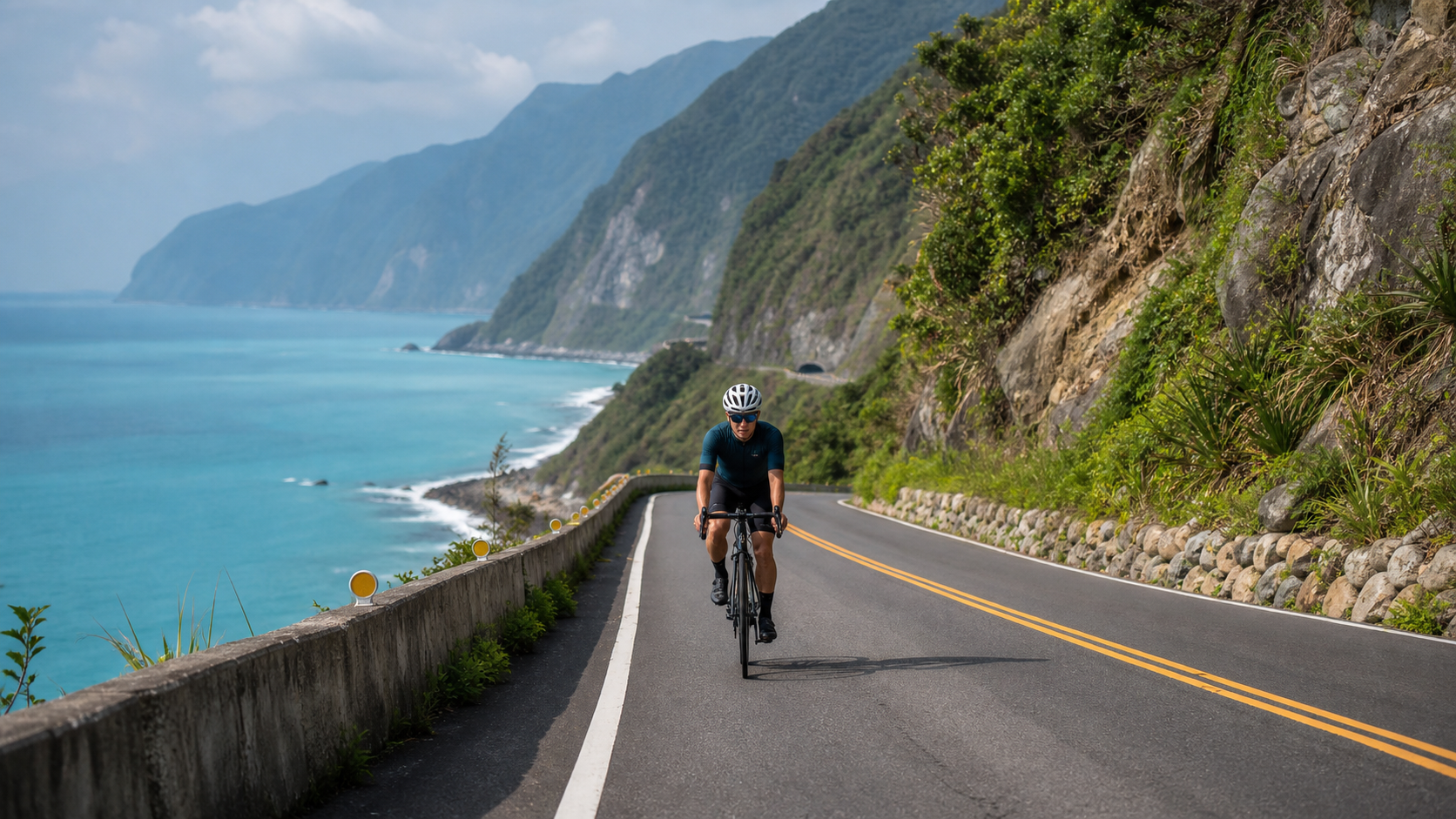
This stretch is called by many cyclists “one of Taiwan’s most beautiful coastal highways.” Provincial Highway 26 hugs the Pacific Ocean, with azure waters on the left and the southern foothills of the Central Mountain Range on the right. The circular structures of the Maanshan Nuclear Power Plant appear faintly in the distance, becoming a distinctive landmark of this stretch.
Xuhai Village is the last settlement on the South Link coast and the northern trailhead of the Alangyi Ancient Trail. The Alangyi Ancient Trail is one of the few footpaths in Taiwan that preserves the original coastal landscape. Bicycles cannot enter, but stopping here briefly to feel the wilderness atmosphere at the trailhead is a necessary pause.
Xuhai Crossing the Mountains to Taitung (County Road 199A to Provincial Highway 9)
From Xuhai, turn onto County Road 199A heading east, passing through the Paiwan indigenous communities of Mudan Township. The climbing is noticeable on this stretch, rising from near sea level to approximately 500 meters, requiring a solid reserve of physical fitness. Along the way, you can see Paiwan slate-house villages, with Mount Taimali clearly visible in the distance.
After rejoining Provincial Highway 9 on the South Link Highway, a gentle 25-kilometer descent begins, ending at Zhiben in Taitung. Zhiben is renowned for its hot springs, and soaking in one after the ride is the perfect finale.
Safety Considerations for Coastal Cycling
Provincial Highway 26 and the South Link corridor are relatively remote areas where emergency response times are longer, making safety preparations especially important:
- Mobile phone signal: Signal is weak on parts of the Fenggang to Xuhai section; it is recommended to inform family and friends of your itinerary
- Supply intervals: There are no shops for approximately 20 kilometers between Xuhai and Daren; you must carry sufficient food and water
- Wind effects: Southern Taiwan experiences strong winds year-round, especially during the winter northeast monsoon season (November to March), when crosswinds can reach force 7–8, making riding difficult
- Traffic volume: The South Link Highway (Provincial Highway 9) has heavy truck traffic, and night riding carries high risk; daytime riding is recommended
Attractions and Supplies Along the Way
- Fangliao Fishing Harbor: Tuna dishes—a hearty breakfast option before departure
- Checheng Fuan Temple: Taiwan’s largest temple dedicated to the Earth God; a good spot for a short rest
- Xuhai Hot Springs: A low-key hot spring area where you can soak your feet and relax
- Hotel Royal Chihpen Hot Springs: A hot spring treat at the finish line; advance reservation required
Practical Tips
- Direction of travel: Riding from north to south is recommended, allowing tailwinds in winter; in summer, riding from south to north takes advantage of the southwest monsoon tailwinds
- Bike choice: Both road bikes and touring bikes work well; tires of 28c or wider are recommended
- Accommodation planning: Xuhai has homestays for overnight stays, making it suitable for splitting the route into a two-day, one-night itinerary
- Seasonal advice: Spring and autumn (March–May, September–November) offer moderate winds and comfortable temperatures, making them the best riding seasons
Conclusion
The route from Fangliao, Pingtung to Zhiben, Taitung is one of the most unforgettable segments of Taiwan’s island-circumnavigation routes. The Pacific Ocean is right beside you, the mountains are at your back—you are not just riding a highway, but a page in Taiwan’s geographic epic. If you can only choose one route in southern Taiwan, this Pacific coastal highway deserves your top priority.
Related Reading
- South Link Highway Section: The Mountain-Sea Boundary Experience from Taitung to Pingtung
- Southern Taiwan Cycling: Tropical Scenery Bike Routes in Pingtung and Kenting
- Southern Segment of Taiwan’s Cycling Island Loop: Tropical Riding Experience from Pingtung to Taitung
- Pingtung Kenting Peninsula Route: Southern Taiwan Charm Riding Along the Coast from Fangliao to Eluanbi
山道猴出沒!? JJSC屏東單車行 Day1 一直催 / 皮卡丘來了!/ 墾丁 旭海 恆春 社頂 / 公路車 / CT Yeh
2 年前
嘉義大埔、阿婆灣挑戰賽,美到以為在日本!ft. 環騎5 Cool 西拉雅188 / 公路車 / CT Yeh
7 個月前
藤枝二集團 單車行 Day1 | 南部小武嶺 | 爬坡爬到罵罵叫 | JJSC | 公路車 | CT Yeh
3 年前
大武山20%魔王陡坡【JJSC南台灣遊騎Day2】!屁股真的要裂開了...凡士林抹滿也沒用?神秘金教堂還有超便宜夜市
3 個月前
觀霧 變好騎了! | 北高車友爆笑大會師 | 公路車 | 單車旅遊 Taiwan Cycling Route GuanWu
6 年前
日本島波海道 EP1 / 五大絕景路線之一! / 私房溫泉 x 豪華單車客棧 / 今治 to 大三島 / 公路車 / CT Yeh
2 年前
大武山後門26%歡樂陡坡!JJSC南台灣單車行Day2 / 被颱風追著跑 / 公路車 / CT Yeh
2 年前
虎豹潭!日本老師來台一日約騎 台灣車友熱情招待私房路線 / CT Yeh
20 天前