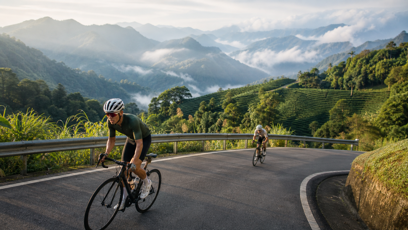
Alishan Highway in Chiayi: Complete Guide to the Long Climb from Zhuqi to Alishan
Introduction
Several roads in Taiwan hold legendary status in the cycling community, and the Alishan Highway (Provincial Highway 18) is undoubtedly near the top of the list. Starting from Chiayi City, the route climbs eastward along Provincial Highway 18, passing through Zhuqi, Fenqihu, and Shizhao before finally reaching the Alishan National Scenic Area—approximately 74 km in total with over 2,100 meters of cumulative elevation gain. This is not just a climbing route; it is the most magnificent mountain cycling journey in southern Taiwan.
The challenge of the Alishan Highway lies in its sustained, long-distance climbing with no flat recovery sections—from start to finish, it is almost entirely uphill. But precisely because of this, it tests not only physical strength but also mental endurance and passion for riding.
Route Segment Breakdown
| Segment | Distance | Elevation | Climb | Features |
|---|---|---|---|---|
| Chiayi City → Zhuqi | 14 km | 0→80 m | 80 m | Flat start section |
| Zhuqi → Fenqihu | 28 km | 80→1,403 m | 1,323 m | Main climbing section |
| Fenqihu → Shizhao | 16 km | 1,403→1,700 m | 297 m | High-mountain tea country |
| Shizhao → Alishan | 16 km | 1,700→2,216 m | 516 m | Cloud forest zone |
Detailed Breakdown of Key Sections
Zhuqi to Fenqihu (Core Challenge Segment)
This is the most critical climbing section of the entire route—over 1,300 meters of elevation gain within 28 km, with an average gradient of about 5%, though some sections reach 8–10%. The road winds upward along the valley of a tributary of the Nanzixian River, offering open views across the Chianan Plain. This section tests your pacing ability; many riders tend to push too hard here out of eagerness, exhausting their energy for the later stages.
Fenqihu Rest Stop
At 1,403 meters above sea level, Fenqihu is the most important midway resupply point on the entire route. This historic mountain town is famous for the Alishan Forest Railway, and the bento boxes, desserts, and hot drinks in the old street are the greatest reward during the climb. It is recommended to rest here for at least 30 minutes, replenishing carbohydrates and electrolytes to prepare for the second half.
Shizhao Tea Country Section
After entering Shizhao, tea plantations stretch continuously along the roadside. This is a major production area for Taiwan’s high-mountain tea—Alishan oolong tea is grown and harvested in this region. If time permits, stop at a roadside tea farmer’s direct-sale shop for a tasting; a cup of high-mountain tea will instantly dissolve the fatigue of the climb.
Final Climb to Alishan
On the final 16 km from Shizhao to Alishan, you enter the cloud belt where temperatures drop noticeably and mist swirls around. The road surface is occasionally damp, requiring extra caution on descents. When you reach the entrance of the Alishan National Scenic Area, the exhaustion throughout your body will transform into a deep sense of accomplishment.
Essential Preparations
Training Recommendations
- Before tackling the Alishan Highway, it is recommended to have a training foundation of climbing over 1,000 meters continuously in a single ride.
- It is advisable to complete warm-up training first at Wuling in Taichung (advanced) or Yangmingshan in Taipei (beginner).
Equipment Checklist
- Lightweight climbing bike (recommended minimum cassette size of 32T or larger)
- Warm clothing (temperatures on Alishan are 10–15°C lower than on the plains)
- Ample supplies (at least 4 energy bars or gels)
- Headlight (if planning an early-morning departure)
- Spare inner tubes (the mountain roads have plenty of gravel)
Resupply Points Overview
- Chiayi City: final resupply before departure
- Zhuqi: convenience stores
- Fenqihu: old street snacks and drinks
- Shizhao: tea farmer direct-sale shops, small grocery stores
- Alishan: restaurants near the visitor center
Practical Tips
- Departure Time: It is recommended to depart at 5:00 AM, using the coolest part of the day to complete the main climb and arriving at Alishan before noon.
- Descent Caution: The descent is 74 km long, with high speeds and numerous curves. Be sure to alternate between front and rear brakes throughout to avoid overheating.
- Best Season: March to May and September to November, avoiding the landslide risks of the plum rain season and typhoon season.
- Accommodation Options: If you do not plan to return the same day, there are multiple lodging options on Alishan—you can book a stay and watch the sunrise the next day before descending.
Conclusion
The Alishan Highway is a route that demands respect. Its length and elevation gain do not allow you to take it lightly, but with proper preparation, you will be rewarded with the most breathtaking mountain cycling experience on Taiwan’s roads. Departing from the heat of the Chiayi plains, passing through bamboo forests, tea country, and cloud forests, and finally standing above the sea of clouds on Alishan—this is a fantastical journey that vertically traverses Taiwan’s landscapes, one worthy of being etched into every serious cyclist’s riding history.
Related Reading
- Alishan Highway in Chiayi (Provincial Highway 18): The Climbing Challenge from the Plains to the Clouds
- Alishan Highway Cycling Challenge: Climbing Guide from Chiayi to Alishan
- Alishan Highway Cycling in Chiayi: The Classic Climb from Zhuqi to Fenqihu
- Alishan Highway (Provincial Highway 18) Riding Guide: The Pilgrimage Road from Chiayi to Alishan
半日 小台灣 極限單車路線挑戰實錄
7 年前
梅山36彎 奮起湖 單車挑戰 下集 #公路車
6 年前
一定要騎一次!阿里山最深處:里佳部落!單車旅行 | 2800m爬升 | 深度部落體驗:嗨翻晚會、螢火蟲、銀河 | feat. JJSC & 廢物伙伴 | 公路車 CT Yeh
9 個月前
4K單車實境) 嘉義 梅山36灣 訓練台 爬坡 輕鬆騎
6 年前
阿里山塔塔加 兩倍特濃版!全新隧道開通! 進喔!公路車 | CT Yeh
3 年前
里佳部落 阿里山單車深度旅遊! | 竹山/草嶺/來吉/奮起湖 | 無敵銀河絕景 全新路線探索! 驚險狀況百出! | 4K沉浸式畫質 | 公路車 | CT Yeh
3 年前
嘉義單車路線推薦:碧湖山茶園超陡坡挑戰!里佳部落-奮起湖-瑞峰 (附路線)
7 個月前
那瑪夏x茶山 阿里山系深山單車行 Day2 累積爬升6000M | 🥶超陡連續下坡 整路看隊友刷 | 爬升一座西進武嶺 | JJSC | 公路車 | CT Yeh
3 年前