Taiwan's Hundred Peaks Surrounding Highway Routes: The High Mountain Scenic Route from Wushe to Cingjing Farm
Introduction
Provincial Highway 14A starts in Wushe, Nantou County, climbs southeast through Cingjing Farm, and finally reaches the summit of Wuling (3,275 m)—the highest point on Taiwan’s road network and one of the very few high-altitude highway routes in Asia that can be completed by bicycle. From Wushe (about 1,100 m) to Wuling, the full distance is roughly 22 km with over 2,100 m of cumulative climbing, making it the ultimate challenge among Taiwan’s cycling climb routes. This article focuses on the advanced section from Wushe to Cingjing Farm, while also providing extended information on the Wuling summit.
Route Basic Information
| Item | Wushe→Cingjing Farm | Cingjing→Wuling Summit |
|---|---|---|
| Distance | Approx. 9 km | Approx. 13 km |
| Starting Elevation | 1,148 m | 1,750 m |
| Ending Elevation | 1,750 m | 3,275 m |
| Cumulative Climb | Approx. 600 m | Approx. 1,525 m |
| Average Gradient | Approx. 6.7% | Approx. 11.7% |
| Road Surface | Asphalt, good condition | Asphalt, some sections under repair |
| Difficulty | ★★★☆ | ★★★★★ |
Starting Point: Wushe
Wushe is an important township in Ren’ai Township, Nantou County, famous for the history of the 1930 “Wushe Incident,” and it also serves as the launching point for climbing Provincial Highway 14A. Before departing, it is recommended to stock up thoroughly in Wushe town:
- Refill water at convenience stores (supplies are very limited before Wuling)
- Energy bars and electrolyte tablets
- Check the weather forecast (visibility and rainfall in the mountains have a huge impact)
Wushe to Cingjing Farm (Approx. 9 km)
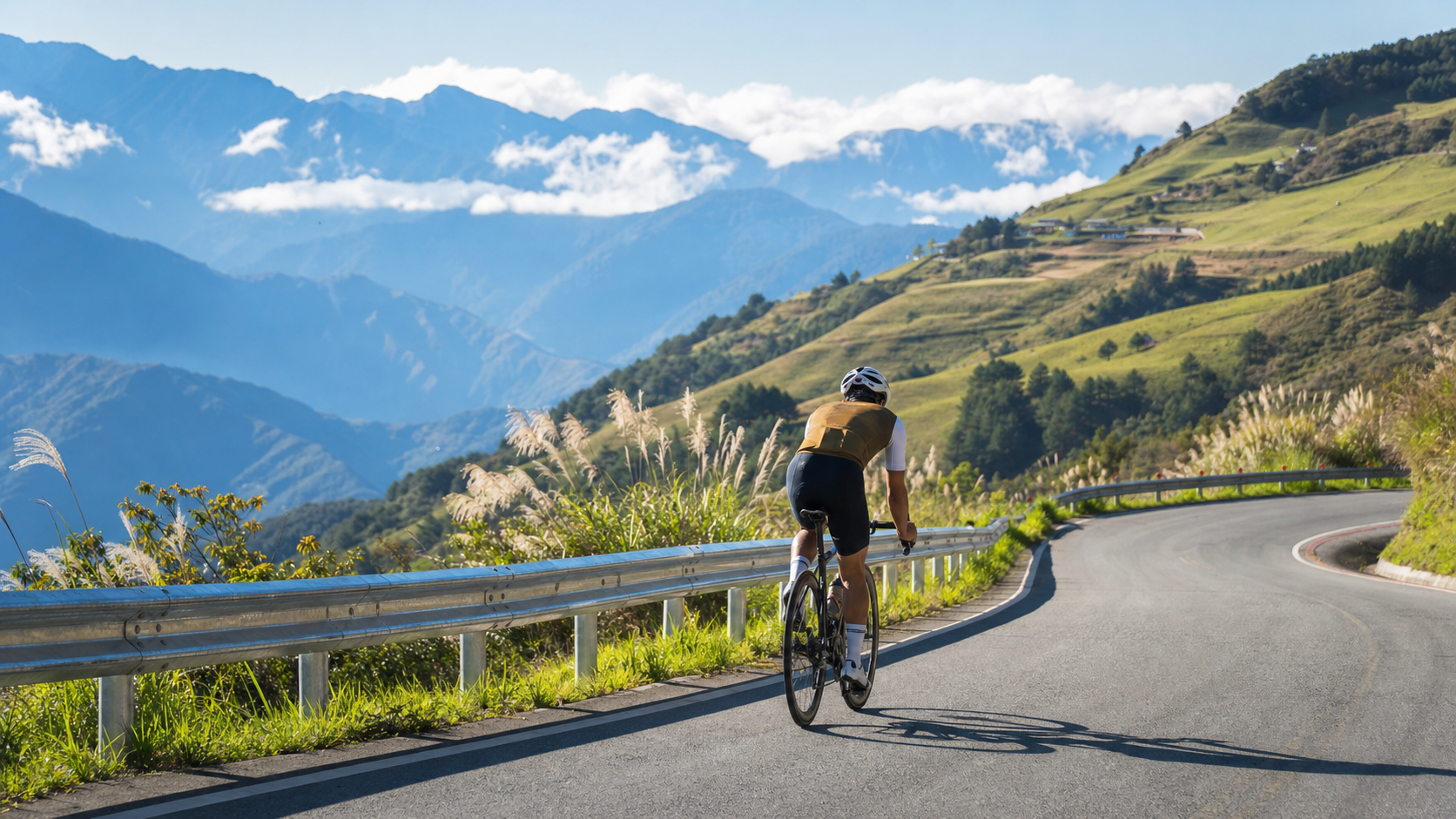
This section is a warm-up segment with relatively gentle gradients for the entire route, averaging about 6.7%, which remains manageable for riders with climbing training. Along the way, the views gradually open up, revealing the ridgeline silhouette of the Central Mountain Range.
Key sections:
- Chunyang Village (approx. 3 km): An Atayal settlement where traditional bamboo weaving crafts can be seen
- Guanyuan (approx. 6 km): One of the steepest parts of the mountain road, with gradients around 10–12%; conserve your energy here
- Cingjing Farm Entrance (approx. 9 km): At an elevation of about 1,750 m, with numerous guesthouses and restaurants for hot meals
Scenery Around Cingjing Farm
Cingjing Farm (Qingjing Grassland) is Taiwan’s most famous alpine pasture, at an elevation of 1,750–1,960 m, with distinct scenery in every season. For cyclists, reaching Cingjing Farm is already a remarkable achievement. Here you can:
- Admire the spectacular mountain sea of clouds (most likely to appear in the morning)
- Watch the high-mountain sheep grazing
- Taste Cingjing high-mountain tea and goat milk products
- Rest at a guesthouse (if you choose the overnight option)
Weather and High-Altitude Cycling Safety
Weather on high-mountain routes changes in an instant. The following safety rules are absolutely non-negotiable:
- Cold weather preparation: Morning temperatures at Cingjing Farm can drop to 5–10°C (in summer), and at Wuling they can fall below 0°C (in winter). Long-sleeve base layers, windproof jackets, and gloves are absolutely essential
- Rockfall warnings: After the rainy season, Provincial Highway 14A may have rockfalls; pay attention to warning signs along the road
- Descent braking: On downhill sections exceeding 10%, ensure your brake pads are in good condition to avoid overheating and failure
- Mountain fog: When visibility is low in thick fog, stop at a safe spot and wait for the fog to clear before continuing
Seasonal Recommendations
- Spring (Mar–May): Pleasant weather, occasional mountain fog possible; plum blossoms and alpine wildflowers in bloom
- Summer (Jun–Aug): High chance of afternoon thunderstorms; it is recommended to start in the morning and pass the highest point before noon
- Autumn (Sep–Nov): Best cycling season, stable weather and clear visibility
- Winter (Dec–Feb): Wuling may have snow accumulation and some sections may be closed; check the Directorate General of Highways announcements in advance
Advanced Challenge: Wuling Summit (3,275 m)
For advanced climbing enthusiasts, the 13 km from Cingjing Farm to Wuling is the true test. This section has an average gradient exceeding 11%, with the steepest parts reaching 15%, and due to the thin air at high altitude, the cardiovascular load is far greater than at lower elevations. Before reaching the Wuling monument, you will pass through layers of clouds and mist and experience the pristine forests near Dayuling—the indescribable thrill of conquering nature is unmatched.
Practical Tips
- For a Wuling summit attempt, depart from Wushe at 5:00 AM to ensure completion before the afternoon thunderstorms
- Carry one spare rear derailleur cable and one spare inner tube; there are no bike shops in the mountains
- Descent speeds exceeding 50 km/h are common; a high-quality helmet is a must, preferably with dual-layer EPS protection
- The Cingjing Farm entrance has public restrooms and water fountains—the last resupply point before Wuling
- Nantou Fire Bureau emergency rescue hotline: 0800-024-151
Conclusion
The route from Wushe to Cingjing Farm is a passage connecting the lowlands to the clouds. Every pedal stroke is a conversation with the mountains, and every valley view you look back upon is a reward for your effort. Whether you choose to stop at Cingjing Farm to enjoy the alpine pasture or continue climbing to Wuling to touch Taiwan’s highest road, this route will leave an indelible mark on your cycling history.
Related Reading
- Cingjing Farm Road Bike Guide: The Magnificent High-Altitude Scenery of Provincial Highway 14A
- Cingjing Farm Challenge: Hitting the Wall Mid-Climb on Provincial Highway 14A and Overcoming It
- Cingjing Farm Cycling Route: The High-Mountain Highway Journey from Puli to Cingjing
- Wuling Guide Supplement: Comparison Between the East Approach and West Approach to Wuling
#北橫 + #北進武嶺 最硬的員工旅遊 EP1 | #公路車 #拉拉山 | 明池 | 武嶺 | 武陵農場 | 雲海 | Taiwan Cycling Route Wulin
6 年前
西進武嶺最新路況場勘,台14到清境,還適合騎單車上去嗎?/ 居然有這優勢!?/請開啟字幕/當天現剪/公路車/CT Yeh
2 年前
台灣登山王之路 KOM 全程參賽4K臨空錄影 PART1 穿越峽谷地形! #東進武嶺 太魯閣 / 燕子口 / 天祥 / 西寶 PART1 (公路車 / CT Yeh)
3 年前
2025 乘鞍岳登山賽 比賽全紀錄篇 / 完整路線攻略介紹 / 日本版武嶺 公路最高點 / 高山空拍絕景 / 明年會開團! / 公路車 / CT Yeh
10 個月前
半日 小台灣 極限單車路線挑戰實錄
7 年前
太平山單車員工旅遊 | 這樣玩CP值最高!| 公路車
5 年前
大武山20%魔王陡坡【JJSC南台灣遊騎Day2】!屁股真的要裂開了...凡士林抹滿也沒用?神秘金教堂還有超便宜夜市
3 個月前
台北闊瀨陡坡 騎旅 / 日本單車雜誌編輯車友臨時加入!/ 髮香才是最強的 / feat. 北迴歸線小隊 / 公路車 CT Yeh
6 個月前