Hualien Coastal Highway Cycling Journal: The Blue Sea and Sky of Provincial Highway 11 and Tribal Charm
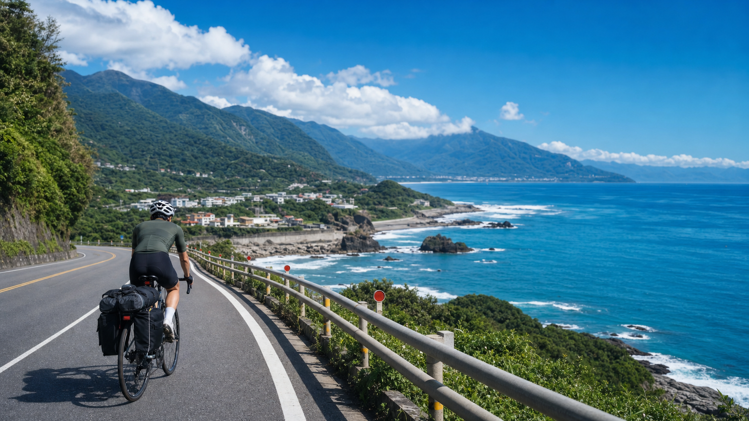
Cycling on the Hualien Coastal Highway: The Blue Skies and Ocean of Provincial Highway 11 and Tribal Charm
Provincial Highway 11, also known as the Huadong Coastal Highway, runs south from Hualien City along the Pacific coast all the way to Taitung, covering about 170 kilometers in total. This route boasts Taiwan’s most magnificent coastal scenery—the azure Pacific, rugged sea-eroded terrain, indigenous tribal culture, and a tranquil atmosphere with sparse population—making it a dream route for many cycling travelers. This article focuses on the Hualien section (Hualien City to Fengbin Township), about 80 kilometers of the most scenic stretch.
Route Basic Information
- Starting Point: Hualien City (elevation approx. 10 meters)
- Ending Point: Shimen, Fengbin Township (elevation approx. 20 meters)
- Total Distance: Approx. 80 kilometers
- Total Elevation Gain: Approx. 800 meters
- Difficulty: ★★★☆☆
- Estimated Time: 5 to 7 hours
Detailed Section Analysis
Section 1: Hualien City → Yanliao (0-15 km)
Terrain: Flat road transitioning to gentle climbs
Coastal Features: Open sandy beaches and surfing waters
Departing from Hualien City, pass Hualien Harbor and head south along Provincial Highway 11. Shortly after leaving the city, you enter the coastline, with the boundless Pacific on your right. Yanliao is a well-known surfing spot in Hualien, featuring wide beaches and pristine white waves. Nearby, you’ll find famous seafood restaurants such as “055 Seafood.”
Supplies: Plenty of supplies available in Hualien City. Yanliao has restaurants but few convenience stores; it’s recommended to stock up before departure.
Section 2: Yanliao → Shuilian → Niushan Huting (15-25 km)
Terrain: Rolling terrain with two noticeable small hills
Coastal Features: Pristine bays and ranch scenery
This section begins to showcase the typical “rolling” terrain of Provincial Highway 11—not long climbs, but a series of small hills, each with an elevation gain of about 50 to 100 meters. The Shuilian tribe is an Amis settlement that preserves a traditional tribal way of life. Niushan Huting is an art installation space facing the sea, ideal for a brief rest stop.
Supplies: Shuilian has small grocery stores, and Niushan Huting has a café.
Section 3: Niushan → Baqi Lookout (25-35 km)
Terrain: The steepest climb of the entire route
Coastal Features: Spectacular view of Qizhi Bay from Baqi
The stretch from Niushan to Baqi is the most challenging section of the Hualien portion of Provincial Highway 11. Climbing from sea level to the Baqi Lookout (elevation approx. 150 meters), this is about 4 kilometers of climbing with an average gradient of 4%, and the steepest sections reaching about 7%. But the moment you reach the Baqi Lookout, the view makes all the effort worthwhile—the entire arc-shaped coastline of Qizhi Bay unfolds before you, with azure waters interweaving with verdant mountains. It is the most iconic viewpoint on Provincial Highway 11.
Supplies: The Baqi Lookout has a rest area and vending machines.
Section 4: Baqi → Qizhi → Xinshe (35-50 km)
Terrain: Descent followed by flat road
Coastal Features: Qizhi Beach and the Kavalan tribe
From Baqi, enjoy a smooth descent to Qizhi, home to the largest beach on the Hualien coastline (open in summer). Continue on to the Xinshe tribe, one of the few Kavalan settlements in Taiwan. The Xinshe rice terraces face the Pacific and represent the most unique cultural landscape on the east coast. The annual “sea rice” harvest event held on the terraces attracts many visitors.
Supplies: Qizhi has small shops and B&B restaurants; the Xinshe tribe has a banana fiber workshop with a light meal service.
Section 5: Xinshe → Shitiping → Shimen (50-80 km)
Terrain: Rolling terrain with multiple small hills
Coastal Features: Spectacular sea-eroded terrain and Changhong Bridge
This section is a paradise for geology enthusiasts. Shitiping is a coastal terrace composed of volcanic rock and coral reefs, featuring potholes, sea-eroded gullies, sea stacks, and more. Walking into the Shitiping park area to explore takes about 40 minutes, and it’s well worth getting off your bike for a stroll.
Continuing south to Changhong Bridge, this red arch bridge spans the mouth of the Xiuguluan River and serves as the finish point for rafting activities. From the bridge, you can enjoy a magnificent view of the river flowing into the Pacific. Shortly after crossing Changhong Bridge, you’ll arrive at Shimen, which features a natural sea-eroded cave (Shimen Cave)—an ideal turnaround point or place to stay overnight.
Supplies: Shitiping recreation area has vending machines, snack stalls near Changhong Bridge (on weekends), and B&Bs and restaurants near Shimen.
Wind Direction and Seasonal Strategy
The wind patterns on the Hualien Coastal Highway greatly affect the riding experience:
Summer (June-September)
- Usually southerly or southwesterly winds; riding south to north (against the typical direction) allows you to enjoy a tailwind
- Afternoon thundershowers are frequent; it’s recommended to start early in the morning
- Temperatures of 30-35 degrees; sun protection and hydration are crucial
Winter (November-March)
- Strong northeast monsoon; riding north to south allows you to enjoy some tailwind
- Wind speeds can reach 5-6 on the Beaufort scale, and headwind sections feel colder
- It’s recommended to wear a windbreaker
Best Season
April to May and October to November offer relatively mild winds, comfortable temperatures, and less rainfall.
Accommodation Recommendations
If you plan to complete the full Hualien to Taitung route (170 km) over two days, it’s recommended to stay at the following locations:
- Qizhi: Several ocean-facing B&Bs at moderate prices
- Fengbin: More options available, including hostels and distinctive B&Bs
- Shitiping: Campground (bring your own gear) and nearby B&Bs
Supply Strategy Summary
One of the biggest challenges on Provincial Highway 11 is the long distances between supply points. Here are key reminders:
- Be sure to fill your water bottles and stock up on food before leaving Hualien
- Carry at least 3 servings of portable nutrition (energy gels or energy bars)
- Replenish water whenever you encounter an open shop
- In summer, it’s recommended to carry electrolyte powder or salt tablets
- Reapply sunscreen every two hours
Bike Selection and Setup
- Bike Type: Road bikes or disc-brake gravel bikes are both suitable
- Tires: 28-32mm is more comfortable; the road surface occasionally has loose gravel
- Gearing: A standard crankset is sufficient; the climbs are not long
- Storage: It’s recommended to add a rear rack or saddle bag to carry supplies and a change of clothes
Safety Reminders
- Some sections of Provincial Highway 11 have no shoulders; stay alert when large vehicles pass
- Cell phone signals may be unstable in remote sections; it’s recommended to download offline maps
- Stray dogs may appear on some sections; stay calm and pass slowly
- Please ask for permission before taking photos in indigenous tribal areas
The riding experience on Provincial Highway 11 can be summed up in one word: freedom. On this road, mountains are on your left, the ocean on your right, and an endless highway stretches ahead. All you need to do is pedal steadily and let the Pacific breeze carry you forward.
Related Reading
- Huadong Coastal Highway Provincial Highway 11: Complete Guide to 180 km of Pacific Companionship
- Hualien Harbor to Yanliao Coastal Highway: Complete Guide to an Easy Scenic Ride in Northern Hualien
- Taitung Coastal Highway Cycling: The Most Beautiful Riding Scenery on the East Coast
- Taiwan East Coast Marathon: Coastal Running Scenery on Provincial Highway 11
那瑪夏x茶山 阿里山系深山單車行 Day2 累積爬升6000M | 🥶超陡連續下坡 整路看隊友刷 | 爬升一座西進武嶺 | JJSC | 公路車 | CT Yeh
3 年前
2022 環花東挑戰賽 Day2 搭到特快車 高速真空吸引! 台東一路逆風殺回花蓮! 總排 ??| Feiyu Pocket 2s | 公路車 | CT Yeh
4 年前
日本島波海道 EP1 / 五大絕景路線之一! / 私房溫泉 x 豪華單車客棧 / 今治 to 大三島 / 公路車 / CT Yeh
2 年前
微東進 太魯閣 蘇花 單車兩日遊 ! 颱風過後路況超刺激 行程大亂 | 最狂的鹹酥雞訂單 | CT Yeh | 4K 高畫質空拍絕景!
4 年前
半日 小台灣 極限單車路線挑戰實錄
7 年前
公路車 | 塔塔加驚險員工旅遊 | 還好手腳快沒被抓交替!
5 年前
太平山單車員工旅遊 | 這樣玩CP值最高!| 公路車
5 年前
台北闊瀨陡坡 騎旅 / 日本單車雜誌編輯車友臨時加入!/ 髮香才是最強的 / feat. 北迴歸線小隊 / 公路車 CT Yeh
6 個月前