文章導覽
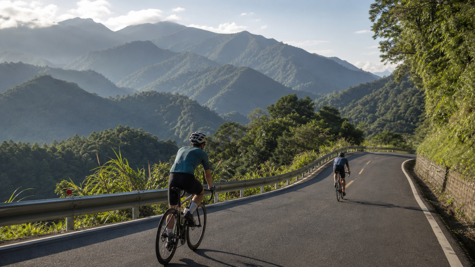
Nantou’s Best Mountain Roads: Five Stunning Climbs Beyond Hehuanshan
Nantou is Taiwan’s only landlocked county, yet it holds the island’s richest concentration of mountain terrain. Mention cycling routes in Nantou and almost everyone thinks first of Wuling — the highest point on Taiwan’s road network at 3,275 meters. Wuling is certainly special, but Nantou’s mountains don’t end there. This article highlights five mountain routes beyond Hehuanshan, each with its own scenery and challenge.
Route 1: New Central Cross-Island Highway — Tataka Section (Xinyi Township)
Basics
- Start: Xinyi Township (Provincial Highway 21, km 85, approx. 300m elevation)
- Finish: Tataka Visitor Center (Provincial Highway 21, km 145, approx. 2,610m elevation)
- Distance: approx. 60 km
- Total climbing: approx. 2,310 m
- Average gradient: approx. 3.8%
- Difficulty: ★★★★☆
- Estimated time: 5–8 hours (one way)
Route Character
The New Central Cross-Island Highway is one of Taiwan’s three cross-island routes (strictly speaking, an “unfinished” one). The Tataka section climbs from the low-elevation river valley of Xinyi all the way to the trailhead area of Yushan, with vegetation shifting from subtropical broadleaf forest to cool-temperate conifer forest along the way — offering rich scenic variety.
Segment Breakdown
Xinyi → Tongfu (20K, +500m): Gentle climb following the Chenyoulan River valley. A stop at the Meizi Dream Factory (Xinyi Farmers’ Association) makes a good break.
Tongfu → Tataka (40K, +1,800m): This is where the real mountain climbing begins. Past Tongfu the gradient steadily increases. You’ll pass the famous “Husband and Wife Trees” (now fallen but still a local landmark) and the Shishan service station before hitting the final switchbacks. The last 10 km average over 5%, with sections reaching 8%.
Fueling Strategy
- Full services available in Xinyi town center
- Tongfu has small shops and guesthouses
- No services for roughly 40 km between Tongfu and Tataka — carry plenty of water and food
- Vending machines and a small shop at the Tataka Visitor Center
Things to Note
- Parts of the New Central Cross-Island Highway have uneven surfaces from typhoon repairs
- Tataka sits above 2,600m, where temperatures run more than 15°C cooler than the lowlands
- A permit may be required if entering Yushan National Park
Route 2: Sun Moon Lake Loop + County Road 131 to Jinlong Mountain (Yuchi Township)
Basics
- Start/Finish: Shuishe, Sun Moon Lake
- Distance: approx. 55 km (lake loop plus out-and-back to Jinlong Mountain)
- Total climbing: approx. 1,100 m
- Difficulty: ★★★☆☆
- Estimated time: 4–6 hours
Route Character
This route builds on the classic Sun Moon Lake loop with an added challenge up Jinlong Mountain. At 820m elevation, Jinlong Mountain is one of Taiwan’s best-known low-elevation cloud sea viewpoints — early mornings often reveal the “glazed light” phenomenon, where town lights glow dreamily through the mist below.
Segment Breakdown
Lake Loop (30K): The classic Sun Moon Lake circuit — see our dedicated Sun Moon Lake feature for details.
Jinlong Mountain Section (25K round trip): Starting from Yuchi town, climb along County Road 131. The early section passes tea plantations with a gradient around 5–6%. Near the summit, several hairpins push the gradient up to 8–10%. The summit viewpoint offers outstanding views.
Best Time to Ride
Depart at 4:30am to summit Jinlong Mountain for sunrise before returning to loop the lake. Autumn and winter (October–January) offer the best odds of catching the cloud sea and glazed light.
Route 3: County Road 89 to Aowanda (Ren’ai Township)
Basics
- Start: Wushe (Provincial Highway 14, km 83, approx. 1,150m elevation)
- Finish: Aowanda National Forest Recreation Area (approx. 1,100m elevation)
- Distance: approx. 23 km (one way)
- Total climbing: approx. 600 m
- Difficulty: ★★★☆☆
- Estimated time: 1.5–2.5 hours one way
Route Character
Aowanda is known as “Taiwan’s maple leaf hometown,” drawing large crowds during the red-leaf season from November to December. County Road 89 is the only route to Aowanda, winding along the Wanda River valley with a moderate road width and light traffic.
Segment Breakdown
What makes this route interesting is that it isn’t a simple climb. From Wushe you first descend to the bottom of the Wanda River valley (approx. 750m elevation), then climb back up to Aowanda. The return trip reverses this — down then up. Pace yourself carefully: don’t burn your legs on the outbound descent, because the climb on the way back is the real test.
Fueling
- Convenience stores and restaurants in Wushe
- Restaurants and vending machines inside the Aowanda recreation area
- No services along the route itself
Route 4: County Road 83, Xitou to Shanlinxi (Lugu Township)
Basics
- Start: Xitou Nature Education Area (approx. 1,150m elevation)
- Finish: Shanlinxi Forest Recreation Area (approx. 1,600m elevation)
- Distance: approx. 17 km (one way)
- Total climbing: approx. 550 m
- Average gradient: approx. 3.2%
- Difficulty: ★★☆☆☆
- Estimated time: 1–2 hours one way
Route Character
County Road 83 from Xitou to Shanlinxi is a forest road flanked by giant trees. Along the way you’ll pass the “Twelve Zodiac Curves” — a series of bends each named after a zodiac animal and marked with a stone marker. The gradient here is gentle, and the entire ride passes through forest, staying cool and comfortable even in summer.
Route Highlights
- Forget Worry Forest (around 10K): A dreamlike landscape created when an earthquake-triggered barrier lake submerged a cedar forest. It’s about a 30-minute walk from the road, but well worth the detour.
- Twelve Zodiac Curves: Twelve consecutive hairpin turns, each around 6–8% gradient — the most challenging stretch of the route.
- Shanlinxi Recreation Area: The endpoint is famous for hydrangeas (June–August), peonies (March–April), and maple leaves (November–December).
Route 5: Provincial Highway 16 to Shuanglong Tribe (Xinyi Township)
Basics
- Start: Jiji (approx. 230m elevation)
- Finish: Shuanglong Waterfall (approx. 800m elevation)
- Distance: approx. 40 km (one way)
- Total climbing: approx. 700 m
- Difficulty: ★★★☆☆
- Estimated time: 2–3.5 hours one way
Route Character
Provincial Highway 16 follows the upper reaches of the Zhuoshui River deep into Bunun tribal territory, passing dramatic canyon terrain along the way. Shuangong Tribe has become popular in recent years thanks to the “Shuangong Waterfall Rainbow Suspension Bridge,” which spans the waterfall at an impressive height with equally impressive views.
Segment Breakdown
Jiji → Shuili (15K, flat): Ride along the Zhuoshui riverside, passing through the Jiji Green Tunnel (a camphor-tree-lined avenue), one of Taiwan’s most beautiful shaded boulevards.
Shuili → Dili Tribe (15K, gentle climb): The road begins to rise into the mountains, gradient around 2–3%. You’ll pass the entrance to the Danda Forest Road along the way.
Dili → Shuangong (10K, climb): The final stretch steepens to 5–7%, leading into the Bunun village of Shuangong. Once you arrive, you can walk to the rainbow suspension bridge (tickets and reservation required).
Fueling
- Convenience stores and restaurants in Jiji town center
- Full services in Shuili town (try the local meatballs and shaved ice)
- Small shops in Dili and Shuangong, though hours can be irregular
General Tips for Mountain Riding in Nantou
Altitude and Altitude Sickness
Many Nantou routes climb above 2,000m. Riders new to high-altitude cycling should keep in mind:
- Mild altitude symptoms (headache, nausea) can appear above 2,500m
- Keep your breathing steady — don’t push a hard pace
- Stay well hydrated, as dehydration happens faster at altitude
Preparing for Temperature Swings
Nantou’s mountains see large temperature differences both between day and night and across elevation:
- Roughly a 6°C drop for every 1,000m of elevation gained
- Always carry a windproof, insulating layer, even if it’s hot when you set out
Checking Road Conditions
Nantou’s mountain roads are frequently affected by typhoons and earthquakes. Before you go, check:
- The Directorate General of Highways’ real-time road condition system
- Announcements on each national forest recreation area’s official website
- Real-time traffic conditions on Google Maps
Every mountain in Nantou has its own story. Hehuanshan may be the brightest star, but once you ride these five routes, you’ll discover that Taiwan’s mountain beauty is far more than any single Wuling can represent.
Related Reading
- Taiwan’s Five Classic Climbs: Wuling, Tataka, Alishan, Hehuan North Peak, and Taiping Mountain
- The Hehuanshan Cycling Route Network: High-Altitude Alternatives to Wuling
- Best Climbing Routes Around Taiwan’s Baiyue Peaks: Hehuan, Wuling, and Dasyueshan Guide
- Nantou Puli to Hehuanshan: A Complete Race-Prep Strategy for the Central Cross-Island Highway Climb