Shibutoge Practical Guide: 26.97 km Climb to Japan's Highest National Highway Point at 2,172 Meters in Nagano's Sacred Realm
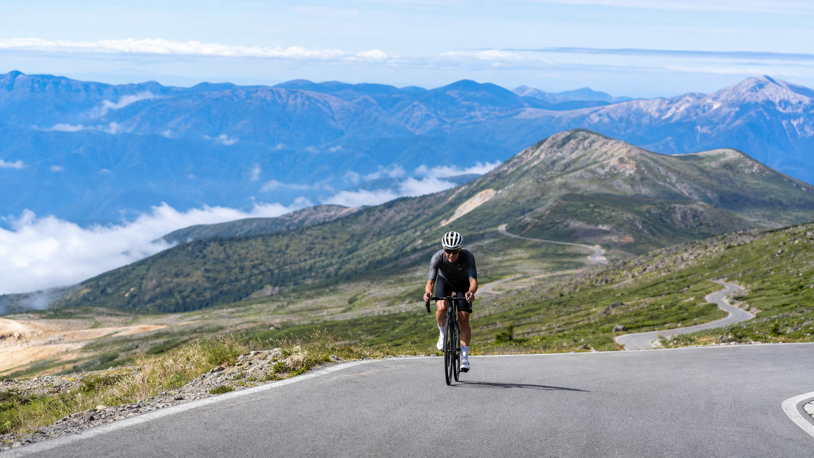
In Japan, if you can only pick one “national highway climb” to add to your collection, many veterans will simply say two words: Shibu-toge. This is the highest point of all national highways in Japan, at 2,172 meters above sea level, straddling the prefectural border between Nagano and Gunma. A stone monument marking the “Highest Point on Japan’s National Highways” stands there—a bucket-list checkpoint for countless cyclists.
Let’s lay out the skeleton data of this route first. This article focuses on the main climbing segment from the Shiga Kogen side: approximately 26.97 km in distance, about 1,563 meters of total elevation gain, with an average gradient of 5.7%. This is a textbook “long but not overly steep, yet extremely high-altitude” mountain climb—the gradient numbers look gentle, but the real challenge is hidden in the altitude and weather further up.
A special note: the official NAGANO CYCLING has also planned a “full loop route starting from Nagano Station,” with a total length of 116.6 km, 2,191 meters of total elevation gain, a difficulty rating of “advanced,” and an estimated riding time of 6.5 hours (excluding rest stops). That’s a full-day loop around the entire area, and it’s a different set of numbers from the “single-side pure climbing segment” we’re breaking down here—please don’t mix them up. This article only covers the 27 km climbing from Shiga Kogen up to Shibu-toge.
1. Route Overview and Real Data Analysis
| Item | Data (Shiga Kogen side climbing segment) |
|---|---|
| Distance | Approx. 26.97 km |
| Total elevation gain | Approx. 1,563 m |
| Average gradient | 5.7% |
| Summit elevation | 2,172 m (highest point on Japan’s national highways) |
| Road | National Route 292 (Shiga-Kusatsu Road) |
| Prefectural border | Nagano Prefecture, Yamanouchi Town ↔ Gunma Prefecture, Kusatsu Town |
| Open season | Approx. late April to mid-November |
| Difficulty rating | Intermediate-advanced (long climb + high altitude) |
An average of 5.7% is a number that “looks easy to negotiate.” Take a rider weighing 70 kg including gear as an example: maintaining 200 watts on this gradient would put you at roughly 12–14 km/h, meaning the 27 km climb should theoretically take around two hours. But that’s sea-level math. Shibu-toge’s cruelty lies in the fact that by the latter half of the climb, you’re standing at over 2,000 meters, where the air has about 20% less oxygen than at sea level. The same pedal output will yield noticeably higher heart rates and faster exhaustion. That’s why veterans all say: Shibu-toge doesn’t defeat you with gradient—it takes you down with “altitude” and “weather.”
According to official segment data, this route can be broken down into several local average gradients: the Maruike section is about 6.3%, the Yokoteyama Drive-in section about 6.1%, and the section before Shibu-toge Hotel (prefectural border) about 5.4%. In other words, the middle is steeper, while it eases slightly near the summit—which is good news for pacing. You can save your strength for the middle section and use the final stretch to enjoy the scenery and wrap things up.
Why an “Average Gradient of 5.7%” Can Be Deceptive
On flat terrain or low-altitude mountain areas, a 5.7% average gradient is indeed a comfortable zone that most riders with some training foundation can complete steadily. But Shibu-toge “stacks” this gradient onto an elevation change that climbs all the way from the base to 2,172 meters, creating two effects you won’t see at lower altitudes:
The first is reduced oxygen levels. For every 1,000 meters of ascent, atmospheric pressure and partial oxygen pressure drop by roughly 10% or more; by the time you reach 2,000 meters, the oxygen you can draw into your lungs is noticeably reduced, and your VO2max drops accordingly. The same 200-watt output will push your heart rate 10–15 beats higher than at sea level. This means you can’t pace by your “feel” from flat ground—you need to manage intensity with a more conservative perceived exertion.
The second is temperature disparity. The base might be a comfortable 20-something degrees, but the summit is only in the teens or even lower, and with afternoon winds and fog common at altitude, the perceived temperature drops even further. That’s extra energy expenditure for a body working at sustained output.
Factor both of these in, and Shibu-toge’s difficulty escalates from a “moderate long climb” to a “high-altitude mountain climb that demands serious pacing and thermal management.”
Where This Road Sits on Japan’s Climbing Map
Japan has several signature long climbs that are “must-ride at least once in a lifetime”: Mount Norikura, several toll roads in the Mount Fuji area, and this Shiga-Kusatsu Road. What makes Shibu-toge unique is that it’s not “a climb up a single mountain,” but rather “the highest point of an entire national highway.” You’re not climbing a peak—you’re riding a national highway that traverses the Shiga Kogen and Kusatsu highlands, carrying you all the way to its own summit. This identity as “the highest point of the road itself” gives Shibu-toge a special significance among countless climbing routes—it’s not about conquering a mountain, but about reaching the ultimate end of a single road.
For Taiwanese riders, the most intuitive comparison is Wuling. Wuling is the highest point on Taiwan’s highways (3,275 meters), while Shibu-toge is the highest point on Japan’s national highways (2,172 meters). The common language between the two is the romance of “the highest point of a road”; the difference is that Wuling is higher, with a longer and harder climb, while Shibu-toge, though lower in elevation, adds two cards Wuling doesn’t have: an active volcano and snow walls. If you’ve ridden Wuling, Shibu-toge’s 27 km and 1,563 meters of climbing will be an experience your body can understand, but with scenery and atmosphere that are entirely different.
2. Segment-by-Segment Strategy
Segment 1: Starting from Shiga Kogen (0–8 km, warm-up and priming)
Starting from the Shiga Kogen area, this segment winds through highland resort areas and forests, with gradients roughly in the 5–6% range. The keyword here is “restraint.” Many people get excited and hammer hard from the start, burning through their glycogen early, only to have nothing left when the high-altitude oxygen debt hits later. Keep your heart rate in the aerobic zone (75–80% of max heart rate) and treat these 8 km as a long warm-up. The Maruike area at 6.3% average gradient is the spot in this section that requires a bit more effort.
The pacing mindset for this segment is “keep it boring.” You need to deliberately suppress the urge to chase the rider ahead or test your legs. Use a steady cadence and steady heart rate to “transport” yourself up the mountain. Shibu-toge’s rewards are up ahead—any moment of overexertion in the early section will cost you double later.
Segment 2: The Tough Middle Section Below Yokoteyama (8–18 km)
The higher you go, the lower the tree line drops and the more open the views become. This segment includes the Yokoteyama Drive-in area, with an average gradient of about 6.1%—the “numerically most solid” block of the entire route. By now, the elevation is approaching 2,000 meters, and you’ll start to feel your breathing getting heavier than the gradient alone would warrant—that’s oxygen debt. The pacing strategy is: drop one to two gears, push your cadence above 80 rpm, and trade spin for muscular recovery, avoiding the lactate buildup that comes from grinding a big gear.
Yokoteyama (elevation 2,307 meters) is the landmark next to Shibu-toge. At its summit sits the “Cloudtop Bakery (Yokoteyama Summit Hut),” billed as Japan’s highest-altitude bakery, along with the Manten Observation Deck offering superb views—on clear days you can see the Northern Alps range. You can take the ropeway to the summit for supplies and photos, treating it as a psychological reward station for the middle section. If you’re a “completion-first” rider, this is also a good spot to reassess your physical condition and decide whether to ease off the pace.
Segment 3: Sprinting to the Prefectural Border at 2,172 m (18–27 km)
The gradient actually eases slightly in this final stretch (about 5.4% before Shibu-toge Hotel), but you’re already above 2,000 meters, and every surge feels like swimming through thin air. Shibu-toge Hotel sits right on the Nagano/Gunma prefectural border—the most iconic scene of the entire route: half in Nagano, half in Gunma. The hotel offers a “Certificate of Reaching Japan’s Highest National Highway Point” (about 100 yen), a souvenir many people come specifically to collect.
Past the hotel and a bit further up, you’ll find the monument reading “Japan’s Highest National Highway Point, Elevation 2,172 m.” Stop, take photos, breathe deep—you’re standing at the highest point of all national highways in Japan. From the pass, you can also look down over the vast Yagisawa Marshland, where trees and wetland greenery interweave—the signature landscape of Shibu-toge.
Although the gradient eases in this section, your body has been working in an oxygen-deprived state for over an hour, so the subjective suffering is actually considerable. The mindset is “count the road signs, don’t stare at the finish”—keep your focus on the short stretch right ahead, eating it up segment by segment, rather than fixating on the distant pass. That will steady your mind far better.
The Science of High-Altitude Pacing: Why You Need to “Take It Slow”
Riding above 2,000 meters triggers a cascade of physiological responses: breathing becomes faster and deeper, heart rate rises, and blood oxygen saturation drops. These are all the body’s attempts to maintain oxygen supply in thin air. The problem is that this compensation has its limits—once your output exceeds a certain threshold, no amount of accelerated breathing can make up for the missing oxygen, and lactate accumulates rapidly, causing your legs to suddenly “give out.”
Therefore, the golden rule for pacing on long high-altitude climbs is: dial the intensity down one to two notches. The power you can sustain for an hour at sea level (FTP) may only be maintainable at around 80% of that at 2,000 meters. Rather than pushing through with sea-level effort and blowing up at the end, it’s better to start with a more conservative output and “evenly” distribute your energy across the entire climb. The Toge’s gradient profile—steeper in the middle section and slightly easier toward the top—actually suits this strategy perfectly. You can establish a rhythm with steady output in the middle, and by the time the gradient eases near the summit, your body will have largely acclimatized to the altitude, allowing you to hold your speed.
Another practical technique is rhythmic breathing. In hypoxic conditions, many people unconsciously shift to shallow, rapid breathing, which actually reduces ventilation efficiency. Deliberately using a “deep inhale, deep exhale” rhythm—filling each breath fully and emptying it completely—can significantly improve subjective feelings of breathlessness. Pairing this with a steady pedaling cadence, syncing your breathing with your pedal stroke, is the hidden secret experienced riders use to maintain efficiency on long high-altitude climbs.
3. Gear Ratio and Equipment Recommendations
The average gradient of 5.7% isn’t particularly brutal in itself, but high altitude will lower your actual power output and increase your cadence demands, so gear ratios should be prepared on the “easier” side:
- Chainrings: A compact 50/34 is the minimum standard setup.
- Cassette: Recommend starting at 11–32T. If you’re a cruising-style rider or want to enjoy the scenery comfortably, an 11–34T will give you more margin in the middle section.
- Cadence Strategy: Aim to maintain 75–85 rpm throughout. Use higher cadence to reduce the muscular load per pedal stroke—this is especially critical in hypoxic conditions. Grinding a big gear at low cadence with high force will accelerate muscle fatigue at altitude and is a major taboo on long climbs.
In terms of equipment, staying warm is the top priority on Toge. Even if it’s summer at the base, temperatures at the summit above 2,000 meters can be only in the teens (Celsius), and with wind chill on the descent, it will feel even colder. Be sure to carry:
- A packable windbreaker (a light one is fine; the key is blocking wind).
- Long-finger gloves or thin gloves to prevent numb fingers from compromising braking on the descent.
- A headband or ear warmers to protect your ears and neck from the strong mountain winds.
- Gloves with good braking feel that can handle a long descent.
Put your jacket on before descending—don’t let the 27 kilometers of hard climbing warmth be drained away in one go on the way down. Hypothermia at altitude isn’t an exaggeration; it’s a real risk that occurs every year.
4. Nutrition and Hydration
High altitude combined with prolonged aerobic output accelerates dehydration and electrolyte loss. There are rest facilities along the way, such as Yokoteyama Drive-In, where you can resupply, but don’t rely entirely on mountain shops for your nutrition (their operating hours and seasons can vary). Recommendations:
- Before departure: Eat plenty of carbohydrates to top off your glycogen stores. A rice ball, bread, or a pasta dish is an ideal pre-ride fuel.
- On the bike: Carry at least two bottles (one plain water, one with electrolytes), plus 2–3 energy gels or food items.
- Mid-climb (around Yokoteyama): This is the ideal formal refueling point—get your blood sugar up before entering the most oxygen-deprived final section.
- Feeding rhythm: On long climbs, eat every 30–40 minutes; don’t wait until you’re hungry. High altitude dulls your hunger sensation—by the time you “feel hungry,” your blood sugar is often already low.
5. Weather and Season
- Open season: The Shiga-Kusatsu Road is closed in winter, typically from mid-November to late April. The officially recommended riding season is late April to late September.
- Snow walls (Yuki no Kairō): From just after the road opens until around Golden Week, towering snow walls remain along the roadside—a stunning sight available only in this season. The official signage indicates the snow wall section is approximately 2.4 kilometers round trip.
- Volatile mountain weather: Above 2,000 meters, clouds, fog, and sudden rain showers are common in the afternoon, with dramatic temperature swings. Be sure to check the day’s mountain forecast and allow time to complete the climb before afternoon conditions deteriorate. It’s recommended to start in the morning to avoid afternoon weather instability.
6. Common Mistakes and DNF Risks
- Ignoring the active volcano warning: This is the most unique aspect of Toge and the one most easily overlooked by out-of-town riders. The route passes by Kusatsu-Shirane, an active volcano, which has an eruption alert level system. There have been recent real examples: in August 2025, the alert was raised to Level 2 and sections of the road were closed; it wasn’t until May 2026 that it was lowered back to Level 1 and the full Shiga-Kusatsu Road reopened. This means “whether you can ride today, and how far” can change with the volcano’s status. Before departing, be sure to check the real-time eruption alert level and road access notices—don’t treat the status at any given moment as a permanent fact.
- Starting too hard: Burning through your glycogen in the first 8 kilometers is the most typical precursor to a DNF.
- Insufficient warm clothing: Getting chilled at the summit and losing body heat on the descent is the most realistic risk on long mountain climbs.
- Miscalculating supplies: Assuming you can definitely buy food on the mountain, only to find the shop closed.
- Starting too late in the day: Setting off in the afternoon makes you more likely to hit changing mountain weather, and both light and temperature work against you on the descent.
Additionally, there is tourist traffic along the route, and some sections have reports from riders of encounters with wildlife (such as bears). Stay focused, ride to the side, and watch for oncoming vehicles. In Japan’s mountain areas, encountering wildlife isn’t uncommon—maintaining an appropriate speed, avoiding riding alone in poor visibility at dawn or dusk, and carrying a bear bell if necessary are all practical ways to reduce risk.
Three Typical DNF Scenarios
Drawing from the experiences of many riders, DNFs on Toge are rarely caused by a single factor but rather by a combination of several. Here are the three most common scenarios—understand them and you can avoid them in advance:
- Scenario 1: “Fuel Depletion”: Starting too hard burns through glycogen → dizziness and weak legs set in mid-climb → high altitude amplifies the discomfort of low blood sugar → forced to stop or even turn back. The key to breaking this pattern: restraint in the early section and regular feeding.
- Scenario 2: “Hypothermia Cascade”: Not bringing enough warm clothing → shivering from cold at the summit → wind chill on the descent further drains body heat → judgment and bike handling deteriorate. The key to breaking this pattern: bring adequate windproof layers and put them on before descending.
- Scenario 3: “Weather Ambush”: Starting in the afternoon → sudden fog, rain, and temperature drops on the plateau → visibility and grip both deteriorate → forced to abandon. The key to breaking this pattern: start in the morning, build in buffer time, and monitor the weather closely.
The common thread across these three scenarios is that they are all “preventable in advance.” Toge rarely defeats riders because of the gradient itself; it’s usually logistical and judgment errors that lead to a DNF. Do your homework, and you’ve already won half the battle.
7. Target Times for Different Rider Levels
The following are reference times for the Shiga Highlands side climb (approximately 27 kilometers with 1,563 meters of elevation gain). Actual times will vary depending on altitude response, weather, and individual conditions:
| Rider Level | Reference Completion Time | Pacing Focus |
|---|---|---|
| Advanced Competitive | Within approximately 1 hr 20 min | Maintain steady high output mid-climb, resist hypoxia in the final section |
| Steady Cruising | Approximately 1 hr 40 min – 2 hr | Restraint early, refuel mid-climb, close it out at the end |
| Sightseeing Challenger | Approximately 2 hr 15 min – 2 hr 45 min (including photo stops) | Easy gears throughout, stop and refuel often, enjoy the scenery |
Toge is not a road for chasing top speed; it’s a road for “arriving.” When you park your bike beside the stone marker at 2,172 meters and look back at the winding national route below, you’ll understand: this wasn’t just climbing a mountain pass—you rode to the very ceiling of Japan’s national highway network.
8. Adding Shibu-toge to Your Itinerary: Transport and Logistics
Shibu-toge sits in the high mountain zone on the border of Nagano and Gunma prefectures. For riders coming from outside the area or from overseas, logistics planning is just as important as physical preparation.
Choosing a Base: Most riders choose Shiga Kogen, Yudanaka Onsen (Nagano side), or Kusatsu Onsen (Gunma side) as their lodging base, allowing themselves to rest and soak in hot springs before and after the climb. Shiga Kogen itself is a resort area and is close to the start of the climb; Kusatsu is ideal for combining the climb with a famous hot spring. If you want an easier approach, choose accommodation at a highland lodge close to the starting point and depart early the next morning to avoid the fatigue of a long transfer.
Bike Transport: Japan’s railways require bicycles to be packed in a “rinko bag” (travel bag), meaning you must disassemble and bag your bike. If you’re renting a car, make sure the roof rack or rear carrier can secure the bike firmly. Some shops around Shiga Kogen also offer bike rentals, which is one option for light-pack travel.
Time Planning: Completing the climb in the morning is the golden rule for Shibu-toge. There are three reasons: first, to avoid the afternoon weather changes common in the highlands; second, traffic is lighter and the air is fresher in the early morning; third, it leaves ample time to handle any unexpected situations (mechanical issues, physical discomfort, weather shifts). Don’t schedule this long high-mountain climb at the end of a day’s itinerary—that would force you to face high altitude and descents while already pressed for energy and time.
9. The Mental Game: How Not to Crack in Thin Air
The biggest enemy on a long, high-altitude climb is often not your legs, but your brain. When you’ve been gasping for air in the thin atmosphere at 2,000 meters for over an hour, your mind starts playing a loop of “reasons to quit.” Here are some battle-tested mental tactics:
- Break the goal into segments: Don’t keep thinking “how many kilometers to the top”—that only magnifies the suffering. Cut the road into smaller pieces (the next corner, the next utility pole, the next signpost) and complete them one small chunk at a time.
- Give yourself milestone rewards: Tell yourself “once I make it to Yokone-yama, I’ll stop for bread” or “once I reach the prefectural border hotel, I’ll get my certificate.” Use landmarks along the way as psychological waystations.
- Accept being slow: At high altitude, slow is not failure—it’s strategy. Allowing yourself to move at a slower pace than usual actually makes it easier to finish.
- Focus on breathing and cadence: Direct your attention to controllable rhythms like “deep inhale, deep exhale, steady spin.” This effectively shifts your focus away from excessive attention to the pain.
When you use these methods to deliver yourself, segment by segment, to that stone marker at 2,172 meters, what you gain is not just a completed ride—it’s the ability to manage yourself under extreme conditions. And that ability will carry over to every long climb you choose to challenge afterward.
10. Descent and Wrap-Up Reminders
Reaching the summit is only half the ride. The descent from Shibu-toge demands equal respect:
- Put on warm layers before starting down—the wind chill on the descent can strip your body heat within minutes.
- Control your speed and anticipate corners—the highland roads carry tourist traffic; don’t risk it just to chase a faster descent.
- Keep your hands warm—numb fingers directly compromise your braking feel.
- If you’re clearly running on empty, rest and refuel on the mountain before descending rather than pushing a long downhill in a fatigued state.
Conclusion
The numbers of Shibu-toge—26.97 kilometers, 1,563 meters of climbing, 5.7% average gradient, 2,172-meter summit—every one of them tells the story of a long mountain climb forged by high altitude, volcanoes, and volatile weather. Its technical difficulty lies not in steepness, but in “altitude” and “unpredictability.” Bring a compact gearing setup, carry ample warm layers and supplies, and do your homework on the active volcano and weather conditions, and you’ll be able to deliver yourself steadily to the highest point on Japan’s national highways. This is a sacred Nagano route that any long-climb enthusiast should plan carefully and keep close to their heart. If you bring three things—the discipline of pacing, respect for altitude, and vigilance toward the weather—Shibu-toge will reward you generously with its 2,172-meter views.
One final summary for riders coming from afar: Shibu-toge doesn’t test how strong your legs are—it tests how thorough your preparation is. Gearing, warm layers, supplies, time, weather, volcano advisories—check off these six items one by one, and you can confidently deliver yourself to the highest point on Japan’s national highways, then descend at ease, heading home with a completion certificate and a head full of highland memories. That, in the end, is what makes Shibu-toge, this sacred Nagano route, so captivating.
Related Reading
- Riding to the Cloudtop Bakery: Volcanoes and Snow Walls on Shibu-toge, Yokone-yama, and the Shiga-Kusatsu Road
- Open Only Half the Year: Shibu-toge, the Japan National Highway Ceiling You Must Catch Within Its Seasonal Window
- Hakone-toge (Route 1) Practical Guide: Segment Pacing and Gear Ratios for 15.6 km with 846 m of Climbing
- Kuju Chojabaru → Makinoto-toge Guide: Pacing, Wind Protection, and Summit Tips for a 5.1 km 5.6% Highland Climb
台北闊瀨陡坡 騎旅 / 日本單車雜誌編輯車友臨時加入!/ 髮香才是最強的 / feat. 北迴歸線小隊 / 公路車 CT Yeh
6 個月前
2025 乘鞍 KOM 登山賽挑戰實錄 / 日本公路最高 ! 賽前探路篇 / 比富士山厲害,無敵絕景!/ 40週年 / 中文YT首發 / 公路車 / CT Yeh #乘鞍ヒルクライム
10 個月前
2025 乘鞍岳登山賽 比賽全紀錄篇 / 完整路線攻略介紹 / 日本版武嶺 公路最高點 / 高山空拍絕景 / 明年會開團! / 公路車 / CT Yeh
10 個月前
小野田真的存在!日本赤城山爬坡公路賽 台灣首發團完全實錄 | 頭文字D真實賽道! | 看完東奧自行車賽後好想再去騎一次啊! | 公路車 | CT Yeh
4 年前
半日 小台灣 極限單車路線挑戰實錄
7 年前
#北橫 + #北進武嶺 最硬的員工旅遊 EP1 | #公路車 #拉拉山 | 明池 | 武嶺 | 武陵農場 | 雲海 | Taiwan Cycling Route Wulin
6 年前
新竹羅平 x 天湖部落 大禹嶺級變態陡坡! 4K超高畫質 空拍 | 公路車
5 年前
萬年峽谷! 30% 超激陡坡 里佳部落DAY2 還是很硬! | 公路車 | CT Yeh
3 年前