Zhonghua Bridge to Bawengweng Turnaround Race Guide: Full Analysis of the 90km East Coast Triathlon Segment
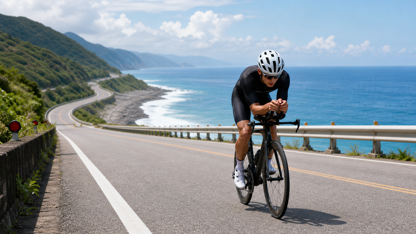
Route Overview and Race Positioning
Among the cycling routes on Taiwan’s east coast, the “Zhonghua Bridge to Bawengweng Out-and-Back” stands out as one of the few segments that carries dual significance in both “training value” and “race fidelity.” This route strings together nearly 100 km of Provincial Highway 11 along the coast between downtown Taitung City and Fengtian Community in Chenggong Township, making it an indispensable benchmark route when discussing pacing strategies for the triathlon bike leg.
Let’s lay out the hard numbers first:
| Item | Data |
|---|---|
| Route Name | Taitung Zhonghua Bridge to Bawengweng Out-and-Back |
| Location | Taitung County (starting in Taitung City) |
| Total Distance | 90,372 meters (approx. 90.37 km) |
| Total Elevation Gain | 530.4 meters |
| Average Gradient | 0.0% (nearly flat) |
| Terrain Classification | Classification Code 0 (flat grade) |
| Strava Tag | Triathlon |
On paper, this is a classic “fake flat” route—while the average gradient reads 0.0%, the actual riding experience is far from level throughout. The 530 meters of cumulative climbing comes from countless gentle rolling sections along the coastal highway: bridge approach ramps, low undulations cutting through seaside hills, and gradual grades entering and leaving settlements. The challenge this route poses to riders isn’t the muscular output of a single long climb, but rather the endurance management and wind resistance capability required to “maintain a steady power output over a long duration”—which is precisely why this route carries the triathlon attribute tag.
This route heavily overlaps with the bike leg of the “Challenge Taiwan International Triathlon,” held locally in Taitung. Organized by the Taiwan Triathlon Development Association and guided by the Taitung County Government, Challenge Taiwan was introduced to Taiwan in 2012 and belongs to the international Challenge Family series, billed as one of the largest triathlon events in Asia. The event features multiple race categories, among which the half-distance long-course group is commonly called “113”—referring to the sum of a 1.9 km swim, 90 km bike, and 21 km run (totaling approximately 113 km)—rather than being the event’s official full name. This is a common misconception among cyclists that deserves clarification. The route’s 90.37 km distance and 530.4 meters of climbing closely match the scale of the 113 half-distance bike leg, so it can reasonably be treated as a training substitute route. However, exact course details, registration information, and event editions should still be confirmed against official announcements (challenge-taiwan.com), and this article makes no speculation. Starting in 2025, the event’s main venue has moved from Tiehua Village to the Taitung County Stadium; cyclists planning training routes or spectator logistics should take note of this change.
For riders preparing for half-distance long-course triathlons, standard-distance triathlons, or simply looking to challenge their long-distance flat-road endurance, this route offers the most race-realistic training scenario: sustaining a TT position for extended periods, resisting crosswinds off the sea, and carefully managing nutrition timing—every one of these is a real variable encountered on race day. Below, following the order of the start and finish points, the route is broken down into four practical segments, with terrain characteristics, risks, and riding strategies explained segment by segment.
Segment 1: Departing from Zhonghua Bridge—Warm-Up and Position Calibration
The route starts at Zhonghua Bridge in downtown Taitung City. Spanning the Beinan River, this bridge is 1,320 meters long and 13 meters wide, forming part of Provincial Highway 11 and connecting downtown Taitung City with the Fugang area. Opened on September 20, 1991, it serves as a key node linking Taitung City to the east coast highway system.
From a riding strategy perspective, the Zhonghua Bridge section is the “only stretch where terrain needs no concern” across the entire 90 km course—the deck is flat and straight, visibility is open, and pavement quality is consistent. But precisely because of this, it’s the segment most easily overlooked. In practice, it’s recommended to treat this roughly 1 km bridge section as a “dynamic warm-up zone” rather than a starting sprint point:
- Gradual heart rate ramp-up: Deliberately keep output low for the first 3–5 minutes, letting heart rate climb smoothly from resting levels into the target pacing zone, avoiding an early surge into the anaerobic range that could trigger premature lactate accumulation over the 90 km ahead.
- Position calibration: This is the best opportunity to check whether aerobar height, saddle fore-aft position, and handlebar grip feel match your body’s condition on the day. The flat, undisturbed bridge deck is ideal for fine-tuning triathlon bike fit at low speed.
- Wind direction assessment: Crossing the bridge gives an initial sense of the day’s wind direction and speed, which is critical for pacing allocation over the next 90 km (see the wind conditions section below).
After crossing the bridge, the route joins Provincial Highway 11 and formally enters the coastal highway system, transitioning from urban roads to seaside hilly terrain. Riders will begin to feel the first wave of gentle rolling sections—this is also the signal point to enter “aero mode.”
Segment 2: Xiaoyeliu, Jialulan, Shanyuan Coast—Terrain Undulations and Rhythm Management
Leaving downtown Taitung City, the route heads north along Provincial Highway 11, passing sequentially through the Xiaoyeliu, Jialulan Recreation Area, and Shanyuan Coast area. This section covers roughly the first third of the entire route, features the most frequent terrain changes of the whole course, and is one of the main sources of the 530 meters of cumulative climbing.
The terrain signature of this section is “short, punchy undulations”: along this stretch, Provincial Highway 11 adapts to the coastal topography with several gentle climbs that aren’t steep but are long enough to accumulate fatigue, typically accompanied by curves entering and exiting headland terrain. For flat-road endurance riders, the difficulty of this terrain lies not in the absolute challenge of any single climb, but in how it disrupts the steady power output rhythm you’ve set.
Practical advice:
- Don’t approach these rollers with a climbing mindset. These grades typically don’t exceed 3–5% and are limited in length; riding them in a TT position with a slightly elevated cadence is sufficient. No need to get out of the saddle, throw the bike, or surge hard—save that energy for later.
- Use descents to recover. Rolling terrain means a downhill usually follows each uphill—these are among the few opportunities across the entire course to let heart rate briefly drop and muscles relax slightly. Don’t keep pushing full power on the descents.
- Use visual landmarks as pacing checkpoints. Xiaoyeliu’s distinctive rock formations and the art installations at Jialulan Recreation Area are clearly recognizable landmarks that can serve as mental markers for tracking your progress and whether your planned pace is on target, helping avoid the “distorted sense of time” common on long flat roads.
This section runs along the coast with open views and almost no shelter, making it the stretch where wind resistance has the most direct impact across the entire course. The wind-resistance strategies mentioned in the “Gearing and Equipment” and “Weather and Seasons” sections below should therefore be activated starting here. This is also the first point where riders truly realize that the definition of “flat” is actually a trap—on the map it looks gentle, but under the pedals there’s a constant rhythm disruption requiring more refined power distribution thinking to maintain overall efficiency.
Segment 3: Water Flowing Uphill to Donghe—The Core Test of Long-Distance Cruising
After passing Shanyuan Coast, the route enters the area from Water Flowing Uphill to Donghe—the longest stretch of the entire course, with relatively simpler terrain, yet the core cruising segment that most tests long-distance endurance management. Here the terrain levels out, the frequency of undulations decreases, and the segment’s character shifts from “dealing with terrain changes” to “maintaining a steady output over a long duration.”
This is the section that most closely embodies the essence of the triathlon bike leg across the entire 90 km: with no significant terrain variables forcing you to change rhythm, the test is purely pacing discipline and mental resilience. A common failure mode is that riders on visually monotonous, long straight roads unconsciously start “riding by feel,” causing power output to fluctuate up and down—seemingly smooth but actually inefficient in energy expenditure.
Specific pacing management recommendations:
- Use power or heart rate zones as the primary reference, not speed. Sea wind strength directly affects ground speed at the same output; if you pace by speed, you risk overexerting in tailwinds when you misjudge your condition as good, and pushing too hard out of anxiety in headwinds when speed drops.
- Set segmented mental checkpoints. Establish a checkpoint every 10–15 km to confirm whether current power/heart rate, nutrition progress, and body sensations match the original plan, catching deviations early and correcting them rather than realizing only late in the ride that you’re running on empty.
- Maintain TT position stability. Sustaining an aero position for extended periods places continuous strain on the core and neck. It’s recommended to make minor position adjustments periodically (such as briefly sitting upright and mobilizing the shoulders and neck) to avoid aero efficiency losses from position fatigue or lower back pain affecting later performance.
The old Donghe Bridge area is a visually significant landmark on this segment and a psychological signal that “the turnaround section is approaching,” making it a suitable reference point for mid-to-late pacing adjustments. Worth adding: because this stretch is long and the scenery relatively monotonous, many riders experience lapses in attention and forget to execute scheduled hydration and nutrition. It’s recommended to use a timer or bike computer reminder function to force yourself to perform a nutrition action at fixed intervals rather than relying on subjective feelings. On long flat roads, the biggest fear isn’t gradient—it’s efficiency loss from loose rhythm. This segment is the ultimate test of self-discipline.
Segment 4: Bawengweng Turnaround—Physical Sensation and Mental Management Before the Finish
The route’s endpoint is set at Bawengweng, in the Fengtian Community area of Chenggong Township, Taitung County—this is where the turnaround point lies. The old name of Bawengweng derives from the traditional Amis place name “Bawengweng She,” which was phonetically adapted to “Bawengweng” after the war. Although the official place name has since been changed to “Fengtian,” the area remains widely known by its old name due to the approximately 3.5 km-long bike path that retains it, and it is an important Amis settlement cultural zone.
This segment falls in the later portion of the route mileage (approximately the 75–90 km range) and is the section with the greatest physiological and psychological pressure across the entire course. The main challenge is no longer terrain, but rather “sustained output capacity under accumulated fatigue” and “mental endurance before reaching the turnaround point.”
- Recognize the psychological trap of the “false finish”: Many riders unconsciously relax when they spot the turnaround landmark, causing rhythm to loosen and output to drop. In reality, there’s still considerable mileage to cover after the turnaround (if returning along the same route); letting up here could send the rest of your pacing into full disarray.
- Final nutrition planning: This is the last critical checkpoint to confirm remaining nutrition stock and hydration status. If the plan is to return along the same route, be sure to verify here that remaining supplies can support the return mileage, avoiding a nutrition gap in the later stages.
- Reassess wind conditions: Wind conditions on the east coast often shift with the time of day, and outbound versus return wind direction and speed can be completely different. Upon reaching the turnaround, it’s recommended to reassess the wind strategy for the return leg rather than directly applying the outbound pacing assumptions.
Bawengweng itself also serves as the route’s endpoint in a cultural sense—departing from a city bridge, riding nearly 100 km along the Pacific coastline, and concluding at a settlement that preserves its Amis old name. This complete geographic and cultural narrative is one of the reasons this route is repeatedly recommended as a classic east coast long-distance ride. For riders training with a purpose, it’s worth pausing briefly at the turnaround point, doing simple stretches for the lower back and neck, reconfirming nutrition and heart rate status before heading back, and laying a solid foundation for the second half of the long ride with a disciplined finishing routine.
Gearing and Equipment Recommendations: Aero Efficiency Decides Success
With an average gradient of 0.0% and classification code 0, the core logic for gear selection on this route is completely different from climbing-oriented routes—the contest here isn’t about who has the lightest low gear, but whose aero efficiency and high-speed cruising gear configuration are more sensible.
Frame and Position: If the goal is triathlon training or racing, a TT bike (time trial bike) or a road bike fitted with clip-on aerobars is the ideal setup for this route. With 90 km of nearly uninterrupted flat riding, this is precisely the scenario where aero gains are maximized—at cruising speeds above 30 km/h on flat roads, wind resistance is generally the dominant factor consuming a rider’s energy, far exceeding the combined total of gravity and rolling resistance. If you don’t have a TT bike, at minimum ensure your road bike has suitable clip-on aerobar options and train in advance to adapt your breathing and core control in that position.
Gearing Configuration: With virtually no steep climbs across the entire course, there’s no need to sacrifice high-speed gearing efficiency to handle brief climbs. It’s recommended to design primarily around mid-to-high speed cruising: the front chainring can remain standard (such as 50/34 or 52/36), while the rear cassette choice depends on your personal average cruising speed needs—there’s no need to swap in ultra-low climbing gears specifically for this route. Instead, ensure that at your target cruising speed (e.g., 30–35 km/h), your cadence falls in your most economical range (typically 85–95 rpm), rather than being forced to grind with too heavy a gear or spin out with too light one.
Wheel Selection: Crosswinds are a constant variable on this route (see the wind conditions section below), so wheel choice requires a trade-off between “aero benefit” and “crosswind stability.” Deep-section wheels (e.g., over 80 mm) or full disc wheels can create handling risks in strong crosswinds. For most amateur riders, mid-depth wheels (35–50 mm) with good crosswind stability design are the more pragmatic choice.
Other Equipment Details:
- For the nutrition system, consider bottle cages or storage bags mounted on the top tube or in front of the aerobars to minimize the disruption of reaching for nutrition while holding a prolonged TT position.
- Prioritize one-piece triathlon suits or tight-fitting jerseys to reduce extra drag from flapping fabric.
- Sun protection and cooling gear (see next section) are necessities rather than options on this unsheltered coastal route.
- Consider adding a small rearview mirror or rear radar warning device. Traffic on Provincial Highway 11 is not exactly sparse, and maintaining a low TT position for extended periods compresses your ability to monitor vehicles approaching from behind—an aspect of safety that cannot be ignored.
Nutrition and Hydration Management: The Key Variable on a 90 km Unsheltered Route
Ninety kilometers is already long-distance for the average recreational rider, and with this route almost entirely exposed to coastal sun and sea wind, the importance of nutrition and hydration management far exceeds that of typical suburban routes.
Hydration Rhythm: For long-distance flat cruising, a “timed rather than thirst-driven” hydration strategy is recommended—take small sips every 15–20 minutes rather than waiting until thirsty to drink heavily. Summer sunlight in the Taitung east coast is intense, and perceived temperature often runs noticeably higher than the thermometer reading in weather forecasts. Additionally, while sea breeze creates a cooling illusion, the body continues losing fluid through sweat and respiration, making it easy to underestimate actual dehydration levels.
Energy Intake Planning: Estimating at 90 km with an average speed of 25–30 km/h, total riding time falls around 3–3.5 hours (depending on individual ability and wind conditions)—a duration that has entered the range requiring proactive carbohydrate intake. It’s recommended to consume approximately 30–60 grams of carbohydrates per hour (adjusted to individual gastrointestinal tolerance), alternating between sports drinks, energy gels, and energy bars to avoid gastrointestinal fatigue from a single source.
On-Route Supply Points: This route passes multiple east coast settlements and recreation areas along Provincial Highway 11 (Xiaoyeliu, Jialulan, Shanyuan Coast, and the Donghe area), with a reasonable density of convenience stores and local shops available for impromptu resupply. However, specific store locations and operating hours change over time, so riders should verify real-time conditions using map tools themselves rather than fully relying on roadside resupply. Carrying sufficient bottles and nutrition is still essential—especially around the Bawengweng turnaround, where settlement density is relatively lower and requires advance planning and adequate self-carried stock.
Sun Protection and Heat Illness Prevention: Summer sunlight on the east coast is intense and the route offers almost no shade, so the risk of heatstroke and heat exhaustion from prolonged exposure cannot be ignored. Recommendations:
- Apply sunscreen with sufficient SPF thoroughly before departure, and reapply mid-ride based on sweat levels.
- Wear long-sleeved jerseys with UPF ratings or arm sleeves to reduce direct skin exposure while aiding heat dissipation and sweat evaporation.
- If you experience prodromal symptoms of heatstroke such as dizziness, nausea, or cessation of sweating, stop riding immediately, find shade to cool down and rehydrate—never push through to finish.
- Carry simple electrolyte supplements. Prolonged sweating in high heat causes sodium loss; hydrating with plain water without replacing electrolytes can actually trigger hyponatremia—a frequently overlooked detail in long-distance endurance sports.
Weather and Seasons: The East Coast Wind Is the Real Terrain
Although this route is classified as “flat” terrain, the wind intensity of the east coast effectively plays the role of “invisible terrain”—many riders report after finishing that the actual perceived difficulty of this route is far higher than the 0.0% average gradient suggests, and the key factor is wind.
Crosswind, Headwind, and Tailwind Strategies: Provincial Highway 11 runs along the coast with the route direction roughly parallel to the shoreline, meaning the angle between wind direction and riding direction changes with the course’s alignment. Crosswinds are the norm rather than the exception on this route. Crosswinds pose particular handling challenges for riders in TT positions and on deep-section wheels. Practical advice:
- When encountering obvious crosswind sections, proactively lower your grip position on the handlebars or switch to the drops to increase handling stability; if necessary, temporarily abandon the TT position for safety.
- If wind direction differs between outbound and return legs (a common scenario—summer prevailing southerly or southwest monsoonal flow on the Taitung east coast, and significant northeast monsoon influence in winter), plan pacing strategies for each leg separately rather than using one power setting throughout.
- On headwind sections, proactively lower target speed and heart rate ceiling to avoid overexerting to maintain a “scheduled speed”; on tailwind sections, moderately increase cruising speed to leverage the wind and save overall time and energy.
Seasonal Recommendations:
- Summer (approximately May–September): Intense sunlight and high temperatures make this the season when finish times typically perform less favorably, but it’s also the season when most triathlon events (including Challenge Taiwan) are held. For training, it’s recommended to depart in the early morning to avoid the midday heat peak, with enhanced sun protection and hydration planning.
- Winter (approximately November–February): Under the influence of the northeast monsoon, winds on the east coast strengthen noticeably, and headwind/crosswind intensity can substantially increase overall riding difficulty. However, temperatures are cooler and perceived strain is relatively lower, making this a suitable window for specialized wind-resistance endurance training.
- Regardless of season, check the day’s real-time wind speed and direction forecast before riding, and adjust that day’s pacing targets and nutrition plan accordingly rather than applying a fixed scheduled time. The ideal training scenario for this route is to ride it once in different seasons and under different wind conditions, building a personal database of practical pacing data across various wind scenarios, so that on race day you can respond calmly no matter the weather.
Common Mistakes and DNF Risks: The Hidden Traps of Long-Distance Flat Roads
Compared to climbing routes, the risks on flat long-distance segments are often more subtle and easily underestimated. Below are the most common mistakes that most frequently lead to mid-race abandonment (DNF) or performance significantly below expectations.
Mistake 1: Underestimating wind resistance and pushing too hard early. Many riders start with the intuitive mindset that “flat roads are easy,” surging hard in the early stages when tailwinds or light winds mask the effort, without realizing that the energy consumed by wind resistance is far more insidious than imagined—it doesn’t immediately show up as a heart rate spike like climbing does, but gradually accumulates in muscle fatigue and core strength depletion, until you hit headwinds or crosswinds later and suddenly realize your energy is nearly gone.
Mistake 2: Poor fatigue management in the prolonged TT position. Sustaining an aero position continuously for over 1–2 hours, for riders without adequate training adaptation, gradually turns neck, lower back, and shoulder fatigue into tangible losses in handling and output efficiency, potentially triggering cramps or muscle spasms. It’s recommended to accumulate several training sessions exceeding 2 hours in the TT position before race day, rather than “adapting on the spot” during a 90 km long-distance segment.
Mistake 3: Poor nutrition scheduling leading to “nutrition gaps”. Some riders rely on roadside shops for resupply without carrying enough supplies themselves. When stores are closed, routes are adjusted, or supply points are sparser than expected, a nutrition gap can occur in the mid-to-late stages, causing physical energy and mental focus to decline simultaneously—one of the high-risk triggers for DNF. Always follow the principle of “self-carried first, roadside resupply as backup.”
Mistake 4: Ignoring the dual physical and psychological fatigue after the turnaround. As noted earlier, the period around the turnaround is prone to a dual effect of psychological relaxation and physiological fatigue plateau. Without anticipating and actively managing pace and mindset, significant slowdown or even abandonment can occur in the final 20–30 km.
Mistake 5: Failing to dynamically adjust target pacing based on wind conditions. Insisting on a fixed scheduled pace table without flexibly adjusting to the day’s actual wind conditions is the most common root cause of severe late-stage energy depletion. Wind variability on this route is extreme; “the same pacing plan” can produce completely different fatigue curves under different weather conditions.
Mistake 6: Neglecting the impact of prolonged single-position riding on the cervical spine and field of vision. Spending excessive time with the head down in a TT position not only causes muscle fatigue but also compresses reaction time to vehicles ahead and to the side, as well as road hazards. Especially on busier sections, it’s recommended to periodically lift the head to check road conditions—safety takes priority over aero efficiency.
Target Time References for Riders of Different Levels
For a 90 km flat segment, finish times vary significantly based on rider ability, wind conditions, and equipment. The following provides approximate ranges for planning reference; actual performance should be flexibly adjusted based on the day’s conditions and should not be treated as absolute standards:
| Rider Level | Average Speed Reference | Estimated Finish Time |
|---|---|---|
| General recreational rider | Approx. 20–24 km/h | Approx. 3.75–4.5 hours |
| Triathlon trainee (advanced) | Approx. 28–32 km/h | Approx. 2.8–3.2 hours |
| Competitive/elite level | Approx. 35–40 km/h and above | Approx. 2.3–2.6 hours |
It should be specifically noted that the reference times above are estimated on the premise of “simply completing a 90 km ride” and do not account for the fact that in an actual triathlon, riding the same distance in a fatigued state after the swim and before the run typically yields lower average speeds than in single-discipline training. If the goal is to simulate race-condition training, it’s recommended to incorporate brick training—doing a swim or high-intensity interval session first, then transitioning to riding this route—to more accurately reflect the physical sensations and pacing challenges of race day.
Regardless of level, the greatest training value of this route lies not in challenging a single physiological limit, but in cultivating the combined capability of “sustained steady output, dynamic wind response, and nutrition rhythm management” in one—which is precisely the core subject of the triathlon bike leg, and indeed any long-distance flat endurance event. The 90 km from Zhonghua Bridge to Bawengweng is worth revisiting repeatedly to verify whether your pacing strategy has truly matured. For athletes seriously preparing for the Challenge Taiwan half-distance long-course group or standard-distance triathlon, this route can be described as the training ground closest to real race conditions, worthy of being placed on the regular training calendar for the season.
Related Reading
- Complete Analysis of the Challenge Taiwan Taitung Course: Three-Segment Guide to Living Lake, East Coast, and Forest Park, Plus Hot-Humid Weather Strategies
- Riding Ninety Kilometers Alongside the Pacific: From Zhonghua Bridge to Bawengweng, an East Coast Journey to Rediscover Place-Name Memories
- Complete Analysis of Taiwan Triathlon Courses: Course Guides for Taitung, Kenting, and Penghu
- Taiwan’s Ultimate Challenges: A Complete Guide to Top-Tier Challenges from Wuling to Twin Towers
台北闊瀨陡坡 騎旅 / 日本單車雜誌編輯車友臨時加入!/ 髮香才是最強的 / feat. 北迴歸線小隊 / 公路車 CT Yeh
6 個月前
半日 小台灣 極限單車路線挑戰實錄
7 年前
大武山20%魔王陡坡【JJSC南台灣遊騎Day2】!屁股真的要裂開了...凡士林抹滿也沒用?神秘金教堂還有超便宜夜市
3 個月前
嘉義大埔、阿婆灣挑戰賽,美到以為在日本!ft. 環騎5 Cool 西拉雅188 / 公路車 / CT Yeh
7 個月前
大禹嶺 到 武嶺牌樓 全程前後實況錄影 | 北進武嶺 | 東進武嶺 | KOM | 訓練台 | 坡度分析 | Taiwan KOM Last 10 km HARD | 公路車
6 年前
爬坡ITT實境)台中 魔王 松鼠坡 首航 6:12 大肚山 大三元 科福路
8 年前
大武山後門26%歡樂陡坡!JJSC南台灣單車行Day2 / 被颱風追著跑 / 公路車 / CT Yeh
2 年前
水金九不厭五分 10度寒流冷到不願停!feat. 卡卡 / 公路車 / CT Yeh
6 個月前