Xuejian–Simaxian Forest Road Guide: Full Analysis of the 24.94 km Forest Road Climb — Data, Gear Ratios & Nutrition Strategy
Route Overview and Data Analysis
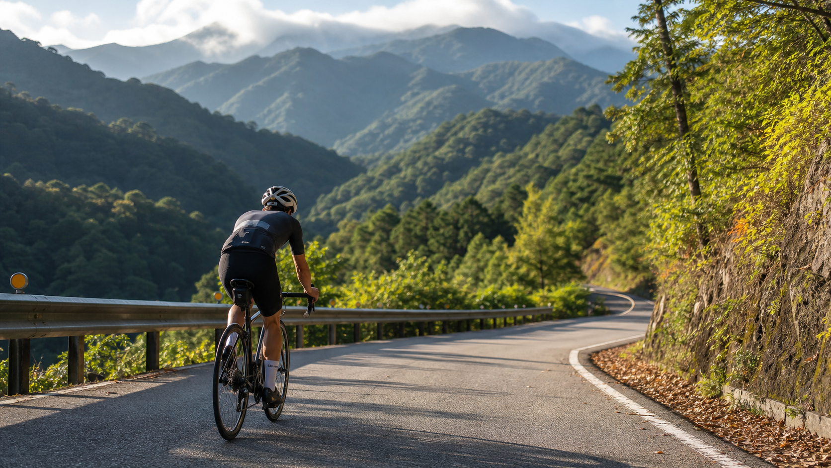
The Xuejian Simaxian Forest Road is a highly representative long-distance forest road climb located in Tai’an Township, Miaoli County. The route starts from the junction with the mountain roads of Tai’an Township, winding its way up along the Simaxian Forest Road system, and ends near the entrance to the Xuejian Recreation Area of Shei-Pa National Park. The reason this route is repeatedly discussed in the cycling community is not because of any shockingly steep gradient figures, but because it combines “long distance” with a “steady, moderate gradient,” creating a dual test of endurance and willpower. According to the segment record on the Strava platform (Segment ID 10432801), the total length of this route is 24,939.2 meters, which is approximately 24.94 km, and the average gradient (avg_grade) indicated by the platform is 5.6%. These two figures are the core basis for all the segmented strategies, equipment recommendations, and time estimates in this article, and readers should use them as the standard when planning their trip.
Before officially diving into the segmented strategy, there is a data issue that must be honestly addressed, and it is a key point this article specifically wants to remind all cyclists to pay attention to. In some database records, the raw GPS elevation data for this route indicates a total elevation gain of up to 3,342 meters. However, if you cross-validate this figure with the distance and average gradient, it becomes clearly unreasonable. Consider this: for a 24.94 km distance to achieve a total elevation gain of 3,342 meters, the back-calculated average gradient would be as high as 13.4%. This would mean there are almost no gentle slopes or downhill sections for respite along the entire route, requiring a sustained double-digit steep grade for the full 24.94 km. Compared to all currently known long-distance forest road climbs in Taiwan, this level of data is extremely rare for continuous climbs exceeding 20 km. It can even be said that it is physically and topographically unlikely to form naturally on a paved or gravel forest road surface alone—maintaining an average gradient of over 13% for more than 20 km typically requires extremely continuous hairpin turn mountain terrain, which does not match the actual topographical characteristics of the Xuejian Forest Road (which ascends gently along contour lines and has multiple relatively gentle transitional sections).
The cause of this anomalous data is likely a GPS signal interference problem unique to forest road sections. Forest roads often traverse dense forests, where the tree canopy can cause satellite signal reflection and multipath effects. Coupled with fragmented terrain undulations in some sections, GPS devices recording elevation are prone to generating “false elevation gain” due to signal jumps—meaning the same actual amount of climbing is repeatedly superimposed and calculated, causing the final cumulative total elevation gain figure to be far higher than the actual terrain’s elevation gain. This phenomenon is not uncommon in GPS tracks for long-distance forest roads and hiking trails and is a known type of device measurement error, rather than the route actually having such an exaggerated gradient.
Therefore, this article uses an average gradient of 5.6% combined with a distance of 24.94 km, applying the basic gradient back-calculation formula (Total Elevation Gain ≈ Distance × Gradient), to estimate a more reasonable total elevation gain of approximately 1,350 to 1,400 meters. This figure not only perfectly matches the 5.6% average gradient but is also comparable in magnitude to other known long-distance forest road climbs in Taiwan (such as other forest road routes located in the mountainous areas around Shei-Pa), falling within a reasonable and credible estimation range. It is recommended that all cyclists preparing to challenge this route use the actual elevation gain recorded live by their personal GPS watch or bike computer as the standard, and treat the 1,350 to 1,400 meters range as a reasonable reference baseline for planning fitness and fueling, rather than blindly trusting the unverified raw figure of 3,342 meters in the database. This attitude of maintaining skepticism towards data and cross-validating it is, in fact, a fundamental skill every serious cyclist should possess when planning long-distance challenges—when facing any route data, especially for non-standard mapped roads like forest roads and service roads, always cross-check distance and gradient to avoid misjudging energy allocation before the ride, or even making overly conservative or overly aggressive fueling strategies due to a miscalculation of total elevation gain.
Overall, the Xuejian Simaxian Forest Road is a “marathon-style” rather than a “sprint-style” climb. It doesn’t have any single section with a gradient so steep that it forces one to dismount and walk (unless due to an individual’s specific physical condition), but it uses a distance of nearly 25 km to continuously drain the cyclist’s muscular strength and willpower. The endpoint altitude can climb to around 1,600 to 2,000 meters in the mountainous area, where changes in temperature and oxygen concentration will gradually become apparent in the latter stages. This route is more suitable for training long-duration power output management, psychological endurance, and fueling rhythm control, rather than being a route type purely for pursuing explosive power.
Segmented Strategy from Start to Finish
To fully deconstruct a long forest road route of nearly 25 km, you cannot summarize the entire course with a single gradient figure. It must be broken down into several sections with different characteristics, analyzing gradient changes, surface material transitions, and energy allocation strategies segment by segment. The entire course is roughly divided into six sections below based on altitude and topographical features, allowing cyclists to build a mental map before the actual challenge.
Section 1: Start to ~4 km (Warm-up Paved Section)
The route start typically connects from the mountain access roads of Tai’an Township. This section is mostly still asphalt-paved, with relatively smooth road conditions and a gentler gradient, roughly fluctuating between 3% and 5%. This is the most important “warm-up zone” of the entire challenge. Many cyclists easily make the most common strategic mistake on long forest road climbs: pushing upward with excessively high power output when their energy is still abundant and adrenaline is high. It is recommended to control heart rate within 65% to 75% of your maximum heart rate during this section, and power output is suggested to be around 60% to 70% of your FTP (Functional Threshold Power). The goal is to truly awaken the body, allowing the cardiorespiratory system and muscles to gradually adapt to the sustained climbing load pattern, rather than hastily depleting precious glycogen reserves in the early stages.
Section 2: ~4 to 9 km (Gradient Increase and Surface Transition Zone)
After entering the second section, the gradient begins to increase noticeably. Some intervals may feature brief steep slopes of around 7% to 9%, and the road surface material may start to show a transitional mix of asphalt and gravel. This is a characteristic section where a typical forest road transitions from an existing access road into a road managed by the forestry service system. Cyclists need to pay special attention to changes in tire grip in this section, especially after rain or in humid weather, as the mixed gravel and sandy soil surface can easily cause the rear wheel to slip. It is recommended to fine-tune power output to 70% to 80% of FTP at this point. Heart rate can be allowed to rise slightly to 75% to 80% of maximum heart rate, but reserve capacity must still be maintained. Absolutely avoid standing up and sprinting just because the gradient steepens. The biggest taboo on a long forest road climb is squandering limited anaerobic energy in the early to middle stages.
Section 3: ~9 to 14 km (Core Gravel Forest Road Zone)
This section can be considered the most challenging core zone of the entire route in terms of road conditions. The surface largely transitions to a complete gravel forest road surface. Some parts may have deeper ruts or loose sand and gravel accumulation due to forestry operation vehicle traffic. The gradient fluctuates around the overall average of 5.6%, but due to increased rolling resistance, the actual perceived effort of riding will be significantly higher than on an asphalt section with the same gradient. It is recommended to adopt a riding rhythm of “primarily seated, supplemented by standing,” minimizing unnecessary out-of-the-saddle efforts to conserve energy and prevent rear wheel spin. Regarding fueling strategy, this section is an ideal time to plan a short mid-ride break to replenish fluids and energy gels, as the altitude will continue to climb in the upcoming sections, temperatures will drop, and perceived exertion will increase. It’s best to top up blood sugar and hydration levels in a relatively flat area beforehand.
Section 4: ~14 to 18 km (Entering Mid-to-High Altitude Forest Zone)
As the altitude gradually climbs above 1,000 meters, the surrounding vegetation landscape begins to change. The original secondary forest gradually transitions to a more pristine forest type, and the temperature will be noticeably lower than at the mountain base. Especially during early morning or afternoon hours prone to fog, visibility may decrease significantly. The overall gradient in this section remains near the average, but due to the thinning air effect caused by the increasing altitude, the subjective feeling of exertion (RPE) will gradually increase even if power output remains constant. It is recommended to consciously fine-tune output starting from this section, preferring to slightly reduce power to maintain a stable cadence and avoid an unanticipated spike in heart rate. The suggested heart rate zone to control is between 78% and 85% of maximum heart rate. This is already approaching the upper limit zone that most amateur cyclists can sustain for a long duration. If you feel continuously strained, you should immediately reduce speed rather than push through.
Section 5: Approximately 18 to 22 km (The Final Mental Fortitude Test)
This is the section of the entire route where “hitting the wall” is most likely to occur. After nearly 20 kilometers of continuous climbing, most riders’ muscle glycogen stores are significantly depleted. Coupled with the additional physiological stress from altitude and temperature changes, the subjective feeling here will be the most agonizing part of the entire ride, even if the gradient doesn’t steepen. This is also the moment that most critically tests whether your nutrition strategy has been properly executed—if you haven’t kept up with fueling in the previous sections, you are very prone to hypoglycemia, cramps, or loss of concentration here. The forest road is narrow, and some sections are adjacent to slopes; the risk increases significantly if your attention wanders. It is advisable to slow your rhythm and push through this section with a more conservative power output. If necessary, dismount and walk for a few minutes to catch your breath. This won’t significantly impact your overall finishing time and can prevent accidents from pushing too hard or the predicament of being completely unable to ride due to cramps.
Section 6: Approximately 22 km to the Finish (Gentle Slope Finish Before Syuejian Recreation Area)
Entering the final push, as you approach the entrance to the Syuejian Recreation Area, the gradient eases slightly in some parts, giving riders a chance to regain their cadence rhythm and prepare for the final stretch. In this section, riders are advised to moderately increase their output intensity and sprint towards the finish line based on their remaining energy. However, still be mindful that you are now in a high-altitude area above 1,600 meters, where the temperature can be significantly lower than at the mountain base. If there is wind or fog, prioritize riding safety before considering sprint performance. After reaching the finish line, it is recommended to immediately add warm clothing. After prolonged climbing, you will have sweated profusely, and combined with the sharp temperature drop at high altitude, failing to keep warm can very easily lead to hypothermia and catching a cold. This is especially important to note when tackling this route during the autumn and winter seasons.
Gear Ratio and Equipment Recommendations
As a long forest road route spanning nearly 25 kilometers with an average gradient of 5.6% and variable surfaces (alternating between asphalt and gravel), the Syuejian Simakeng Forest Road demands completely different gear ratio configurations and bike equipment compared to typical short, steep climbs. The core challenge of this route is not an instantaneous extreme gradient, but the compound fatigue from sustained, long-duration output combined with changing road surfaces. Therefore, equipment selection should focus on “endurance” and “surface adaptability,” rather than purely pursuing lightweight climbing gear ratios.
Regarding gear ratio configuration, it is highly recommended to use a drivetrain with a wide gear range. This allows the rider to find a gear combination that maintains a stable cadence and enables long periods of seated climbing without needing to frequently stand and pedal out of the saddle. For road bike riders planning to tackle this route, it is advisable to choose a groupset with a wide-ratio rear cassette, paired with a compact crankset, ensuring the lightest gear can handle the climbing demands at higher altitudes when energy is fading in the later sections. For riders using mountain bikes or gravel bikes, the advantage of a wide gear range is even more pronounced, allowing them to more comfortably handle the extra torque output required due to increased resistance on gravel sections.
Below is a summary of recommended gear ratio configurations and applicable scenarios for different bike types:
| Bike Type | Recommended Front Chainring | Recommended Rear Cassette Range | Applicable Scenario Description |
|---|---|---|---|
| Road Bike (Race-Oriented) | Compact 50-34T | 11-32T or 11-34T | Suitable for advanced riders with better fitness seeking a faster finishing time, but still requires a wide gear ratio to cope with the fatigue phase in the later sections. |
| Road Bike (Endurance/Touring) | Compact 50-34T or smaller | 11-34T or wider | Suitable for riders with average fitness, prioritizing having a sufficiently light gear available for the later sections to avoid blowing up. |
| Gravel Bike | 1x 40T or 2x 46-30T | 10-42T or 10-51T wide-range cassette | Best adaptability on gravel sections; the wide gear ratio can meet the dual demands of both paved and gravel surfaces. |
| Mountain Bike (Hardtail) | 1x 30-32T | 10-51T wide-range cassette | Strongest surface adaptability; suitable for riders who are conservative about road conditions and prioritize finishing the ride. |
Tire selection is the most easily overlooked yet potentially critical aspect of equipment planning for this route, directly impacting whether you can finish safely. Since a significant proportion of the route consists of gravel forest road surfaces, and some sections may have sharp gravel or rock debris left by forestry vehicles, the high-pressure, narrow tires commonly used on road bikes (such as 25c or 28c racing tires) not only offer poor comfort on this surface but also significantly increase the risk of punctures and cuts. It is highly recommended to choose tires with a thicker puncture-resistant layer, with a width of at least 32c or more. If using a gravel or mountain bike, selecting off-road tires with a certain tread depth can greatly enhance grip and handling stability on loose gravel surfaces. This is particularly noticeable on the return descent, where off-road tires significantly aid braking distance and cornering stability.
Carrying spare tubes and repair tools is not optional but an absolute necessity on this route. As the forest road is located in a remote mountainous area, if you get a flat tire or puncture, there are virtually no bike shops or supply stations nearby to seek help. Without sufficient spare tubes, inner tubes, or sealant and tire plugs for a tubeless system, you could easily end up in the predicament of having to walk your bike for several kilometers or even call for rescue. Mountain rescue services themselves can be time-consuming due to poor signal reception and difficult road access. It is recommended to carry at least one spare inner tube (if using a tubeless system, ensure sealant levels are sufficient and carry a tire plug kit), along with a basic portable pump or CO2 inflator. Also, confirm beforehand that you possess basic roadside repair skills, rather than relying entirely on riding partners or post-incident assistance.
Furthermore, considering the significant altitude change and potential for drastic temperature differences along the route, it is advisable to carry a lightweight, packable windproof and warm jacket. Even if the temperature at the mountain base feels warm at the start, the temperature drops sharply upon reaching the high-altitude finish, and combined with the wind chill effect on the descent, the perceived temperature can be much lower than expected. For gloves, it is recommended to choose a style with some cushioning and warmth. The vibration and fatigue on your hands from controlling the handlebars over long periods on gravel surfaces will be noticeably greater than on typical asphalt rides.
Nutrition and Hydration Strategy
For a 24.94-kilometer long-distance forest road climb, compounded by the inherent limitation of scarce supplies in mountainous terrain, the importance of planning your nutrition and hydration strategy is no less than physical training itself. There are virtually no convenience stores or commercial supply points along this route. Once you start and enter the forest road, you enter an isolated segment where replenishment depends entirely on the supplies you carry. Therefore, pre-ride nutrition planning must be extremely meticulous and thorough.
For planning your water carrying capacity, it is recommended to make a comprehensive estimate based on the day’s temperature, your personal sweat rate, and the estimated finishing time. Generally, during long climbs in moderate temperatures, hourly fluid loss is about 500 to 800 milliliters. If the estimated finishing time for the route is two to three hours or even longer, the total water carried should be planned for at least 1,500 milliliters. Larger riders or those with higher sweat rates are advised to carry 2,000 milliliters or more. Since the capacity of frame-mounted water bottle cages is limited, it is recommended to use a climbing backpack with a hydration bladder system. This not only significantly increases water-carrying capacity but also allows you to store nutrition, a wind/rain jacket, a power bank, and other emergency items, serving multiple purposes at once.
For energy replenishment pacing, it is recommended to adopt a “little and often” principle, rather than waiting until you clearly feel hungry or your energy drops. Based on the length and intensity of this route, it is advisable to take a small portion of energy nutrition every 20 to 30 minutes. This can be energy gels, energy bars, or real food (natural carbohydrate sources like bananas or sweet potatoes). Pay special attention to ensuring consistent fueling at the two key points mentioned in the segmented strategy: Section 3 (the gravel core area, approximately 9 to 14 km) and Section 5 (the mental fortitude test, approximately 18 to 22 km). These are the sections where you are most prone to a cliff-like drop in performance due to glycogen depletion.
Electrolyte replenishment is equally crucial and should not be overlooked. Especially when tackling this route in summer, heavy sweating leads to the rapid loss of electrolytes like sodium and potassium. If you only replenish water and ignore electrolytes, you are prone to muscle cramps in the later stages. This is particularly dangerous on mountain forest road sections, as a cramp can cause a sudden loss of balance and a fall. It is recommended to add electrolyte powder to your water bottles or hydration bladder, or carry extra electrolyte tablets, adjusting the replenishment frequency based on temperature and sweat rate.
Due to the lack of reliable commercial supply points along the route, it is strongly recommended that all nutrition be fully prepared at the mountain base before departure. It is better to carry too much than to rely on the false hope of finding a shop along the way. If you plan to tackle the full round trip (outbound and return), the amount of nutrition should be doubled in your planning. Although the return leg is mostly downhill, controlling the bike on a descent after physical exhaustion still requires concentration and energy support, and must not be taken lightly.
Weather and Seasonal Recommendations
The Syuejian Simaixian Forest Road is located in the mountainous area surrounding Shei-Pa National Park, with an elevation spanning from the foothills all the way up to around 1,600 to 2,000 meters. This significant elevation difference means that weather changes are far more dramatic than on flat terrain or lower-altitude routes, making it a crucial factor that cannot be ignored when planning your challenge schedule.
Afternoon thunderstorms in the mountains are one of the most critical weather risks to guard against on this route. During summer afternoons, the mountainous regions of central Taiwan often experience localized thunderstorms due to strong convection. These storms arrive suddenly and intensely, often transforming clear skies into torrential rain within just a few dozen minutes. As the forest road surface becomes slippery after rain, especially on sections mixed with gravel and sandy soil, the combination of wet conditions and poor visibility significantly increases the risk of crashes and veering off the route. It is strongly recommended to start your challenge on this route as early in the morning as possible. The goal should be to complete the majority of the climbing sections before noon, around the time when convection is most active, or at least to have descended back to a relatively safe area.
Dense fog is another common and non-negligible weather phenomenon on mountain forest roads. Particularly in high-altitude sections with dense tree cover obstructing visibility, thick fog not only reduces sight distance, affecting a rider’s judgment of road conditions, curves, and oncoming vehicles (such as forestry service vehicles), but also makes the temperature feel even more damp and cold. If you find the mountain fog to be exceptionally severe on the day of your challenge, it is advisable to carefully evaluate whether to postpone your attempt. Safety should always take priority over itinerary planning.
The risk of rockfalls is an inherent characteristic of forest road routes, especially on sections with steeper gradients or less stable slope geology. After heavy rain or earthquakes, the risk of rockfalls increases significantly. Riders are advised to constantly watch for signs of fresh rockfall debris on the road surface during the ride. If you notice obvious signs of collapse or accumulated rockfall on a section, you should immediately slow down or even dismount and walk your bike through. Never rush through sections with poor visibility or unclear road conditions just for the sake of speed.
In terms of seasonal selection, autumn and winter are typically periods in central Taiwan’s mountainous areas with a relatively lower probability of rainfall, better air quality, and a higher chance of enjoying beautiful views of the sea of clouds and mountain ridges. However, you must also pay attention to the low temperatures during early mornings and nights in autumn and winter, especially on the high-altitude sections near the finish point. Be sure to prepare sufficient warm clothing. Although summer offers longer daylight hours, afternoon thunderstorms and the physical drain from high heat and humidity are additional challenging variables. If you choose to take on the challenge in summer, you must start even earlier and pay extra attention to hydration and sun protection.
Regarding mountain entry regulations, as the endpoint of the Syuejian Forest Road route is adjacent to the Syuejian Recreation Area of Shei-Pa National Park, some sections or specific periods may involve national park entry controls or application requirements. Actual regulations may be adjusted over time, so please be sure to follow the latest entry regulations of Shei-Pa National Park. Before departure, check online or call to confirm whether you need to apply for a mountain entry permit or complete other related procedures, to avoid affecting your itinerary or violating relevant control regulations due to unfamiliarity with the rules.
Common Mistakes and DNF Risks
Due to its unique terrain environment and limited resupply options, long forest road climbing routes present several common mistakes that can easily lead to a failed challenge (DNF, Did Not Finish) or even accidents. Below are at least five risk points that riders should be particularly vigilant about.
The first common mistake is inadequate resupply planning, which is also the most prevalent reason for failure on long-distance forest road climbs. Many riders are accustomed to estimating the water and energy needed for a long forest road climb based on their experience with short-distance routes. As a result, they often find their water bottles empty and energy gels depleted midway through the route, with no stores nearby to replenish supplies. Ultimately, they are forced to turn back prematurely or wait for assistance. The previous section on resupply strategy has detailed the recommended quantities to carry; it is imperative to err on the side of bringing too much rather than taking risks.
The second risk is rockfalls and road collapses. This is an inherent geological risk of forest road routes, requiring heightened alertness, especially on sections after rain or earthquakes. There have been cases of riders crashing and getting injured due to negligence of loose rocks on the road surface, as well as cases of riders inadvertently entering dangerous sections by failing to notice signs of slope collapse. It is recommended to constantly observe the surrounding terrain during the ride and, when encountering suspicious sections, it is better to slow down or even dismount and walk through.
The third risk is sudden weather changes, particularly the afternoon thunderstorms and dense fog issues mentioned earlier. Weather in mountainous areas changes much more rapidly than on flatlands. If the challenge schedule is poorly planned, you may encounter sudden rainfall or fog when climbing to the high-altitude sections near the finish point. This not only greatly increases the difficulty of riding but also sharply raises the risk of hypothermia. It is recommended to start early and constantly monitor weather forecasts and on-site weather changes. If necessary, decisively abandon the challenge and turn back along the original route.
The fourth risk is loss of control due to skidding on loose gravel surfaces. Riders with inappropriate tire choices (such as using overly narrow racing tires or tires with shallow tread) are particularly prone to tire slippage on gravel forest road sections due to insufficient grip. At best, this results in a crash and abrasions; at worst, losing balance could cause a slide towards the roadside slope, leading to more serious injuries. This also echoes the importance of tire selection emphasized in the earlier equipment recommendations section.
The fifth risk is the difficulty of obtaining support after a mechanical failure. Forest roads are located in remote areas where mobile phone reception is often unstable or completely absent. If a mechanical failure occurs that cannot be fixed on the spot (such as severe damage to the drivetrain or significant wheel deformation), calling for vehicle rescue or contacting companions for assistance can be extremely difficult. You might need to walk your bike for several kilometers before reaching an area with signal or signs of habitation. It is recommended to tackle this route with companions whenever possible, avoid attempting it alone, and ensure your bike undergoes a complete inspection and maintenance before departure to minimize the probability of mechanical failure.
In addition to the five main risks above, riders are also reminded to pay attention to an honest assessment of their personal physical condition. Long forest road climbs place very high demands on cardiovascular fitness and muscular endurance. If your usual training volume is insufficient and you rashly attempt the full 24.94-kilometer distance, you are likely to experience severe physical exhaustion in the middle to later stages, potentially triggering more serious physiological conditions like heat exhaustion or hypoglycemia. It is recommended that before challenging this route, riders first confirm they have a training foundation capable of sustaining continuous riding for at least two to three hours and are familiar with long-distance pacing rhythms. Do not recklessly challenge a long-distance forest road route that exceeds your ability level on a whim.
Target Times for Riders of Different Levels
As the full Syuejian Simaixian Forest Road is nearly 25 kilometers long with an average gradient of 5.6%, it is a long-distance, sustained moderate-intensity challenge route. Completion times can vary significantly based on the rider’s fitness level, equipment choices, and the day’s weather conditions. Below are reference target completion times for riders of different levels, provided in hours, to serve as a benchmark for readers planning their itinerary.
| Rider Level Classification | Average Power Output Reference (% of FTP) | Estimated Completion Time (One Way) | Description |
|---|---|---|---|
| Elite/Competitive Rider | Approx. 80% to 90% FTP | Approx. 1.5 to 2 hours | Possesses a long-term, systematic training foundation; familiar with long-distance pacing and forest road surface handling. |
| Advanced Recreational Rider | Approx. 70% to 80% FTP | Approx. 2 to 2.5 hours | Has some climbing training experience; can stably maintain medium-high intensity output. |
| General Recreational Rider | Approx. 60% to 70% FTP | Approx. 2.5 to 3.5 hours | Possesses basic climbing ability; requires more mid-ride rest and resupply time. |
| Entry-Level Challenger Rider | Approx. 50% to 60% FTP or lower | Approx. 3.5 to 5+ hours | Recommended to use equipment with wider gear ratios and reserve ample time for resupply and rest. |
The above time estimates are for one-way reference only. If you plan to challenge the complete out-and-back route, although the return journey is mostly downhill with relatively lower physical exertion, you still need to consider the concentration required for downhill handling and the time cost. It is recommended to reserve at least an extra hour as a buffer for the return trip and mid-ride breaks. Furthermore, actual completion times will fluctuate based on the day’s temperature, wind direction, road surface wetness, and personal on-the-day condition. It is advised that all riders, when planning their challenge schedule, err on the side of allowing a more generous time margin. Do not push yourself to finish the challenge while physically exhausted just to pursue a specific time goal. Completing the ride safely should always be the top priority in this long forest road route challenge.
Related Topic Reading
- Alone, One Forest Road, 24.94 Kilometers: The Solitude and Grandeur of the Syuejian Simaixian Forest Road
- Complete Dasyueshan Forest Road Climbing Guide: 20 Kilometers of Uninterrupted 6.2% Ascent, a Major Threshold Endurance Test
- Dasyueshan Forest Road Cycling Challenge: A Primeval Forest Climb in Taichung’s Hidden Realm
- Practical Guide to the 32km Dasyueshan Long Climb: An Endurance Mountain, Gently Ascending 1557 Meters from Dongshi
半日 小台灣 極限單車路線挑戰實錄
7 年前
台北闊瀨陡坡 騎旅 / 日本單車雜誌編輯車友臨時加入!/ 髮香才是最強的 / feat. 北迴歸線小隊 / 公路車 CT Yeh
6 個月前
單車 梅山36灣 坡度介紹 路段介紹 空拍 (相關遊記影片,請參考說明或我的頻道喔,歡迎訂閱)
6 年前
大武山後門26%歡樂陡坡!JJSC南台灣單車行Day2 / 被颱風追著跑 / 公路車 / CT Yeh
2 年前
司馬庫斯 | 單車員工旅遊 | 比武嶺還接近上帝的路 | 2021 全面實況 路況解析 | 空拍 櫻花炸開超濃密 | 財伯觀光果園 | CT Yeh
5 年前
台灣登山王之路 KOM 全程參賽4K臨空錄影 PART1 穿越峽谷地形! #東進武嶺 太魯閣 / 燕子口 / 天祥 / 西寶 PART1 (公路車 / CT Yeh)
3 年前
#北橫 + #北進武嶺 最硬的員工旅遊 EP1 | #公路車 #拉拉山 | 明池 | 武嶺 | 武陵農場 | 雲海 | Taiwan Cycling Route Wulin
6 年前
爬坡ITT實境)台中 魔王 松鼠坡 首航 6:12 大肚山 大三元 科福路
8 年前