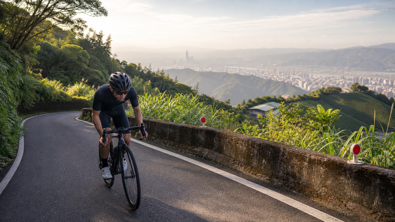
Fenghuizui Climbing Guide: Taipei’s Most Popular Suburban Climbing Pilgrimage
Fenghuizui (風櫃嘴), at an elevation of about 580 meters, sits on the ridgeline at the northern edge of the Taipei Basin and serves as an important mountain pass connecting Neihu and Jinshan. The classic climb from downtown Taipei to Fenghuizui starts from Kangle Street (康樂街) in Neihu, running about 10km with roughly 570m of cumulative elevation gain at an average gradient of about 5.7%.
This is the highest-density climbing training ground for Taipei cyclists — on weekend mornings, riders start heading out from as early as six o’clock, and many more are on their way back down in the afternoon. Fenghuizui’s Strava KOM segment is one of the most fiercely contested in Taiwan.
Basic Route Information
| Item | Data |
|---|---|
| Common start point | Kangle Street intersection in Neihu (near Xihu MRT Station) |
| End point | Fenghuizui (elevation ~580m) |
| Climbing distance | ~10km |
| Cumulative elevation gain | ~570m |
| Average gradient | ~5.7% |
| Steepest section | Jinlong Road to the turning point, ~8–10% |
| Strava KOM reference | Men ~28–33 minutes, women ~35–42 minutes |
Detailed Section Analysis
Early Section (0–3km): Warm-up
Heading from the Kangle Street intersection toward Jinlong Road (金龍路), the gradient starts at about 3–5%, a typical warm-up stretch. This section has street lighting and good road conditions, passes through residential areas, and occasionally has parked vehicles to watch out for.
Middle Section (3–7km): Main Climb
After passing the fork at Jinlong Road and Baishihu (白石湖), you enter the main climbing zone. The gradient here is about 6–9%, the stretch where most riders burn through their energy fastest. There are occasional farmhouses and tea gardens along the road, and the view gradually opens up.
Final Section (7–10km): The Mental Test
After the fork at the Wuzhishan Forest Trail (五指山林道), the gradient stays at 6–8%, and many first-time challengers start to visibly struggle here. The key is: don’t burn through your rhythm in the middle section.
In the last kilometer before reaching the Fenghuizui saddle, there is a short stretch of ridge road with open views — on a clear day you can see all the way across the Taipei Basin and the Keelung River, a truly spectacular sight.
Why Is Fenghuizui a Training Pilgrimage Site?
Location
It takes only about 20–30 minutes of riding from downtown Taipei to reach the start point, with no long trek required. For cyclists who need frequent, high-intensity climbing training, this is the most efficient choice.
Repeatability
The Fenghuizui route lends itself to “there-and-back” repeats — climb up, descend the same road back to the start, then climb again — known as “brushing the climb” (刷坡). Many riders do 2–3 repeats in a single morning, accumulating over 1000m of elevation gain.
An Everesting Base
Fenghuizui is where the most riders in Taiwan have completed an “Everesting” challenge (repeatedly climbing the same slope to accumulate 8,848m of elevation). Thanks to relatively consistent traffic, a conveniently sized climb distance, and stable road conditions, it’s well suited to extremely long, continuous climbing sessions.
Time Targets for Different Levels
Below are reference completion times for riders of different levels:
| Level | Estimated time | Suggested power (W/kg) |
|---|---|---|
| Beginner (1–2 years riding) | 45–60 minutes | 2.5–3.0 W/kg |
| Intermediate | 35–45 minutes | 3.0–3.8 W/kg |
| Advanced | 28–35 minutes | 3.8–4.5 W/kg |
| Competitive | Under 25 minutes | 4.5+ W/kg |
Common Mistakes
Mistake One: Starting Too Fast
Many riders push too hard in the first 3km because the gradient is gentle there, and end up severely burnt out in the middle section (the steepest 3–7km). The correct approach is to maintain a steady pedaling cadence and let your heart rate rise gradually rather than maxing out right from the start.
Mistake Two: Heading Out Without Supplies
Although Fenghuizui is only 10km, the round trip plus repeated training sessions add up to a very high energy expenditure over a single morning. It’s recommended to bring at least one bottle of electrolyte drink and two energy gels.
Mistake Three: Ignoring Descent Safety
Fenghuizui’s descent has many curves and locally slippery road surfaces. Many riders speed up on the way down because they’re eager to start the next climb, and this is the most dangerous behavior. It’s recommended to keep descending speed under 30km/h and brake early before corners.
Route Extensions from Fenghuizui
After reaching Fenghuizui, there are several extension routes to choose from:
- Continue toward Jinshan: Descend north from the Fenghuizui saddle to Jinshan (金山), about 18km, where you can resupply before heading back (requires a shuttle or riding back via Provincial Highway 2)
- Toward Qingtiangang: Head west to connect with the Yangmingshan grassland section — more open terrain, but rougher road conditions
- Xiping Highway to Xizhi: Extend eastward, connecting to Xiping Highway (汐平公路) down to Xizhi (汐止) — a longer route with fewer people
Best Times to Ride
- Early morning 5:30–8:00: The most riders out, moderate temperatures
- Weekday afternoons 3:00–6:00: Working professionals’ training window, fewer people, quieter roads
- Avoid: Weekend midday 12:00–14:00 (hot, lots of tour buses), and the 24 hours after heavy rain (rockfall, slippery roads)
The Spirit of Fenghuizui
Fenghuizui is not Taiwan’s toughest climb, nor its highest mountain, but it represents something of the daily spirit of Taipei cyclists: every morning, dragging a tired body out the door, holding a conversation with yourself on that 10km slope, then riding back into the city with a sense of satisfaction.
Whether it’s your first challenge or your hundredth repeat, Fenghuizui is always there, waiting for you.
Related Reading
- Complete Technical Breakdown of the Fenghuizui Climb: Secrets of Northern Taiwan’s Training Pilgrimage
- Classic Fenghuizui Climb Analysis: Northern Taiwan’s Training Pilgrimage
- Fenghuizui Practical Guide: 6.13km, 410.8m Elevation Gain — Segment Breakdown and Gear Ratio Calculations for Taipei’s Cycling Pilgrimage
- Complete Guide to Classic North Coast and Northeast Coast Routes: Fenghuizui, Bālākǎ, and Buyanting
#公路車 台北 #風櫃嘴 23:47 全台單車實境請訂閱鎖定
7 年前
風櫃嘴 | 全台最多大砲的單車路線 | 尋寶網攝影師告訴你怎麼擺拍起來才好看 | 熱門攝影地點巡禮
6 年前
風櫃嘴時間 預測西進武嶺時間?13000名車友統計數據分析告訴你 !
5 年前
台北闊瀨陡坡 騎旅 / 日本單車雜誌編輯車友臨時加入!/ 髮香才是最強的 / feat. 北迴歸線小隊 / 公路車 CT Yeh
6 個月前
爬坡ITT實境)台中 魔王 松鼠坡 首航 6:12 大肚山 大三元 科福路
8 年前
台灣登山王之路 KOM 全程參賽4K臨空錄影 PART1 穿越峽谷地形! #東進武嶺 太魯閣 / 燕子口 / 天祥 / 西寶 PART1 (公路車 / CT Yeh)
3 年前
大禹嶺 到 武嶺牌樓 全程前後實況錄影 | 北進武嶺 | 東進武嶺 | KOM | 訓練台 | 坡度分析 | Taiwan KOM Last 10 km HARD | 公路車
6 年前
半日 小台灣 極限單車路線挑戰實錄
7 年前