Beiyi Highway's Nine Bends and Eighteen Turns: A Cyclist's Reverse Challenge on a Motorcycle Mecca
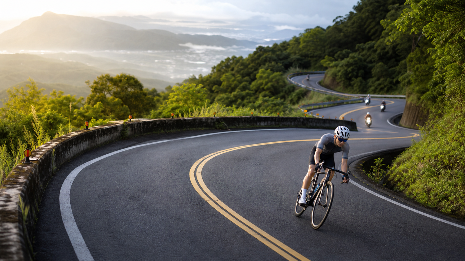
An Old Highway Dominated by Motorcycles
The Beiyi Highway (Provincial Highway 9, Xindian–Toucheng section) is approximately 58 km long, with its highest point at Shipai, about 500 meters above sea level. After the Hsuehshan Tunnel opened, car traffic was largely diverted away, leaving this old road as a mountain route shared by cyclists and heavy motorcycles. For cyclists, it’s a road with a steady gradient, ideal for practicing long climbs—provided you know how to coexist with the motorcycles.
Sections and Gradients
| Section | Distance | Cumulative Climb | Characteristics |
|---|---|---|---|
| Xindian→Pinglin | 27 km | Approx. 720 m | Main climbing section, heavier traffic |
| Pinglin→Shipai | 8 km | Approx. 280 m | Highest point, open views |
| Shipai→Toucheng | 23 km | Mostly downhill | Nine Bends and Eighteen Turns technical descent |
How to Ride the Nine Bends and Eighteen Turns Downhill
From Shipai toward Toucheng, the Nine Bends and Eighteen Turns is a series of continuous hairpin switchbacks descending roughly 400 meters in total elevation. The key points are the “outside-inside-outside” line, completing your braking before entering each turn, and accelerating only after exiting. This is a hotspot for heavy motorcycles—stay to the right through corners, never cross into oncoming traffic, and keep your downhill speed within 40 km/h.
A Milestone-by-Milestone Breakdown of Xindian to Pinglin
The main climbing section isn’t one uniform slope; breaking it into segments using landmarks along the way makes it much easier mentally:
| Milestone | Approximate Distance | Elevation | Mental Anchor |
|---|---|---|---|
| Xindian MRT Station | 0 km | 30 m | Starting point, don’t go out too hard |
| Shuangfeng Intersection | 6 km | 150 m | The real climb begins |
| Shipai, highest point of Beiyi | 35 km | 500 m | Highest point of the route, stop for photos |
| Pinglin Old Street | 27 km | 230 m | Only major resupply point, turnaround |
Over the 21 km from Shuangfeng to Pinglin, gradients mostly fall between 4% and 6%—no killer steep pitches, but it never lets up, making it ideal for building sustained threshold. Suggested workout: use Pinglin as the turnaround and do 2×40 minutes of Sweet Spot (roughly 88% to 94% of FTP), refueling at Pinglin Old Street with a tea egg and a cup of Baozhong tea.
Resupply Points
Pinglin is the only major resupply stop on the entire route; the old street offers Baozhong tea and tea eggs, and convenience stores are well stocked. After Pinglin, there’s almost no resupply until Toucheng, so be sure to top up your water.
Timing Strategy
After 8 AM on weekends, heavy motorcycle density is extremely high. For safety reasons, weekdays or early mornings are recommended. In winter, the northeast monsoon sweeps into the Lanyang Plain, and the Toucheng end often sees strong headwinds and rain—guard against slipping and hypothermia.
Suitable Training Purposes
The 27 km from Xindian to Pinglin has a steady gradient, making it an excellent venue for long Sweet Spot threshold work. You can set a 2×40-minute Tempo workout with Pinglin as the turnaround.
Beiyi isn’t for racing. Its bends are there to remind you: in the world of descents, getting home alive matters far more than being 10 seconds faster.
Related Reading
- The Complete Beiyi Highway Guide: The Classic Climb from Xindian to Toucheng
- Beiyi Highway (Provincial Highway 9) Riding Guide: Gradient Analysis of the 9 Bends and 18 Turns
- Beiyi Highway Cycling Guide: Scenery and Resupply from Pinglin to Yilan
- Beiyi Highway Pinglin Section 4 km Analysis: The Climbing Testbed for Taipei Riders
台北闊瀨陡坡 騎旅 / 日本單車雜誌編輯車友臨時加入!/ 髮香才是最強的 / feat. 北迴歸線小隊 / 公路車 CT Yeh
6 個月前
單車 一日北高 ( 雙城 ) 肥宅雙人瘋狂行 紀錄片 REACTO
10 年前
北宜騎車⋯好刺激 差點被🐒尻 / 露營單車旅 / 公路車後背攜車架開箱!/ 百人大團露 / YAKIMA 設備開箱儀式感都來了 / 公路車 / CT Yeh
12 個月前
大武山20%魔王陡坡【JJSC南台灣遊騎Day2】!屁股真的要裂開了...凡士林抹滿也沒用?神秘金教堂還有超便宜夜市
3 個月前
大武山後門26%歡樂陡坡!JJSC南台灣單車行Day2 / 被颱風追著跑 / 公路車 / CT Yeh
2 年前
半日 小台灣 極限單車路線挑戰實錄
7 年前
#北橫 + #北進武嶺 最硬的員工旅遊 EP1 | #公路車 #拉拉山 | 明池 | 武嶺 | 武陵農場 | 雲海 | Taiwan Cycling Route Wulin
6 年前
新玉門關 單車挑戰賽 多視角主集團衝刺菁華版 4K #公路車
5 年前