Introduction
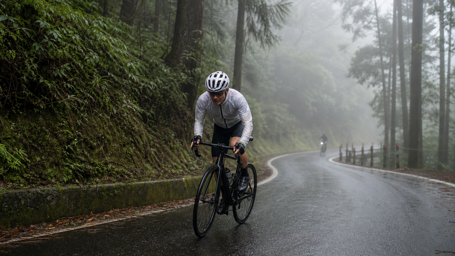
Taiping Mountain National Forest Recreation Area is located in Datong Township, Yilan County, with a maximum elevation of approximately 2,000 meters, making it one of Yilan’s important mountain biking routes. Unlike the vast, open expanses of Wuling, most of the Taiping Mountain climbing route winds through dense forest roads, with towering Taiwan cypress and yellow cypress trees shading the sky on both sides. The road surface remains damp year-round, and combined with Yilan’s unique “nine rains a day” climate, the Taiping Mountain climbing race presents a distinctly different set of challenges. For riders accustomed to riding on open roads, the forest road environment of Taiping Mountain demands greater technical skill and weather preparedness.
Analysis of Forest Road Section Characteristics
The Taiping Mountain climbing race typically starts from Tucheng or Renze, ascending along Provincial Highway 7C. This route has several notable features worth understanding in advance:
| Section | Characteristics | Cautions |
|---|---|---|
| Tucheng→Renze Hot Spring | Warm-up section with gentle climb, gradient around 3-4% | Wider road surface, ample space |
| Renze→Jianqing Historic Trail Junction | Gradient gradually increases to 5-7%, dense forest shade | Damp road surface, moss can be slippery |
| Jianqing Junction→Taiping Mountain Villa | Gradient reaches 7-10%, many curves | Low visibility in fog, requires caution |
| Near Taiping Mountain Villa | Gradient eases, approaching the finish | Watch for sudden temperature drops |
The most distinctive feature of forest road sections is the “damp road surface.” Even on sunny days, the road surface beneath the forest canopy lacks direct sunlight, causing moisture to evaporate slowly, often leaving moss or water stains. Speed should be reduced especially at curves to prevent the outer tire from slipping during turns.
Immediate Response to Weather Changes
The mountain weather in Yilan is one of the most unpredictable in Taiwan. Moisture brought by the northeast monsoon forms clouds and fog around Taiping Mountain—often the sun is shining brightly at the start of the morning, but by the middle section, thick fog has already enveloped the route. This rapid weather transition presents multiple challenges for climbing race participants:
Reduced Visibility:
- When riding in fog, forward visibility may be reduced to 20-30 meters
- Maintain a safe distance from the rider ahead to avoid rear-end collisions from sudden braking
- Turn on bike lights (if equipped) to alert riders behind and oncoming vehicles
Decreased Tire Traction:
- Braking distance in rain increases by more than 50% compared to dry road surfaces
- Brake early, ensuring speed has dropped to a safe range before entering curves
- Disc brakes perform more consistently than rim brakes on wet surfaces; prioritize them if equipment allows
Risk of Body Temperature Imbalance:
- In fog and rain, the body continuously loses heat, and core temperature drops far faster than on sunny days
- Even during high-intensity climbing, shivering may occur due to the low ambient temperature
- Pack a lightweight down jacket or windproof/waterproof shell in a rear pocket as backup
Pacing Strategy and Cadence Recommendations
The forest road gradients on Taiping Mountain are relatively consistent, with few extremely steep sections, but prolonged continuous climbing will drain significant energy. Recommended pacing strategies are as follows:
- Overall Pacing: Maintain 75-82% of FTP, avoiding excessive energy expenditure in the early forest road sections
- Cadence Selection: With the winding and narrow forest roads, maintain 80-90rpm to preserve agile cornering ability
- Gear Shift Timing: Shift to an easier gear before entering curves to avoid rear-wheel slip from hard pedaling mid-corner
- Heart Rate Monitoring: Heart rate may read low in cold temperatures; do not rely solely on heart rate to gauge intensity—combine it with RPE
Equipment Recommendations
Given the unique forest road environment of Taiping Mountain, equipment selection should emphasize all-weather functionality more than a typical climbing race:
- Tire Pressure: On wet surfaces, reduce pressure by 5-10 PSI to increase contact patch and improve grip
- Goggles: Moisture in fog can impair vision; consider anti-fog lenses
- Gloves: Even if the weather isn’t cold, the extended time gripping the handlebars on forest roads makes gloves essential for reducing fatigue
- Rear Light: Forest roads block sunlight; keep a rear taillight on even during the day to increase visibility
Practical Tips
- Check the detailed weather forecast for Yilan’s mountain areas the day before the race, paying special attention to mountain fog predictions
- Always assess your physical condition at the Renze aid station; if you already feel significant fatigue, moderately reduce your pace for the latter half
- The descent is more dangerous than the climb; if you need to descend after finishing, maintain low speed and use your brakes fully
- Moss on forest road surfaces is especially slippery on white lines or road markings; keep a straight line when crossing them
- Bring a waterproof bag or waterproof rear pocket to protect your phone and food from getting soaked and failing
Conclusion
The beauty of the Taiping Mountain climbing race lies in the tranquility of the forest roads and the pristine nature of Yilan’s mountains; the challenge lies in the unpredictable weather and damp road surfaces. Prepare a weather response plan, choose equipment suited for wet conditions, and maintain steady pacing—if you get these three things right, Taiping Mountain’s forest roads will become one of your most unforgettable climbing experiences.
Related Reading
- Taiping Mountain Cycling Challenge: A Forest Climb from Yilan to Taiping Mountain
- Taiping Mountain Road Challenge: A Hidden Climbing Route in Yilan’s Mountains
- Yilan Jiaoxi Hot Spring to Taiping Mountain: A Complete Guide to the Climbing Route Starting from the Hot Spring
- Chiayi Meishan Taiping Mountain Route: Detailed Analysis of a Climbing Training Route in Chiayi County
太平山單車員工旅遊 | 這樣玩CP值最高!| 公路車
5 年前
大武山後門26%歡樂陡坡!JJSC南台灣單車行Day2 / 被颱風追著跑 / 公路車 / CT Yeh
2 年前
爬坡ITT實境)台中 魔王 松鼠坡 首航 6:12 大肚山 大三元 科福路
8 年前
台灣登山王之路 KOM 全程參賽4K臨空錄影 PART1 穿越峽谷地形! #東進武嶺 太魯閣 / 燕子口 / 天祥 / 西寶 PART1 (公路車 / CT Yeh)
3 年前
新竹羅平 x 天湖部落 大禹嶺級變態陡坡! 4K超高畫質 空拍 | 公路車
5 年前
#北橫 + #北進武嶺 最硬的員工旅遊 EP1 | #公路車 #拉拉山 | 明池 | 武嶺 | 武陵農場 | 雲海 | Taiwan Cycling Route Wulin
6 年前
大武山20%魔王陡坡【JJSC南台灣遊騎Day2】!屁股真的要裂開了...凡士林抹滿也沒用?神秘金教堂還有超便宜夜市
3 個月前
那瑪夏x茶山 阿里山系深山單車行 Day2 累積爬升6000M | 🥶超陡連續下坡 整路看隊友刷 | 爬升一座西進武嶺 | JJSC | 公路車 | CT Yeh
3 年前