Beiheng Highway (Provincial Highway 7): The High-Mountain Cycling Challenge from Taoyuan to Yilan
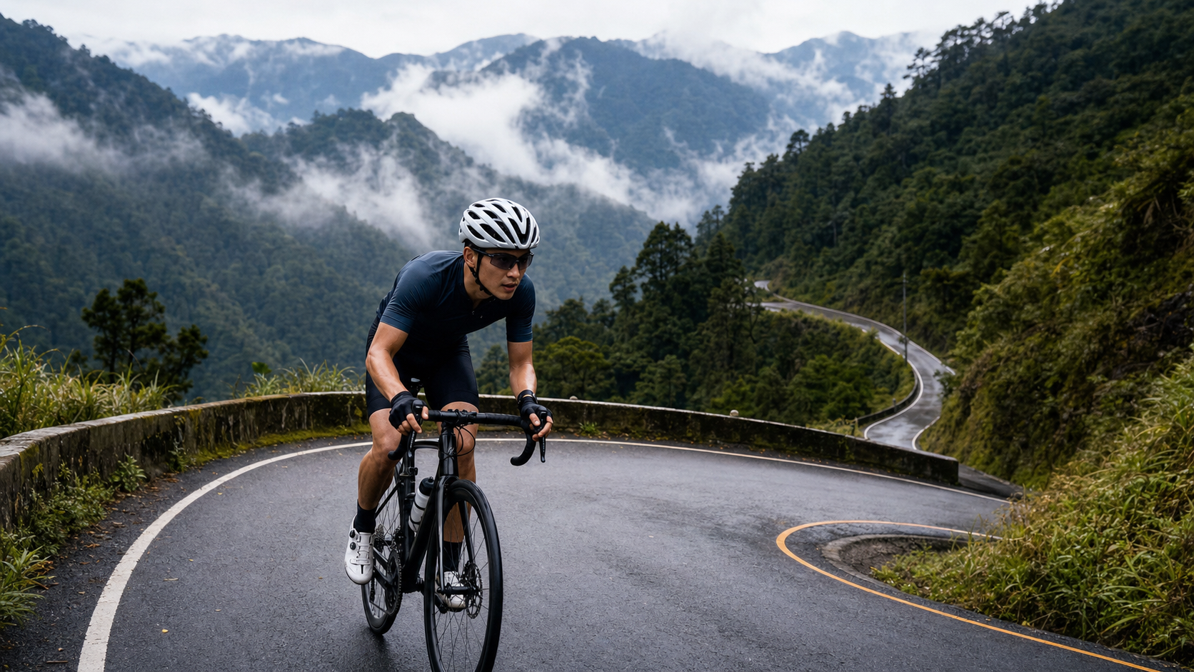
Beiheng Highway (Provincial Highway 7): The High-Mountain Cycling Challenge from Taoyuan to Yilan
Introduction
Provincial Highway 7, the Northern Cross-Island Highway — commonly known as “Beiheng” — is a major road that crosses the central mountain range of northern Taiwan. Spanning 96 km, it connects Daxi in Taoyuan with Zhuangwei in Yilan. Along the way, it passes through Atayal indigenous villages in Fuxing District, the giant tree reserve of Lalashan, the high-altitude alpine lake at Mingchi, and the majestic forests of the Xueshan Range, making it one of the most scenic and demanding road cycling routes in northern Taiwan.
The full route gains roughly 1,800 m in elevation, with its highest point near Bailing at about 1,070 m above sea level. While it falls short of the heights of Wuling or Alishan, the relentless rolling terrain and long cumulative distance make Beiheng one of the toughest one-day challenges for cyclists in northern Taiwan.
Detailed Route Breakdown
| Segment | Distance | Elevation Gain | Altitude | Character |
|---|---|---|---|---|
| Daxi → Jiaoban Mountain | 18 km | 400 m | 0→440 m | Entry-level climbing segment |
| Jiaoban Mountain → Bailing | 22 km | 630 m | 440→1,070 m | Core climbing segment |
| Bailing → Mingchi | 20 km | 500 m | 1,070→1,150 m | High-altitude segment |
| Mingchi → Yilan | 36 km | -1,150 m | 1,150→20 m | Long descent segment |
Key Segment Guide
Daxi → Jiaoban Mountain (Warm-up Segment)
Starting from Daxi in Taoyuan, the road climbs gently alongside the Shimen Reservoir catchment area toward Jiaoban Mountain (Jiaobanshan). The gradient is gentle here, but the sounds of the lowlands already begin giving way to the atmosphere of the mountains. Jiaoban Mountain was traditionally the territory of Atayal chieftains and later the site of one of Chiang Kai-shek’s retreat residences. Jiaoban Mountain Park offers sweeping views over the Dahan River basin.
Jiaoban Mountain → Bailing (Core Challenge Segment)
This is the most critical climbing segment of the entire route, gaining 630 m over 22 km. Deep valleys and towering cliffs line the road, and a series of consecutive hairpin turns test both stamina and bike-handling skill. Several Atayal villages dot this stretch, where indigenous women often sell homegrown produce roadside — peaches and corn make excellent energy top-ups along the way.
Bailing → Mingchi (High-Mountain Mystery Segment)
Beyond Bailing, the route enters alpine terrain above 1,000 m, where the temperature drops noticeably and mist drifts through the forest. The alpine lake at Mingchi lies still as a mirror, reflecting the surrounding cedar trees and swirling fog — one of the most dreamlike natural landscapes in northern Taiwan. Stopping at Mingchi for a hot soup or coffee is one of the greatest pleasures of riding Beiheng.
Mingchi → Yilan (Exhilarating Descent Segment)
From Mingchi, the road descends eastward all the way to the Yilan plain — a 36 km descent that rewards all the hard climbing that came before. Riders should take care, however: this stretch has many curves and rockfall-prone areas. Control your speed on the descent and alternate front and rear braking to avoid brake overheating.
The Giant Tree Reserve of Lalashan
A spur road off Provincial Highway 7 at Bailing leads to Lalashan (Mount Damao), home to some of northern Taiwan’s most precious ancient red cypress and Taiwan cypress trees, ranging from several hundred to over two thousand years old. The spur road is about 12 km long with noticeable elevation gain; it’s recommended to travel light or explore on foot rather than push deep into the reserve by bike.
Practical Tips
- Timing: Start at around 6 a.m. to take advantage of the cool morning temperatures for the main climbs, aiming to finish the full route by 3 p.m.
- Weather Check: Weather in the Beiheng mountain area is highly variable — always check the Central Weather Administration’s mountain forecast before setting out. Fog and rain reduce visibility and make descents significantly more dangerous.
- Supply Points:
- Jiaoban Mountain: convenience stores, small eateries
- Bailing (roadside stalls): peaches, corn, simple food
- Mingchi Recreation Area: ticketed entry, on-site restaurant
- Zhuangwei, Yilan: full supplies upon arrival
- Gear: Temperatures in the high-altitude section can be more than 10°C cooler than the lowlands — bring a lightweight windbreaker. Carry two spare inner tubes, as the mountain roads have plenty of loose gravel.
- Best Season: Spring (March to May) and autumn (September to November), avoiding the plum rain season (June) and typhoon season (July to September).
Conclusion
Beiheng Highway is the defining high-mountain cycling route of northern Taiwan. Starting from the Taoyuan basin, it crosses through the ancestral mountain forests of the Atayal people, climbs over the thousand-meter ridgelines of the Xueshan Range, and finally sweeps down into the lush green Lanyang Plain of Yilan — a journey through the very best of Taiwan’s geography. Beiheng may lack the altitude of Wuling, but it offers a far richer layering of ecology and culture. Every stop at an Atayal village, every bite of a sweet peach, gives this route meaning that goes well beyond a purely physical challenge.
Related Reading
#北橫 + #北進武嶺 最硬的員工旅遊 EP1 | #公路車 #拉拉山 | 明池 | 武嶺 | 武陵農場 | 雲海 | Taiwan Cycling Route Wulin
6 年前
台北闊瀨陡坡 騎旅 / 日本單車雜誌編輯車友臨時加入!/ 髮香才是最強的 / feat. 北迴歸線小隊 / 公路車 CT Yeh
6 個月前
半日 小台灣 極限單車路線挑戰實錄
7 年前
一定要騎一次!阿里山最深處:里佳部落!單車旅行 | 2800m爬升 | 深度部落體驗:嗨翻晚會、螢火蟲、銀河 | feat. JJSC & 廢物伙伴 | 公路車 CT Yeh
9 個月前
嘉義大埔、阿婆灣挑戰賽,美到以為在日本!ft. 環騎5 Cool 西拉雅188 / 公路車 / CT Yeh
7 個月前
藤枝二集團 單車行 Day1 | 南部小武嶺 | 爬坡爬到罵罵叫 | JJSC | 公路車 | CT Yeh
3 年前
爬坡ITT實境)台中 魔王 松鼠坡 首航 6:12 大肚山 大三元 科福路
8 年前
大武山後門26%歡樂陡坡!JJSC南台灣單車行Day2 / 被颱風追著跑 / 公路車 / CT Yeh
2 年前