Introduction
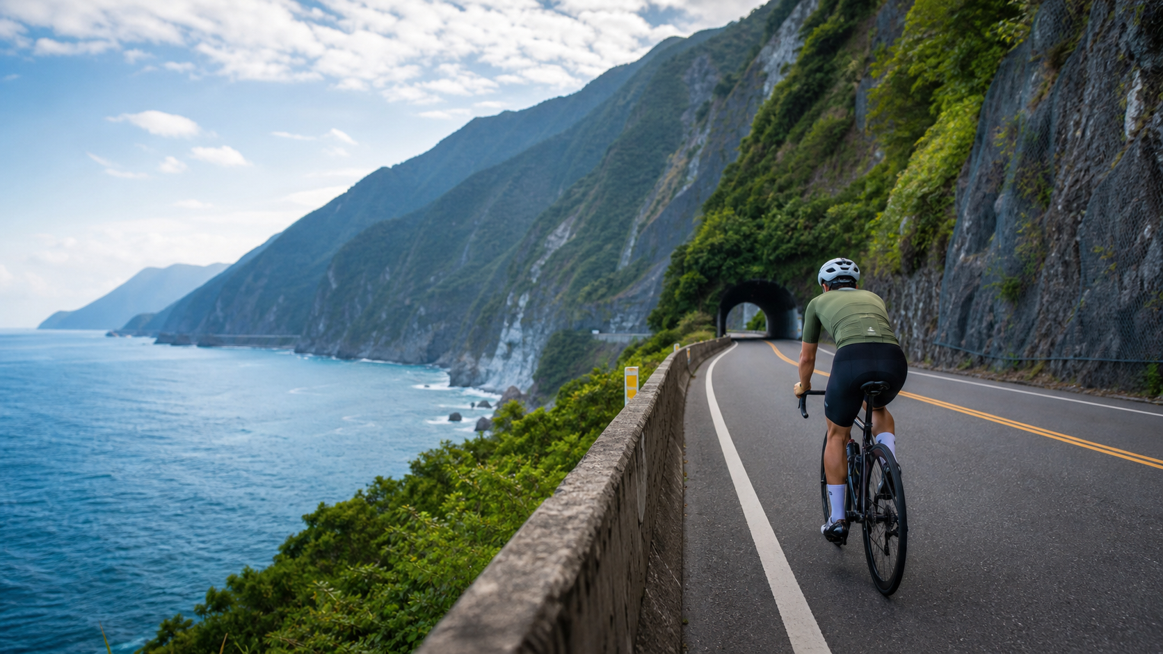
The Suhua Highway, officially designated as Provincial Highway 9 from Su’ao to Hualien, stretches approximately 118 kilometers, winding along the Pacific coast. It stands as one of the most arduous achievements in Taiwan’s highway engineering history. For cyclists, this route represents the ultimate challenge where grandeur and danger coexist—sheer cliffs on one side, the deep blue Pacific on the other. This article focuses on the core northern section: the roughly 60 kilometers from Heping to Su’ao, providing a complete riding guide.
Suhua Highway Basic Information
Before setting off, it is essential to understand the Suhua Highway’s special traffic control system:
| Item | Description |
|---|---|
| Total Length | Approximately 118 km from Su’ao to Hualien (approximately 60 km for the northern section from Heping to Su’ao) |
| Road Surface | Asphalt, with numerous tunnels and cliff sections |
| Number of Tunnels | Over 20, the longest reaching 4.7 km (Gufeng Tunnel) |
| Control Hours | Multiple open windows daily; entry is prohibited outside open hours |
| Cycling Restrictions | Night riding is prohibited within the controlled section; cyclists must coordinate with vehicle traffic control |
| Latest Control Schedule | Updated daily on the Directorate General of Highways website; be sure to check before departure |
Section Analysis: Heping to Su’ao
Starting northward from Heping Township in Hualien County, you’ll pass several scenic spots before arriving at Su’ao Township in Yilan County. The elevation change across the entire route is minimal, but the dense concentration of tunnels is the biggest challenge.
Main Section Descriptions:
-
Heping—Nan’ao (approximately 25 km): A coastal cliff section offering the most spectacular views, with an endless vista of the Pacific Ocean. The road surface has slight undulations, with some sections at gradients of 5–8%. Nan’ao has a gas station and convenience stores, making it a key resupply point.
-
Nan’ao—Dong’ao (approximately 15 km): Entering a denser tunnel zone, with the Dong’ao Tunnel exceeding 2 kilometers in length. Inside the tunnels, temperatures are low, lighting is poor, and vehicle speeds are high—extra caution is required.
-
Dong’ao—Su’ao (approximately 20 km): The terrain is relatively gentler. After reaching Dong’ao, continue north on Provincial Highway 9, passing through the final mountain section before entering the Yilan Plain.
Golden Rules for Safe Riding
The dangers of the Suhua Highway must not be underestimated. Here are the absolute rules when riding:
- Lighting Equipment: A front light (at least 600 lumens) and a rear light (flashing mode) are both indispensable—tunnels are pitch dark even during the day
- Departure Time: It is recommended to depart immediately after the control window opens (usually 7:00 AM or 8:00 AM) to avoid heavy trucks and allow ample time to complete the ride
- Tunnel Etiquette: Before entering a tunnel, confirm no vehicles are approaching from behind, ride on the right side, maintain a steady speed, and do not stop to take photos
- Weather Check: Riding is strictly prohibited during typhoons and heavy rain due to the extremely high risk of falling rocks
- Buddy System: It is recommended to ride with at least one other person, keep your phone charged, and inform family of your route and estimated arrival time
Resupply Point Map
Resupply points along the Suhua Highway are scarce. Here are the main locations:
- Heping, Hualien (starting point): 7-11 convenience store, gas station—stock up fully before departure
- Nan’ao, Yilan (approximately 25 km): FamilyMart convenience store, food stalls—the most important mid-route resupply point on the Suhua Highway
- Dong’ao (approximately 40 km): Has a small supermarket and bento shops, suitable for a lunch break
- Su’ao (finish line): Full town amenities; recommended to try Su’ao cold spring tofu
Alternative Option: The Suhua Improvement Project
The Suhua Highway Mountain Section Improvement Project (abbreviated as Suhua Gai), opened in 2020, provides a safer route for cars and motorcycles, but bicycles are not permitted in the tunnel sections of the Suhua Gai. Therefore, cyclists must still use the old Suhua Highway. When checking control times, pay special attention to the differences between the two routes.
Practical Tips
- Suhua Highway control times can be checked on the Directorate General of Highways’ e-Highway website; the system updates weekly, so confirm again the day before your planned departure
- It is strongly recommended to wear a reflective vest, especially on the Heping to Dong’ao section with its dense tunnel concentration
- For the Nan’ao to Su’ao section, consider combining with the Taiwan Railways Administration—bicycles can be brought on trains (a bicycle ticket must be purchased)
- Bring a power bank; mobile phone signals are weak on some sections of the Suhua Highway, but you can still send an SOS in an emergency
- When falling-rock warning signs appear, pass through quickly without stopping
Conclusion
Riding the Suhua Highway is undoubtedly one of the most unforgettable experiences in Taiwan’s cycling travel. That image of riding along the cliff’s edge, sea wind howling past, and waves crashing against the reefs in the distance will become one of the most precious memories a cyclist can hold. But beauty and danger go hand in hand—only with thorough preparation and respect for the traffic regulations can this road become a badge of courage rather than a lesson of regret. The moment you safely arrive in Su’ao, you’ll find it was all worth it.
Related Reading
- Suhua Highway Cycling Challenge: A Complete Guide to the Coastal Highway Ride from Su’ao to Hualien
- Eastern Coastal Section: Challenges and Safe Riding Guide for the Suhua Highway
- A Full Record of Riding the Suhua Highway: Taiwan’s Most Breathtaking Coastal Highway Experience
- Suhua Highway Cycling Adventure: The Ultimate Riding Experience on the Pacific Cliffs
單車環島 蘇花公路精彩片段
10 年前
微東進 太魯閣 蘇花 單車兩日遊 ! 颱風過後路況超刺激 行程大亂 | 最狂的鹹酥雞訂單 | CT Yeh | 4K 高畫質空拍絕景!
4 年前
半日 小台灣 極限單車路線挑戰實錄
7 年前
4K單車實境) 嘉義 梅山36灣 訓練台 爬坡 輕鬆騎
6 年前
嘉義大埔、阿婆灣挑戰賽,美到以為在日本!ft. 環騎5 Cool 西拉雅188 / 公路車 / CT Yeh
7 個月前
大武山後門26%歡樂陡坡!JJSC南台灣單車行Day2 / 被颱風追著跑 / 公路車 / CT Yeh
2 年前
太平山單車員工旅遊 | 這樣玩CP值最高!| 公路車
5 年前
台北闊瀨陡坡 騎旅 / 日本單車雜誌編輯車友臨時加入!/ 髮香才是最強的 / feat. 北迴歸線小隊 / 公路車 CT Yeh
6 個月前