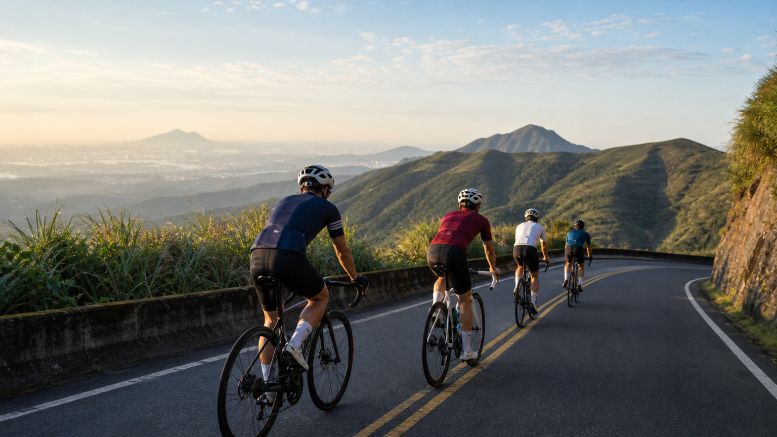
The Complete Guide to Yangmingshan Loop Rides: Five Classic Circuits for Cyclists
Yangmingshan National Park sits at the northern edge of Taipei City, climbing from 200 meters all the way up to the 1,120-meter summit of Qixing Mountain. It is a pilgrimage site for road cyclists and climbing enthusiasts in northern Taiwan. The park offers multiple ascent roads of varying gradients, and combining them with descent routes creates rich loop rides that let riders enjoy both climbing training and the thrill of descending in a single outing. Below are five of the most representative loop routes, arranged from easiest to hardest, complete with detailed route information and refueling advice.
Route 1: Yangde Boulevard – Lengshuikeng – Fengguizui Mini Loop (Beginner)
Distance: approx. 35 km
Total elevation gain: approx. 850 m
Difficulty: ★★☆☆☆
Estimated time: 2.5 to 3.5 hours
Route Overview
Starting from Shilin, climb up Yangde Boulevard, pass Chinese Culture University, continue to Lengshuikeng, descend via the Wanxi Industrial Road toward Neihu, and return to Shilin past the National Palace Museum. This is the classic entry-level Yangmingshan loop. The road surface is good throughout, with a steady gradient of 5% to 7%.
Detailed Segments
- Shilin → Chinese Culture University (7 km, average gradient 6%): Yangde Boulevard is the main ascent road up Yangmingshan. It is wide but carries heavier traffic, so it’s best to avoid weekend mornings. The gradient increases slightly past the Yonggong Road junction.
- Chinese Culture University → Lengshuikeng (5 km, average gradient 5%): Past the Yangmingshan bus terminal the road becomes quiet, with a turnoff to Zhuzihu along the way. Lengshuikeng’s parking area has restrooms and a water fountain.
- Lengshuikeng → descent via Wanxi Industrial Road (8 km, mostly downhill): This section has many switchbacks, so control your speed. The road can have fallen leaves, and extra caution is needed in wet weather.
- Neihu → Shilin (15 km, flat): Follow Neihu Road to Zhishan Road back to Shilin, with a chance to refuel at a convenience store near the National Palace Museum.
Rest Stops
- Before departure: convenience stores around Shilin MRT Station
- On the mountain: restaurants in the Zhuzihu area (open on weekends), vending machines at the Lengshuikeng Visitor Center
- After the descent: convenience stores along Neihu Road
Route 2: Fengguizui – Wanli – Jinshan – Yangjin Highway Loop (Intermediate)
Distance: approx. 75 km
Total elevation gain: approx. 1,200 m
Difficulty: ★★★☆☆
Estimated time: 4 to 5.5 hours
Route Overview
Starting from Neihu, climb up to Fengguizui (elevation 490 m), descend to Wanli, ride along the North Coast to Jinshan, then cross back over Yangmingshan via the Yangjin Highway to return to Taipei. This route combines mountain climbing, coastal scenery, and volcanic terrain, making it a favorite mid-to-long-distance classic among northern Taiwan cyclists.
Detailed Segments
- Neihu → Fengguizui (12 km, average gradient 5.5%): Starting on Bishan Road, the first half passes through a residential area and is steeper, easing up after Bishan Temple. The view from the top of Fengguizui is expansive, with Keelung Islet visible on clear days.
- Fengguizui → Wanli (15 km, mostly downhill): The Wanxi Industrial Road winds down the mountain; the surface is narrow but traffic is light. Once at the flatlands, connect to Provincial Highway 2.
- Wanli → Jinshan (10 km, flat): Ride along the North Coast Highway with the Pacific Ocean on your right. Jinshan Old Street is an excellent lunch stop — the local Jinshan duck is highly recommended.
- Jinshan → Yangjin Highway → Taipei (38 km, including 12 km of climbing): The Yangjin Highway begins climbing from the Jinshan side, with an average gradient of about 4% and steepest sections around 8%. After passing the Machao hot spring area you’ll reach Xiaoyoukeng, followed by a long descent back to Taipei.
Rest Stops
- Top of Fengguizui: no rest stop, bring your own water
- Wanli: convenience stores along Provincial Highway 2
- Jinshan: various eateries on Jinshan Old Street, 7-Eleven, FamilyMart
- Yangjin Highway: beverage vending machines in the Machao area
Route 3: Balakei Road – Sanzhi – North Coast – Yangjin Highway Grand Loop (Upper Intermediate)
Distance: approx. 95 km
Total elevation gain: approx. 1,600 m
Difficulty: ★★★★☆
Estimated time: 5 to 7 hours
Route Overview
Starting from Beitou, climb Balakei Road to the Datun saddle (elevation 830 m), descend to Sanzhi, then follow the North Coast through Shimen and Jinshan, finally returning to Taipei via the Yangjin Highway. The full loop is nearly 100 km, with two major climbs testing your endurance, but the scenery along the way is spectacular.
Detailed Segments
- Beitou → Balakei Road saddle (15 km, average gradient 6%): Balakei Road has the most consistent gradient in the Yangmingshan system, with almost no flat sections throughout. Along the way you’ll pass Datun Nature Park, which offers a stunning silvergrass landscape in autumn and winter.
- Saddle → Sanzhi (18 km, mostly downhill): The northern descent offers beautiful views overlooking the North Coast. The road surface is good but has many curves.
- Sanzhi → Jinshan (25 km, flat with slight rolling terrain): Ride along Provincial Highway 2 on the North Coast, passing Baishawan, Shimen Cave, and the Laomei green reef, among other sights. In summer you can rest and play in the water at Baishawan.
- Jinshan → Yangjin Highway → Taipei (37 km): The same Yangjin Highway section as Route 2 — the second climb is a serious test of endurance.
Notes
- Balakei Road frequently has heavy fog in winter; consider an alternate route when visibility is very low
- Bring a windbreaker — the saddle temperature is 8 to 10 degrees lower than the lowlands
- Carry two water bottles, as there are no rest stops along Balakei Road
Route 4: Shuangxi – Buyanting – Jiufen – Keelung – Fengguizui Loop (Challenge Level)
Distance: approx. 120 km
Total elevation gain: approx. 2,200 m
Difficulty: ★★★★☆
Estimated time: 6 to 8 hours
Route Overview
This is a long-distance loop connecting the mountain and coastal scenery of Taiwan’s northeast cape. Starting from Xizhi, pass through Shiding and Shuangxi, climb up to Buyanting, descend to Jiufen and Keelung, then return to Taipei via Fengguizui. With three climbs and a total distance over 100 km, this is an excellent challenge for advanced riders.
Refueling Strategy
Rest stops are more spread out on this route, so it’s recommended to:
- Fully refill your bottles and food supply in downtown Shuangxi
- Carry at least three energy gels or bars
- Use Jiufen Old Street as a main meal stop
Route 5: Yangmingshan Wuzhishan – Ciwan Road – Pingxi Loop (Advanced Challenge)
Distance: approx. 135 km
Total elevation gain: approx. 2,800 m
Difficulty: ★★★★★
Estimated time: 7 to 10 hours
Route Overview
This super loop connects Wuzhishan, Ciwan Road, and County Road 106 through Pingxi, with total elevation gain approaching 3,000 meters. This route is recommended only for cyclists with extensive long-distance riding experience and strong fitness. Riding with a partner is advised, and make sure your bike is in good mechanical condition beforehand.
Safety Reminders
- Winter daylight hours are short — always carry front and rear lights
- Mountain weather is changeable — a windbreaker and a lightweight rain jacket are essential
- Keep your phone charged, and consider carrying a power bank
- Let family or friends know your route and expected return time in advance
General Tips for Riding Yangmingshan
Best Riding Seasons
- Spring (March–May): Moderate temperatures, but watch for afternoon thunderstorms
- Autumn (October–November): The most stable weather, with the bonus of silvergrass season scenery
- Summer: Start early in the morning to avoid the intense heat
- Winter: Strong northeast monsoon winds affect the area heavily, with frequent strong winds on Balakei Road and the Yangjin Highway
Gear Recommendations
- At least two water bottles (600 ml or larger)
- A windbreaker or lightweight wind jacket
- Spare tube, pump, and a basic tool kit
- Front and rear lights (essential for tunnel sections)
- Sun protection and arm sleeves
The appeal of the Yangmingshan loop routes is that they can be flexibly combined to match your own fitness and available time — from a relaxed two-hour circuit to a full day of hardcore challenge. Pick the route that suits you, and get riding!
Related Reading
- Five Classic Yangmingshan Routes: Fengguizui, Lengshuikeng, Balakei, Datun Mountain, Xiaoyoukeng
- Taipei Yangmingshan Cycling Route: A Mountain Climbing Experience from Yangde Boulevard to Zhuzihu
- The Complete Guide to Classic Yangmingshan Routes: Taipei Cyclists’ Best Climbing Training Ground
- The Complete Guide to Yangmingshan Road Routes: Fengguizui, Balakei, Qingtiangang Loop
半日 小台灣 極限單車路線挑戰實錄
7 年前
4K單車實境) 舊陽金P字道 第1P 仰德大道至小油坑 誤跟武嶺神人們 被拉爆爽飛天 Taiwan Cycling Climb Route Recommend
7 年前
觀霧 變好騎了! | 北高車友爆笑大會師 | 公路車 | 單車旅遊 Taiwan Cycling Route GuanWu
6 年前
車隊介紹) 台北 一年開團365天 車隊 Apollo Ride 晨騎 好選擇 ( 陽明山 風櫃嘴 冷水坑 平等里 聖人 關渡 大稻埕 ) 找人騎車
7 年前
單車 一日北高 ( 雙城 ) 肥宅雙人瘋狂行 紀錄片 REACTO
10 年前
西拉雅五庫單車挑戰 / 曾文水庫 & 南168 二寮 / 500元報名費居然這麼超值/ 公路車 / CT Yeh
10 個月前
太平山單車員工旅遊 | 這樣玩CP值最高!| 公路車
5 年前
大武山後門26%歡樂陡坡!JJSC南台灣單車行Day2 / 被颱風追著跑 / 公路車 / CT Yeh
2 年前