Alishan Highway Complete Guide: Southern Taiwan's 53.57km Pilgrimage of Climbing Over 2,000 Meters
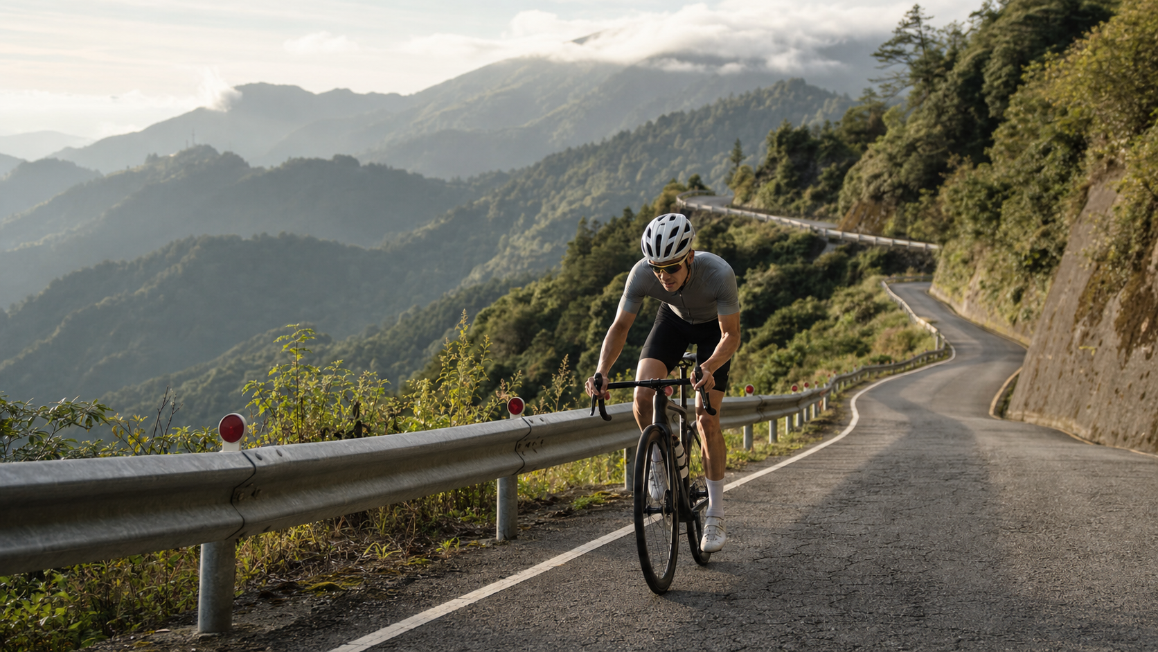
Route Snapshot: Distance 53.57 km | Total elevation gain approx. 2,505 m (cross-calculated estimate approx. 1,982 m, see explanation below) | Average gradient 3.7% | Strava climb category Category 5 (highest tier, ultra-long-distance climb) | Route core is the mountain section of Provincial Highway 18, Alishan Highway
In Taiwan’s cycling world, if you were to draw up a “must-ride climbs in this lifetime” list, the Alishan Highway would almost certainly appear right next to Wuling. It is the core stage of the “Alishan KOM Challenge,” and a legendary route that draws countless cyclists from across Taiwan every year to make a dedicated pilgrimage south. This article is not about scenery or sentiment—it’s about data, tactics, and how to ride this 53.57 km road in the smartest way possible.
1. Decoding the Data: 53.57 km, Over 2,000 Meters of Climbing—How Real Is the Difficulty?
Let’s pin down the core numbers first: this segment is 53,568.3 meters (53.57 km) long, with an average gradient of 3.7%. Strava classifies it in the highest tier of its climb categorization—Category 5, also known as the “HC grade” ultra-long-distance climb. This means that no matter which international climb-grading standard you use, its “distance × gradient” total has already reached the top tier.
As for the elevation gain figure, we need to be honest and break it down. The database records a total elevation gain of 2,505.3 meters. However, if you use a simplified estimate of “distance × average gradient” (53.57 km × 3.7%), the result is only about 1,982 meters—a gap of roughly 500 meters between the two. This discrepancy isn’t because someone marked it wrong; it stems from a fundamental difference in the two calculation logics: the average gradient is an “overall mean” calculated by flattening the entire route (including a few gentle or even slightly descending sections), which dilutes the presence of steep climbs. The 2,505.3-meter figure, by contrast, is the sum of every actual climb along the way, faithfully reflecting the truth that “the steep sections are steeper than you’d imagine.”
This also matches the geographic reality of the Alishan Highway—the road climbs from the Chiayi Plain all the way to Alishan, starting at an elevation of just over 100 meters and reaching over 2,200 meters near the Alishan National Forest Recreation Area at the finish. The sheer absolute elevation difference alone already approaches or exceeds 2,000 meters. Therefore, this article adopts the database figure of 2,505.3 meters as the primary elevation gain number, and reminds every challenger: the gradient of this road is not evenly distributed. The middle and later sections feature stretches noticeably steeper than 3.7%. Riding it with a “steady-average pace mentality” will likely cost you dearly in the second half. In other words, the 3.7% on paper is just “the average grade the government gives you”—in practice, you’ll encounter several sections that genuinely hold 6% or higher, interspersed with a few gentler slopes or flat stretches to catch your breath.
Let’s place it in the coordinate system of Taiwan’s long-distance climbs with a table:
| Comparison Item | Alishan Highway (This Segment) | Notes |
|---|---|---|
| Distance | 53.57 km | “Expedition-grade” distance, not a short sprint climb |
| Total Elevation Gain | 2,505.3 m (database value) | Cross-estimate approx. 1,982 m; gap stems from measurement and segmentation methods |
| Average Gradient | 3.7% | Terrain varies dramatically along the way, not evenly distributed |
| Strava Classification | Category 5 | Highest tier, ultra-long-distance climb |
| Completion Threshold | Endurance > Explosive Power | Tests pacing discipline and prolonged focus |
To put 2,505 meters of climbing into everyday terms: that’s roughly the height of stacking nearly seven Taipei 101 towers beneath you as you push yourself ever upward. This is not a short sprint you can muscle through on willpower alone—it’s an expedition that demands planning beforehand, discipline during, and recovery afterward.
2. Route Backbone: The Geographic Positioning of Provincial Highway 18 and the KOM Road
The Alishan Highway is Provincial Highway 18, starting from the flat road network around Chiayi City in the west and crossing mountains eastward to reach the Alishan National Forest Recreation Area. It is one of the few roads in Taiwan where you can complete a vertical traverse from flatland to a mountain over 2,000 meters by bicycle in a single day. It also serves as the classic race-course backbone long used by the “Alishan KOM Challenge (part of the Taiwan KOM Challenge series),” attracting domestic and international riders every year to take on this grueling battle defined by “long distance, dramatic gradient swings, and high-altitude effects stacked on the latter half” (for actual race dates, cutoff times, and detailed regulations, please refer to the official announcements from the organizer).
The classic riding route passes through several key landmarks in sequence: starting from the Chiayi flatlands, passing through Chukou to enter the mountain area, continuing to Xiding to enjoy the sea-of-clouds scenery, climbing further to the high-mountain tea region around Shizhao and Leye, and finally converging the gradient around Shizilu before surging to the finish at the Alishan National Forest Recreation Area. These place names also form the skeleton of the segment-by-segment strategy that follows.
One macro-level understanding worth establishing first: the Alishan Highway’s climb is “not a steady, uniform ascent.” It is composed of several distinct climbs interspersed with brief flat or even slightly descending sections, making its rhythm far more complex and varied than the “relentless upward grind with almost no respite” of the Wuling western-route climb. This is a double-edged sword for challengers: having recovery points is a blessing, but it also means you must constantly make quick judgments between “accelerate to use the flat sections” and “ease off to handle the steep climbs.” Any misjudgment will accumulate into fatal fatigue in the later stages. I strongly recommend familiarizing yourself with the route’s elevation profile through GPX track files or mapping tools before your official attempt, so that you have a mental map of “where to save, where to push” in your head before you even start.
3. Segment-by-Segment Strategy: Breaking 53.57 km into Six Conquerable Sections
The worst thing about long climbs is intimidating yourself with the “total length.” Breaking 53.57 km into six landmark-based segments and setting small goals for each is the core mindset for finishing. The mileages below are approximate descriptions; please defer to your bike computer and roadside signage for actual figures.
Segment 1: Chiayi Flatlands Start → Chukou (Warm-Up Entry Section)
Starting from the flat road network around Chiayi City, this section is flat. The main tasks are warming up, finding your rhythm, and confirming that nutrition and equipment are all ready. Strategy: Keep your heart rate in an extremely easy zone, use this flat stretch to dial in your cadence, position, and breathing to the most comfortable state. Whatever you do, don’t burn excess energy here out of excitement. Chukou is the dividing line between flatland and mountains—past Chukou, the real expedition officially begins.
Segment 2: Chukou → Longmei (The First Test of Getting into Climbing Mode)
After Chukou, the gradient will clearly step up to a meaningful intensity. This is the first major stretch of “entering climbing mode” for the entire route, with sustained climbing carrying you from flatland into mid-elevation territory. Strategy: Be extremely conservative. This is the most likely place on the entire route to make a fatal mistake—fresh legs and high spirits at the start make it all too easy to ride too fast. But don’t forget: you still have dozens of kilometers and nearly 2,000 meters of climbing ahead. Keep your power at 70–80% of your FTP, your heart rate at the lower edge of the aerobic zone, and your cadence on the higher side of comfortable. Remember one iron rule: on the Alishan Highway, those who ride too fast in the early sections pay back double the pain in the later ones. Around Longmei, there are usually shops where you can refill water and take a brief rest—it’s recommended to complete your first full resupply here.
Segment 3: Longmei → Xiding (Sea-of-Clouds Rolling Section)
Past Longmei, the route arrives around Xiding, a renowned sea-of-clouds viewpoint. Warm, moist air rises along the valley and meets cold air, frequently forming spectacular seas of clouds on sun-facing ridgelines. The gradient here is less monotonous than the previous section, with some rolling variations. Strategy: Use the undulations to modulate your output. On gentle descents or easier stretches, accelerate moderately, spin your cadence up smoothly, and let some lactate clear; when you hit a steep pitch, immediately ease off and return to a steady output. This kind of “power management on rolling terrain” is precisely the biggest difference between the Alishan Highway and monotonous long straight climbs like Wuling—it tests your ability to flexibly allocate energy rather than stubbornly grinding at a fixed pace.
Segment 4: Xiding → Shizhao, Leye (Mid-Section Endurance Battle)
Shizhao (Shizhuo) is an important settlement on Provincial Highway 18 and a junction leading to Fenchihu and onward toward Alishan; the Leye tribe sits in the nearby high-mountain tea region. This stretch is the “mid-section endurance battle” of the entire route—by now you may have been riding for over two hours, and fatigue signals are beginning to surface in both body and mind. Strategy: Discipline and nutrition, both in tandem. The most important thing now is to hold your pacing discipline. Don’t recklessly add intensity just because the early going felt good, and don’t let your rhythm collapse just because you’re tired. Maintain a steady output and keep fueling—it’s recommended to alternate between solid food and energy gels every 30 to 40 minutes, and take small sips of water every 15 minutes. Around Shizhao, there are usually shops and food stalls that can serve as a second full resupply point, but mountain-area business hours fluctuate—please defer to on-site conditions and never rely entirely on external resupply.
Segment 5: Shizhao, Leye → Shizilu (High-Altitude Physiological Test)
Past the Shizhao and Leye area, elevation continues to climb and the oxygen content in the air begins to drop noticeably. You’ll feel the phenomenon of “the same power output, yet heart rate inexplicably spikes and breathing gets heavier”—this is the first wave of warning signs from your body at altitude. Strategy: Proactively shift to easier gears and slow your breathing. Don’t fight your body on high-altitude sections. Deliberately shift to a lighter gear ratio, keep your cadence on the higher side, and slow and deepen your breathing to maximize the efficiency of every breath. The goal of this section is not speed—it’s “staying stable and not cracking.” Mentally, I recommend locking your focus onto the concrete, achievable intermediate target of “make it to Shizilu,” rather than constantly thinking about how far the finish still is—that will only amplify your fatigue.
Segment 6: Shizilu → Alishan National Forest Recreation Area (Final Stretch to the Finish)
The final section: the finish is in sight, elevation is high, fatigue is deep—but the sense of accomplishment is also calling from ahead. Strategy: Allocate your remaining strength and close it out steadily. If you paced the previous five segments well, you should still be able to maintain a steady output here, even slightly accelerating for a push in the final few kilometers. If you’re already quite spent, then make “don’t get off the bike, ride it out steadily” the sole definition of victory for this segment. When the entrance to the Alishan National Forest Recreation Area appears before your eyes, that climb of over 2,000 meters and that persistence across more than 50 kilometers will transform, in the instant you cross the finish line, into a sense of accomplishment you’ll remember for a lifetime.
4. Gearing and Equipment: A Math Problem at Expedition Grade
Although the Alishan Highway’s average gradient isn’t the steepest in Taiwan on paper, the combination of “enormous total volume, long duration, and high-altitude effects stacked on the latter half” dictates that your gearing setup should lean conservative rather than competitive. On a long climb, the gear ratio that lets you maintain a higher cadence and reduce stress on your joints and muscles is what will carry you to the finish.
| Rider Type | Recommended Chainring | Recommended Cassette | Notes |
|---|---|---|---|
| Competitive / KOM Challenge Oriented | 50/34 compact crank | 11–32T or 11–34T | Even when chasing times, keep a light enough bailout gear |
| General Expedition / Fitness Oriented | 50/34 compact crank | 11–34T | Balanced choice between flat-road efficiency and climbing endurance |
| Beginner / First-Time Challenger | 46/30, 48/31, or triple chainring | 11–34T or even 11–36T | Lifesaving light gears for the high-altitude later sections, preventing both knee and energy depletion |
Core principle: Prepare your gearing for “the tired version of you in the later stages,” not for “the fresh, energized version of you at the start.” At the beginning, you’ll feel like you can turn any gear. But when you’re 40 kilometers in, at 2,000 meters of elevation, with legs half-destroyed, you’ll be immensely grateful you installed that seemingly “too light” gear setup.
Expedition-grade equipment checklist—confirm each item:
- Water: Carry at least two large bottles’ worth of capacity. Refill at settlements like Longmei and Shizhao along the way, but make sure you start fully loaded.
- Nutrition: Energy gels, energy bars, bananas, and salt tablets in ample supply. Calorie expenditure on an expedition-grade route is measured in thousands of kilocalories—never underestimate it.
- Warm Layer: The finish area sits above 2,000 meters. Even if it’s scorching at the base, temperatures at the summit and during descents can plummet by over ten degrees Celsius. A lightweight windbreaker or windproof jacket is life-saving gear—bring it. It’s not optional.
- Repair Tools: Spare tubes, tire levers, a pump or CO2 cartridges, and a compact multi-tool. Any mechanical failure on a long route can leave you stranded in the mountains for hours.
- Lights and Protection: Mountain areas are prone to afternoon fog; front and rear lights significantly improve visibility. On long descents, always wear your helmet properly.
5. Nutrition and Hydration Strategy: Fuel Management for an Expedition
With 53.57 km and over 2,000 meters of climbing, calorie expenditure easily exceeds the 2,000-kilocalorie level. The success or failure of your fuel management directly determines whether you’ll “hit the wall” midway—that state of extreme debilitation caused by depleted blood sugar.
Preparation beforehand matters just as much: the night before, top up your carbohydrate stores. One and a half to two hours before departure, eat a carbohydrate-focused, easily digestible meal, avoiding high-fat and high-fiber foods that burden your stomach. During the ride, establishing a discipline of “timed fueling” rather than “fueling when hungry” is key—aim for roughly 40 to 60 grams of carbohydrates per hour (equivalent to one to two energy gels or an equal amount of food), take small sips of water every 15 minutes, and in hot weather be sure to supplement electrolytes to prevent cramping and heat exhaustion.
For resupply point planning, shops or food stalls are usually available around Longmei, Xiding, Shizhao, and Leye as fixed resupply stations, but mountain-area business hours are unreliable—always defer to actual on-site conditions and don’t pin all your hopes on external resupply. The truly safe approach is to carry ample supplies yourself and treat roadside shops as a “bonus” rather than a “dependency.” After finishing, it’s also recommended to consume carbohydrates and protein within 30 minutes to accelerate muscle recovery—a hot meal at the summit will be the most honest reward for the version of you that persisted to the end.
6. Weather and Seasonal Advice: The Dual Test of Mountain Temperature Swings and Afternoon Thunderstorms
The Alishan Highway spans a massive elevation difference from flatland to over 2,000 meters, making its weather complexity far greater than that of typical routes. This is also an aspect many out-of-town riders underestimate—and pay the price for.
Temperature swings are the number-one challenge: at the base, it might be over 30 degrees Celsius, while the summit of Alishan could be only in the teens or even lower. You sweat heavily on the climb; once you reach the summit or start descending, a soaked body meets cold wind, easily triggering hypothermia. A windbreaker or windproof jacket is essential, not an optional extra. Afternoon thunderstorms are also a summer norm in southern mountain areas. For such a long route, it’s recommended to depart before dawn, aim to summit before noon, and complete the descent by afternoon, avoiding the dual risks of afternoon thunderstorms and wet roads.
Seasonally, spring and autumn are typically the golden seasons with the most stable weather and the clearest views, ideal for scheduling an expedition challenge. Summer offers lush greenery, but afternoon thunderstorm probability is high—you must start especially early and monitor weather forecasts closely. Winter brings low temperatures at the summit, with occasional sections of concern for low temperatures or even ice—extra caution is needed for both warm gear and road-condition checks. Additionally, mountain areas often see thick fog in the afternoon, with visibility potentially dropping to just a few meters in a short time. When descending into fog, be sure to slow down, turn on your lights, and stay as far right as possible—safety always trumps speed.
7. Common Mistakes and DNF Risks: What Defeats You Is Often Not the Gradient Itself
Most unfinished attempts on the Alishan Highway aren’t lost to the gradient itself, but to the following preventable shortcomings:
- Losing control of pacing in the early sections: Riding too fast in the first stretch after entering the mountains, leading to a total collapse in the middle and later stages—this is the most classic and most fatal error pattern.
- Hitting the wall from insufficient fueling: Underestimating the calorie expenditure of an expedition route, carrying too little nutrition or fueling too late, causing blood sugar to crash and legs to completely lose strength midway.
- Gearing too heavy: Failing to prepare light enough bailout gears, forcing a low-cadence grind in the high-altitude later sections, paying double the price in both knees and energy.
- Neglecting cold-weather preparation: Thinking only about how hot the climb will be at the start, forgetting to bring a windproof jacket, then suffering hypothermia upon reaching the summit or starting the descent—a rapid turn for the worse.
- Departing too late: Running into afternoon thunderstorms and fog, forcing the descent to be completed in severe weather, significantly raising the risk.
- Underestimating descent risks: After hours of grueling climbing, finally reaching the summit, only to have an accident on the long descent due to fatigue, hypothermia, or wet roads. The descent is the true hidden boss of this road that’s all too easy to underestimate.
8. Target Completion Times for Riders of Different Levels
Below are reference completion time ranges for the 53.57 km, ~2,505 m climb. Actual times will be significantly affected by body weight, weather, daily condition, and other factors—use these only as a psychological anchor before departure:
| Rider Level | Reference Completion Time | Positioning Notes |
|---|---|---|
| Competitive / Elite | Approx. 2.5 to 3 hours | Chasing rankings and personal bests |
| Advanced Expedition | Approx. 3 to 3.5 hours | Steady finish with strict pacing control |
| Intermediate Fitness | Approx. 3.5 to 4.5 hours | Completing it is itself a significant personal achievement |
| Beginner / First-Time Challenger | Approx. 4.5 to 5.5 hours or more | Finishing without getting off the bike is a lifetime-level milestone |
Regardless of which tier you fall into, remember one core mindset: finishing the Alishan Highway is a victory of discipline, not a victory of brute force. Stow away that greed to ride fast in the early sections, plan your fueling in advance, bring your cold-weather gear, and time your departure well—you’ve already completed half of this expedition.
9. The Connection to the Alishan KOM Challenge: Taiwan’s Own King of the Mountain Road
A large part of why the Alishan Highway holds an almost mythical status in Taiwan’s cycling world comes from its deep ties to the “Alishan KOM Challenge.” This is one of the events in Taiwan’s renowned King of the Mountain series, built around the spirit of extreme climbing, attracting professional and amateur riders from home and abroad each year to compete on this route (specific dates, race regulations, cutoff times, and other details vary by edition—please defer to the organizer’s official announcements as the final authority).
For the average cyclist, even if you don’t have the opportunity (or the inclination) to participate in the official race, simply completing this route independently is itself a way to pay tribute to the spirit of the event. Many seasoned riders regard “finishing the Alishan Highway” as a major milestone in their cycling careers—even a capability checkpoint that must be passed before tackling even harder long climbs (such as routes at the ceiling of Taiwan’s road cycling climbs). What this road teaches riders isn’t just how to apply power on steep slopes—it’s how to manage your energy, emotions, and judgment across more than 50 kilometers. And that is the ultimate common challenge of all top-tier long-distance climbs.
Conclusion: The Sacred Mountain Battle for Every Challenger
The Alishan Highway—53.57 km, over 2,000 meters of climbing—this legendary route that countless riders regard as a must-fight battle in their lifetime has never tested only the strength of your legs. Through its length, its variability, and its refusal to grant easy respite, it repeatedly tests your endurance, your pacing discipline, your on-the-spot judgment, and whether you can still hold on to rational preparation when you’re exhausted to your limits.
When you finally ride past the entrance to the Alishan National Forest Recreation Area and look back at the winding mountain road stretching over 50 kilometers and climbing more than 2,000 meters, you’ll understand clearly: what you’ve conquered was never just the elevation of a mountain—it was the version of yourself that once doubted whether you could make it all the way. This is the Alishan Highway—this sacred mountain of Taiwan’s cycling world—leaving every challenger who perseveres to the end its most honest and most precious gift in return.
Related Reading
- First-Time Alishan Highway Challenge: A 74 km Climb from Zero to the Summit
- Alishan Highway Challenge Plan: 11% Average Gradient Training from Chiayi to Alishan
- Chiayi Alishan Highway: Complete Long-Distance Climb Guide from Zhuqi to Alishan
- Alishan Highway (Provincial Highway 18) Riding Guide: The Pilgrimage Road from Chiayi to Alishan
一定要騎一次!阿里山最深處:里佳部落!單車旅行 | 2800m爬升 | 深度部落體驗:嗨翻晚會、螢火蟲、銀河 | feat. JJSC & 廢物伙伴 | 公路車 CT Yeh
10 個月前
半日 小台灣 極限單車路線挑戰實錄
7 年前
阿里山塔塔加 兩倍特濃版!全新隧道開通! 進喔!公路車 | CT Yeh
3 年前
里佳部落 阿里山單車深度旅遊! | 竹山/草嶺/來吉/奮起湖 | 無敵銀河絕景 全新路線探索! 驚險狀況百出! | 4K沉浸式畫質 | 公路車 | CT Yeh
3 年前
那瑪夏x茶山 阿里山系深山單車行 Day2 累積爬升6000M | 🥶超陡連續下坡 整路看隊友刷 | 爬升一座西進武嶺 | JJSC | 公路車 | CT Yeh
3 年前
台北闊瀨陡坡 騎旅 / 日本單車雜誌編輯車友臨時加入!/ 髮香才是最強的 / feat. 北迴歸線小隊 / 公路車 CT Yeh
6 個月前
公路車 | 塔塔加驚險員工旅遊 | 還好手腳快沒被抓交替!
5 年前
梅山36彎 奮起湖 單車挑戰 下集 #公路車
6 年前