Mist Rising Over Mingchi: An 18.5-Kilometer Ride from Baling into the Depths of the Cedar Forest
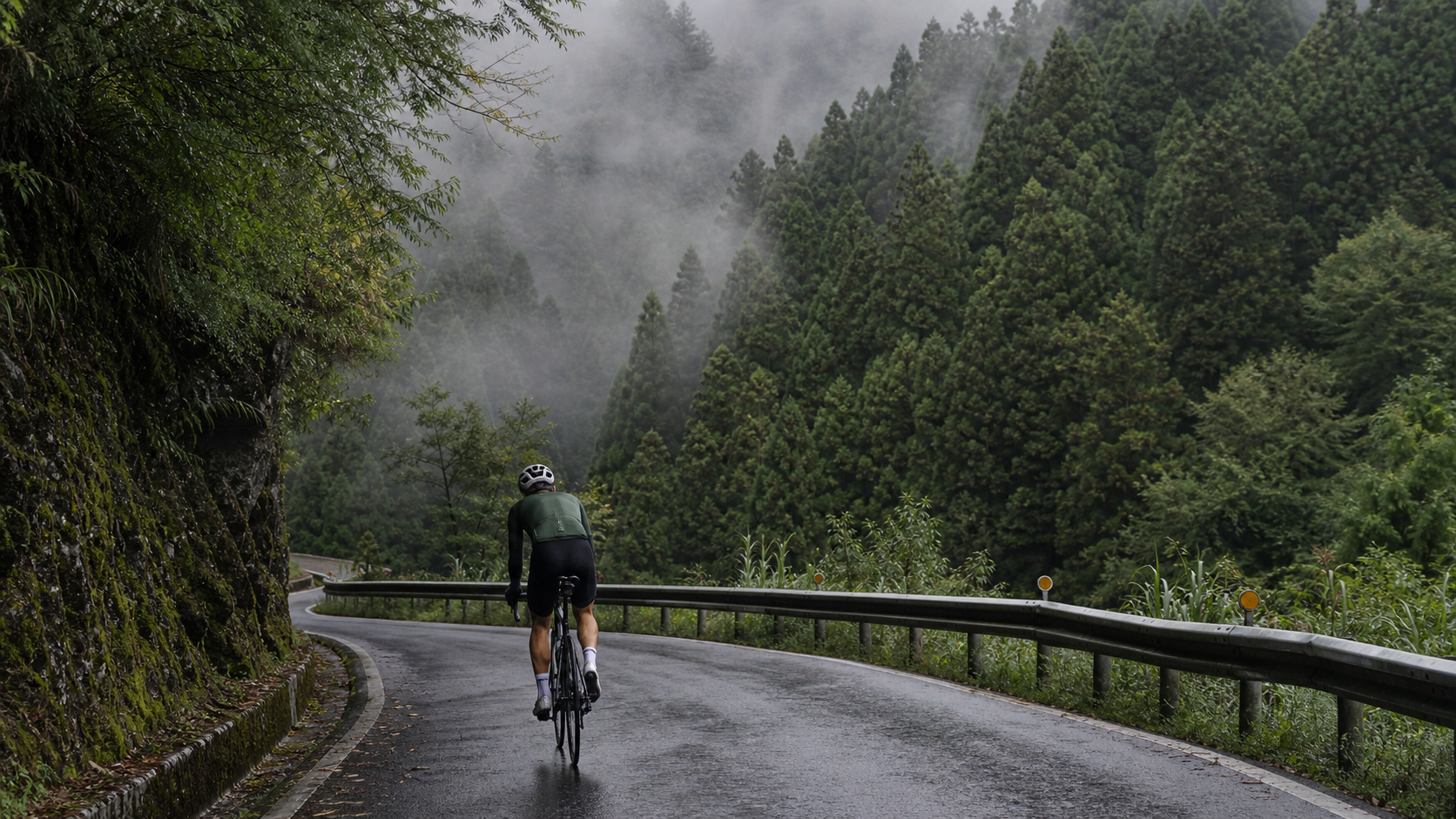
Mist Rising over Mingchi: An 18.5 km Ride from Baling into the Depths of the Japanese Cedar Forest
Some roads are meant for speed, others are meant to be listened to. On this stretch of the Northern Cross-Island Highway from Baling to Mingchi, what I heard was the sound of the stream gradually fading, the wind gradually cooling, and the sound of my own breathing slowly finding its rhythm.
The Geography and Historical Background of the Northern Cross-Island Highway, Baling, and Mingchi
To understand this stretch from Baling to Mingchi, you first have to rewind time. The Northern Cross-Island Highway, officially known as Provincial Highway 7, is one of the few early highways in Taiwan that cut through the northern mountain ranges, connecting Taoyuan and Yilan. Along its route, it links the mountain settlements of the upper Dahan River and carries the traces of generations of Atayal tribal life on this land. Baling is a representative Atayal settlement along this highway—the very name “Baling” itself bears the mark of translated indigenous terminology, and it has long been an important node for mountain transportation and tribal life along the Northern Cross-Island Highway. Walking around Baling, you can still feel a unique atmosphere woven from tribal culture and mountain life—a depth of substance that you simply cannot experience in flatland cities.
Baling is also the junction leading to Lala Mountain (Daguan Mountain Nature Reserve), famous throughout Taiwan for its magnificent groves of ancient red cypress and Taiwan yellow cypress, as well as being a renowned peach-producing area in the north. Every harvest season, the mountain roads take on an extra air of fruit fragrance and abundance. Although the main thread of this story is the ride from Baling toward Mingchi, every time I pass this junction, I can’t help but slow down and think about making a dedicated trip up Lala Mountain someday to see those giant trees said to have stood for over a thousand years—though opinions vary somewhat on the exact ages and numbers of these sacred trees, the more conservative approach is to go see for yourself and read the official explanations on the interpretive signs, which will be more accurate and reliable than numbers casually picked up from the internet.
Mingchi is another landmark along the Northern Cross-Island Highway rich in both geographical and cultural significance. Mingchi Forest Recreation Area sits near the highest point of the highway, at an elevation of approximately 1,150 meters. The park centers on Mingchi Lake, surrounded by vast stands of artificially planted Japanese cedar forest, while also preserving portions of mixed native broadleaf and coniferous vegetation. In Taiwan’s forestry history, the Mingchi area was once an important base for forest management and reforestation. As times changed, it gradually transformed from a purely timber-production site into a forest recreation area combining ecological conservation and leisure functions, currently managed by agencies such as the Forestry Conservation Division of the Veterans Affairs Council. As for the exact development history of Mingchi and the specific years of each phase of transformation, I’d suggest readers interested in deeper understanding consult the official interpretive materials within the park or relevant forestry history literature. Here, I’ll honestly say that riding there yourself and walking into that Japanese cedar forest conveys more of the passage of time this mountain has witnessed than any written record ever could.
Overall, the Northern Cross-Island Highway has witnessed Taiwan’s mountain regions evolving from early industrial roads and timber transport routes into a multifaceted identity encompassing tourism, recreation, and cycling challenges. The stretch from Baling to Mingchi is precisely the most concrete microcosm of this transformation—on the same road, you can see tribal dwellings coexisting with modern highway guardrails, traces of forest changes left by early logging, and modern visitors driving or cycling up specifically to chase the clouds and the lake views. These layered historical textures make this route more than just a number of kilometers of exercise; it reads like a mountain story unfolding slowly.
First-Person Riding Narrative: The Gradual Shifts of Forest, Valley, and Mist
The day I set out from Baling, the sky still held that particular gray-blue tone of early morning, and the air carried the damp scent of dew and soil. In those first few minutes on the bike, my body hadn’t fully awakened, and my legs were still searching for their rhythm, but my eyes were the first to come alive—tribal dwellings scattered across the slopes around Baling, with morning light not yet fully spilling down, a thin layer of mist hanging between rooftops and treetops, as if someone had accidentally tipped over an entire plate of cotton candy across the whole valley.
Once I got onto the main line of the Northern Cross-Island Highway, the road began a gentle climb, and the vegetation on both sides gradually shifted from scattered orchards and vegetable plots to increasingly dense natural forest. I still remember a curve where the view suddenly opened up—below lay a deep valley, the stream glinting silver-white in the distance, and I could faintly hear the sound of water striking rocks. Even at that distance, the babbling sound traveled up through the valley air, mingling with my slightly quickened breathing to form a strange kind of rhythm—as if the stream were accompanying me, moving forward in its own way.
As the elevation slowly rose, I could clearly feel the temperature dropping. The sweat that had seeped from my exertion on my forehead was caught by the mountain wind, sending a chill straight down my collar. The vegetation also changed imperceptibly—broadleaf trees gradually gave way to straight, tall conifers with fine needles. The closer I got to Mingchi, the more distinctly the Japanese cedar forest, with its characteristic faint woody fragrance, surrounded me. Sunlight filtered through layer upon layer of branches and leaves, casting broken, dancing patches of light on the road. With every pedal stroke, the light and shadow seemed to bounce gently across my vision, as if the forest were keeping time for me in its own way.
In the latter half of the route, the mist truly began to “appear” before me, rather than just hanging distantly on the ridgelines. At first it was only a thin layer, softening the distant ridges into a hazy blur. Riding a bit higher, the fog suddenly thickened, visibility instantly shrinking to just a few dozen meters ahead. The towering Japanese cedar forest on both sides appeared and disappeared through the mist, as if the entire forest had been muted—leaving only the sound of my own pedaling, the rhythmic clatter of the chain, and the occasional rustle of wind passing through the treetops. That experience of being wrapped in cloud and mist was, honestly, somewhat magical and somewhat lonely—yet it was a loneliness that brought extraordinary calm, as if the entire world had shrunk to just me and this gently rising slope.
In the final few kilometers, the fog suddenly thinned again, and a faint glimmer of light showed through the sky ahead. I knew Mingchi couldn’t be far now. That instinct of “almost there,” combined with the fatigue accumulated in my body over most of the journey, blended into a complex emotion hard to describe precisely in words—both anticipation and a touch of wistfulness that this road was about to end.
Landmarks Along the Way: Mingchi Forest Recreation Area and the Lala Mountain Junction
The moment I arrived at Mingchi Forest Recreation Area, Mingchi Lake lay quietly cradled in the embrace of surrounding peaks. In the brief window when the mist parted, the lake surface reflected a deep, almost ink-green stillness, with the reflections of lakeside Japanese cedars swaying gently in the breeze—an extraordinarily quiet yet richly layered scene. I leaned my bike to the side and walked onto the lakeside path. Beneath my feet, wooden boardwalks alternated with gravel trails, flanked by towering Japanese cedars whose trunks stood so straight they seemed deliberately arranged. Looking up, I could barely see the full sky, only dappled light filtering through the gaps in the branches.
Beyond the lake and forest trails, the Mingchi park also features rest areas and viewing facilities arranged according to the terrain, suitable for strolling and taking in the scenery at a leisurely pace. The specific facilities and open areas within the park are subject to adjustment based on the management agency’s plans, so I won’t list details here. I’d suggest readers planning a visit check the latest official information before departing—that will be more accurate and reliable than any article’s description. But one thing is certain: that tranquil atmosphere of being surrounded by enormous Japanese cedars, with footsteps muffled by wooden boardwalks and fallen leaves, is Mingchi’s most unforgettable core experience. No list of facilities can fully convey that feeling—only by walking in yourself can you truly understand it.
On the return trip, passing the Baling junction, I glanced once more at the sign pointing toward Lala Mountain. I’ve never ridden that road, but every time I pass it, my curiosity grows—they say the mountain hides groves of ancient red cypress and Taiwan yellow cypress that have stood for an immense span of time, and it’s also a renowned peach-growing region that draws many visitors each harvest season. As for the exact ages of the sacred trees and the complete history of the Lala Mountain protected area, I’ll repeat what I said before: rather than listening to hearsay, ride up there yourself someday, read the official information on the interpretive signs, or ask a local guide directly. The depth of knowledge you gain on-site is far more substantial than any secondhand account.
Sensory Memories: Forest Scents, Stream Sounds, and Mountain Temperature Shifts
If I were to piece together the memory of this ride through the senses, scent would be the first clue to surface. That damp, earthy smell of soil and dew when departing from Baling gradually transformed with rising elevation into something crisper, more woody—the distinctive fragrance of Japanese cedar and other conifers, mingled with the scent of rain-soaked mountain soil. Taking a deep breath felt like having my lungs washed clean, a world apart from the smell of asphalt and vehicle exhaust when riding on flatland.
The memory of sound is equally vivid. In the early stretch, I could still clearly hear the sound of water flowing from the distant valley. As I moved away from the main valley and deeper into the mountains, the water sound was gradually replaced by wind and the rustling of leaves. Especially in the mist-shrouded section, that near-silent atmosphere seemed to amplify every subtle sound—the clatter of the chain, the rustle of tires over fallen leaves, my own slightly heavy breathing—into the clearest background music of the entire journey.
Temperature change was the most direct stimulus to the body. The air, still carrying a slight warmth when I left Baling, turned progressively cooler as elevation climbed. Especially after sweating, when the mountain wind blew, that chill penetrated deep beneath the skin, forcing me to reawaken to the fact that “I am climbing”—not by checking the elevation number on my bike computer, but through the body’s most primitive temperature perception, confirming kilometer by kilometer, step by step, that I was leaving the warmth of the lowlands behind and entering the deeper, cooler, quieter embrace of the mountains.
The Meaning of the Ride and Reflections on the Experience
After completing the ride from Baling up to Mingchi, sitting on a wooden bench by the lake to rest, I suddenly recalled why I had gotten into cycling in the first place. So often, we chase speed, records, and that impressive average speed number on social media. But what this ride gave me was entirely different—it felt more like a slow process of dialogue with myself. 18.5 kilometers at an average grade of 3.2% didn’t push my heart rate to its limit, but it gave me ample time to feel the rhythm of my breathing, how fatigue accumulates drop by drop, and that state of focused concentration where I was clearly out of breath yet still able to maintain a steady cadence and keep moving forward.
This kind of “marathon-style” climbing experience, in a way, more closely mirrors life itself—most of the challenges we face are not sprints that can be solved by a short burst of full effort, but processes requiring long-term steady commitment, patience, and gradual accumulation. The road from Baling to Mingchi seemed to remind me: true endurance isn’t about forcing yourself to give everything in a single moment, but about learning to find a rhythm within a long process that allows you to keep going, keep breathing, and make it all the way through.
Another layer of meaning this route gave me concerns the value of “slowing down” itself. In the misty sections, with visibility shortened and external distractions reduced, that forced state of slowing down and focusing on the few dozen meters of road ahead and my own breathing rhythm allowed me, for the first time, to so clearly “hear” my own psychological state while riding—that slight restlessness, the alertness to unknown road conditions, and the calm that emerged as I gradually adapted to the rhythm. These subtle psychological shifts are things I rarely have the chance to observe so carefully on ordinary rides, which don’t demand this kind of prolonged focus on a gentle climb.
Seasonal Scenery: The Four Faces of Mingchi
From what I understand, Mingchi’s beauty takes on completely different appearances with each season. Although my ride was in a particular season, I pieced together some impressions of Mingchi’s four-season scenery from local residents and fellow cyclists I met along the way. In late spring and early summer, the mountain air is rich with moisture, and the probability of mist and clouds is relatively high. The Japanese cedar forest appears especially lush and verdant under the nourishing damp air, and the lake is often shrouded in a thin layer of fog, creating a hazy, poetic scene.
In autumn and winter, I’m told some vegetation in certain areas around Mingchi shows localized color changes as temperatures drop. Although Mingchi’s primary planted species is coniferous Japanese cedar, and the degree of color change may be more subtle and understated compared to famous maple-viewing spots, that quiet beauty woven from cold, damp air, mist, and a slightly desolate atmosphere reportedly has its own charm. For this, I’d suggest interested readers visit in different seasons to compare for themselves—after all, everyone’s perception of “beauty” differs, and rather than relying on others’ descriptions, it’s better to experience an autumn-winter version of the Baling-to-Mingchi ride yourself.
As for the Baling area and nearby Lala Mountain, every peach harvest season (roughly around summer, with actual timing fluctuating slightly due to climate and yearly conditions), the route takes on an extra air of abundance. Roadside stalls or signs selling fresh seasonal peaches occasionally appear, and the air seems to carry a subtle hint of fruit fragrance. If your ride happens to coincide with the harvest season, consider arranging a stop to taste them—experiencing the sweet flavor nurtured by this mountain land, a pleasure that no elaborately packaged fruit can match, carrying the warmth of being there in person.
Suggested Side Trips: Lala Mountain Peaches, Baling Village, and Route Extensions
If you’re planning to turn the Baling-to-Mingchi ride into a complete mountain getaway rather than just a physical challenge, there are actually quite a few places worth visiting around Baling. Baling Village itself, as an important Atayal settlement along the Northern Cross-Island Highway, preserves many cultural elements worth savoring. If time permits, slow down and take a walk around the village to experience a pace of mountain life completely different from flatland cities. However, the village is also a living space for residents, so I’d suggest visiting with respect and appropriate boundaries.
Lala Mountain peaches are another famous hallmark of the Northern Cross-Island Highway area. During the harvest season, fruit farmers often set up roadside stalls directly along the route. If you happen to be there during the season, it’s definitely worth buying some freshly picked peaches as a sweet conclusion to your ride. As for which specific stall to buy from and pricing, I’d defer to actual on-site conditions. Mountain farmers’ stalls often adjust with the season and individual circumstances, so rather than pinning down specific vendors in an article, I’d encourage readers to go there in person, chat with the local growers, and ask about this year’s harvest. These warm, human interactions are often the most precious part of a mountain trip.
If you still have energy and time to spare, staying overnight in Baling and tackling the Lala Mountain sacred tree forest trail the next day is an extended itinerary combination favored by many cycling and hiking enthusiasts. However, as mentioned earlier, Lala Mountain itself involves a physically demanding climb and trail hike. I’d advise against adding it to the same day as completing the 18.5 km Baling-to-Mingchi challenge. Spreading it over two days and giving your body adequate recovery time is the real way to fully enjoy every aspect of this mountain journey, rather than rushing through it in a state of exhausted depletion.
Words from the Heart for Future Challengers and Summary
If you’re hesitating about whether to take on the Baling-to-Mingchi ride, let me tell you this: this is not a route that will let you immediately show off on social media about “breaking some record.” Its brilliance lies in the quieter, more subtle moments—in that instant when the mist suddenly rolls in and washes the entire Japanese cedar forest in a veil of haze; in that stretch where the sound of the stream gradually fades, replaced by wind and your own breathing; in those few minutes after arriving at Mingchi Lake when you finally set down your fatigue and quietly gaze at the reflections on the water.
I also want to honestly remind future challengers of this route: 18.5 kilometers at an average grade of 3.2% may not sound intimidating, but over an hour of sustained climbing is still a considerable test of both physical strength and willpower. Please make thorough preparations beforehand and ride within your limits—don’t let the words “not a steep grade” mislead you into underestimating the real challenge posed by the distance. Also, please carry with you a sense of respect for the mountains and for the Atayal tribal culture on this land. This route carries not just kilometers of exercise, but a mountain and cultural memory that deserves to be treated with care.
After finishing this ride, looking back at the forests, valleys, and mist traversed from Baling to Mingchi, what surfaced in my mind wasn’t the simple sense of accomplishment of “I completed a route,” but a deeper feeling of quietly paying tribute to this mountain. If you’re ready too, find a day with clear weather and a calm state of mind, ride this road, and let the forests and mist of the Northern Cross-Island Highway slowly guide you to find your own rhythm.
At the moment of leaving Mingchi and preparing for the return journey, I looked back once more at that lake surrounded by Japanese cedars and suddenly realized that what this ride left me wasn’t just sore legs and a string of numbers on my bike computer, but a sense of groundedness hard to fully articulate—the kind accumulated by honestly facing every kilometer of climbing, honestly confronting my physical limits, and ultimately completing the journey through a steady rhythm. On the descent back to Baling, the wind roared past my ears, and the ridgelines and tree shadows that had been obscured by mist moments ago now appeared much clearer in the partially clearing light, as if the entire mountain were bidding me farewell in its own way.
I think this is perhaps the most captivating—yet most easily overlooked—value of long, gentle climbs: they don’t force out your limit reactions with steep grades, but instead use time, distance, and one regular pedal stroke after another to slowly grind out a satisfaction that only those who have experienced it can understand. If you one day ride this road from Baling to Mingchi, I hope that at some curve, in some patch of mist, or in some moment when the stream sound fades into the distance, you’ll find your own unique, one-of-a-kind sense of wonder.
Related Reading
- Northern Cross-Island Highway Mingchi-Baling Section: A Cloudy Forest Ride Beneath Lala Mountain
- Deep in the Clouds: Riding the Northern Cross-Island Highway to Mingchi, a Century-Spanning Transversal Road
- Baling to Mingchi on the Northern Cross-Island Highway: A Practical Guide to the 18.5 km, 3.2% Average Grade, ~592 m Climb Endurance Test
- Northern Cross-Island Highway (Provincial Highway 7): The High Mountain Road Cycling Challenge from Taoyuan to Yilan
滿滿的人還有妹子的香,拉拉山上巴陵挑戰行,絕美山陵空拍!feat. JJSC | 公路車 | CT Yeh
3 年前
#北橫 + #北進武嶺 最硬的員工旅遊 EP1 | #公路車 #拉拉山 | 明池 | 武嶺 | 武陵農場 | 雲海 | Taiwan Cycling Route Wulin
6 年前
台北闊瀨陡坡 騎旅 / 日本單車雜誌編輯車友臨時加入!/ 髮香才是最強的 / feat. 北迴歸線小隊 / 公路車 CT Yeh
6 個月前
一定要騎一次!阿里山最深處:里佳部落!單車旅行 | 2800m爬升 | 深度部落體驗:嗨翻晚會、螢火蟲、銀河 | feat. JJSC & 廢物伙伴 | 公路車 CT Yeh
10 個月前
觀霧 變好騎了! | 北高車友爆笑大會師 | 公路車 | 單車旅遊 Taiwan Cycling Route GuanWu
6 年前
嘉義大埔、阿婆灣挑戰賽,美到以為在日本!ft. 環騎5 Cool 西拉雅188 / 公路車 / CT Yeh
7 個月前
微東進 太魯閣 蘇花 單車兩日遊 ! 颱風過後路況超刺激 行程大亂 | 最狂的鹹酥雞訂單 | CT Yeh | 4K 高畫質空拍絕景!
4 年前
大禹嶺 到 武嶺牌樓 全程前後實況錄影 | 北進武嶺 | 東進武嶺 | KOM | 訓練台 | 坡度分析 | Taiwan KOM Last 10 km HARD | 公路車
6 年前