Central Cross-Island Highway: A Legend in Taiwan's Highway History
The Central Cross-Island Highway (Provincial Highway 8), officially named the "East-West Cross-Island Highway," is Taiwan's first highway connecting the eastern and western parts of the island, opened to traffic in 1960. Stretching from Taroko in Hualien to Dongshi in Taichung, it spans approximately 190 kilometers, with its highest point at Dayuling (elevation 2,565 meters). This highway not only carries the historical memory of Taiwan's development but also stands as the most iconic cross-island cycling route in the hearts of cyclists.
Route Overview
Starting Point: Taroko Archway (Xiulin Township, Hualien County, elevation approximately 60 meters)
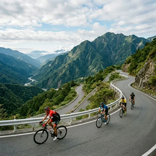
Ending Point: Dongshi (Dongshi District, Taichung City, elevation approximately 300 meters)
Total Distance: Approximately 190 kilometers
Total Climbing: Approximately 3,800 meters
Total Descending: Approximately 3,600 meters
Difficulty Rating: ★★★★☆ (High)
Recommended Duration: 2-3 days
Day 1: Taroko to Dayuling (Approximately 80 Kilometers)
Taroko to Tianxiang (19 Kilometers)
Set off from the Taroko Archway in the early morning, entering the world-class Taroko Gorge. Cycling through the gorge is a surreal experience—towering marble cliffs loom on both sides within arm’s reach, while the Liwu River thunders below. Passing the Shakadang Trail entrance, Swallow Grotto, and Nine Turns Tunnel, every bend presents a National Geographic-worthy scene. Headlights are required inside the tunnels, and be mindful of oncoming traffic. Upon reaching Tianxiang, take a rest at the visitor center next to the Silks Place Taroko Hotel.
Tianxiang to Dayuling (61 Kilometers)
After leaving Tianxiang, the character of the Central Cross-Island Highway begins to change, transforming from a scenic tourist road into a true mountain route. The gradient gradually increases, ranging from 3% to 5%, with certain sections exceeding 8%. Along the way, you’ll pass Xibao Elementary School (one of the highest-elevation elementary schools in Taiwan), Luoshao, Xinbaiyang, and Ci’en. The forest composition along this stretch is remarkably diverse, transitioning from low-elevation camphor and machilus trees, to mid-elevation cypress and cedar, and finally to high-elevation two-needle pine and hemlock.
By the time you reach Dayuling in the afternoon, the elevation has climbed to 2,565 meters. This is the junction of Provincial Highway 8 and Provincial Highway 14A, and also the highest point of the Central Cross-Island Highway. It’s recommended to stay overnight at Dayuling or the nearby Songxue Lodge to conserve energy for the next day’s ride.
Day 2: Dayuling to Lishan to Dongshi (Approximately 110 Kilometers)
Dayuling to Lishan (Approximately 30 Kilometers, Predominantly Descending)
Heading west from Dayuling, you’ll enjoy a thrilling descent. Passing through the Hehuanshan Tunnel (be cautious of low temperatures and slippery surfaces inside), you’ll then enter a series of continuous downhill switchbacks. The scenery along this stretch is magnificent, offering panoramic views of the majestic Xueshan Mountain Range. Upon arriving at Lishan, the elevation is approximately 1,900 meters. Lishan is the most important settlement along the Central Cross-Island Highway, with well-established supply facilities, restaurants, and accommodations. If you opt for a three-day itinerary, consider staying an extra night in Lishan.
Lishan to Guguan (Approximately 50 Kilometers)
The stretch from Lishan to Deji Reservoir features spectacular high-mountain river valley terrain throughout. Passing through Jiayang and Songmao, you’ll arrive at Deji Reservoir, home to Taiwan’s tallest dam. Beyond this point lies the most renowned section of the Central Cross-Island Highway—the route from Deji to Guguan. This section has been repeatedly disrupted by the 1999 Jiji Earthquake and subsequent typhoon damage; some portions have been repaired and reopened, but be sure to verify the latest road conditions before traveling. The riverside hot springs, cliffs, and suspension bridges along this stretch are its defining features. Upon reaching Guguan, treat yourself to a hot spring soak.
Guguan to Dongshi (Approximately 30 Kilometers, Descending)
The final section of the Central Cross-Island Highway, from Guguan to Dongshi, is almost entirely downhill. Descending along the Dajia River valley, passing through Longgu and Heping, you’ll finally arrive at Dongshi. This stretch is relaxed and pleasant, with orchards and farmland along the way. The landscape transitions from high mountains back to rolling hills and plains, evoking a sense of “returning to civilization.”
Important Road Condition Information
Due to its fragile geology, the Central Cross-Island Highway frequently suffers road closures caused by typhoons and heavy rainfall. Currently, the Guguan to Deji section (Provincial Highway 8 Temporary Route 37) is under controlled access, restricted to Lishan residents and permit holders. For cyclists wishing to complete the full Central Cross-Island route, detours via Provincial Highway 7A (Lishan through the Yilan Branch Line) or Provincial Highway 14A (via Hehuanshan) may be necessary as alternative routes. Be sure to confirm the latest road conditions with the Directorate General of Highways before departure.
Gear Recommendations
Since the Central Cross-Island Highway spans multiple climate zones, from subtropical to alpine frigid, layered clothing is essential. It’s recommended to carry a moisture-wicking base layer, an insulating mid-layer, and a windproof and waterproof outer shell. Staying warm on descents is particularly important—during prolonged downhill sections without pedaling, the perceived temperature can feel far colder than the actual air temperature. Additionally, as some sections are remote, it’s advisable to carry at least two spare inner tubes, a pump (rather than relying solely on CO2 cartridges), and basic repair tools.
Accommodation and Supplies
Tianxiang offers the Silks Place Hotel and several guesthouses; near Dayuling, consider the Songxue Lodge (advance reservation required); Lishan has numerous guesthouses and hotels. Operating hours of small shops along the way are irregular, so it’s recommended to stock up on water and food at every settlement you pass. Lishan’s fruits (peaches, apples, and pears) are the most delicious natural provisions along the route.
Related Reading
- Central Cross-Island Highway Cycling Tour: The Magnificent Crossing from Taroko to Lishan
- Central Cross-Island Highway (Provincial Highway 8) Cycling Challenge: Complete Guide from Lishan to Taroko
- Central Cross-Island Highway Lishan Section: An Epic Crossing from Guguan to Dayuling
- Southern Cross-Island Highway Cycling Challenge: An Epic Ride Through the Central Mountain Range
爬坡ITT實境)台中 魔王 松鼠坡 首航 6:12 大肚山 大三元 科福路
8 年前
微東進 太魯閣 蘇花 單車兩日遊 ! 颱風過後路況超刺激 行程大亂 | 最狂的鹹酥雞訂單 | CT Yeh | 4K 高畫質空拍絕景!
4 年前
嘉義大埔、阿婆灣挑戰賽,美到以為在日本!ft. 環騎5 Cool 西拉雅188 / 公路車 / CT Yeh
7 個月前
台灣登山王之路 KOM 全程參賽4K臨空錄影 PART1 穿越峽谷地形! #東進武嶺 太魯閣 / 燕子口 / 天祥 / 西寶 PART1 (公路車 / CT Yeh)
3 年前
#北橫 + #北進武嶺 最硬的員工旅遊 EP1 | #公路車 #拉拉山 | 明池 | 武嶺 | 武陵農場 | 雲海 | Taiwan Cycling Route Wulin
6 年前
台北闊瀨陡坡 騎旅 / 日本單車雜誌編輯車友臨時加入!/ 髮香才是最強的 / feat. 北迴歸線小隊 / 公路車 CT Yeh
6 個月前
大武山20%魔王陡坡【JJSC南台灣遊騎Day2】!屁股真的要裂開了...凡士林抹滿也沒用?神秘金教堂還有超便宜夜市
3 個月前
新竹羅平 x 天湖部落 大禹嶺級變態陡坡! 4K超高畫質 空拍 | 公路車
5 年前