Introduction
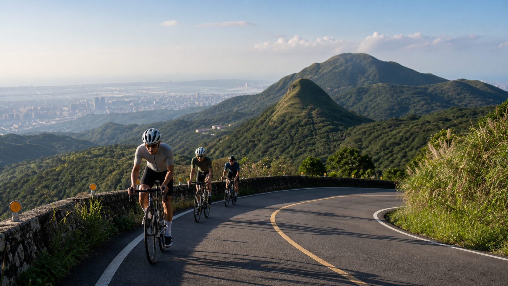
Yangmingshan National Park is only a twenty-minute drive from downtown Taipei, yet it holds ridgelines over a thousand meters in elevation, sweeping highland grasslands, and varied volcanic terrain. For cyclists in northern Taiwan, Yangmingshan is not just a weekend climbing training ground — it’s a natural treasure that can completely reset your mindset in a short amount of time. Fenghuizui (風櫃嘴), Balakar Road (巴拉卡公路), and the Qingtiangang (擎天崗) loop each represent a different riding experience, and together they form a complete map of Yangmingshan cycling.
Overview of the Three Routes
| Route | Start | End / Highest Point | Distance | Elevation Gain | Difficulty |
|---|---|---|---|---|---|
| Fenghuizui | Bishan Rd. junction, Neihu, Taipei | Fenghuizui Saddle (approx. 620m elevation) | approx. 8 km | approx. 520 m | Moderate |
| Balakar Road | End of Xingyi Rd., Beitou | Erziping / Xiaoyoukeng | approx. 12 km | approx. 750 m | Moderate to Hard |
| Qingtiangang Loop | Zhuzihu | Qingtiangang Grassland (approx. 800m elevation) | approx. 15 km | approx. 500 m | Moderate |
Fenghuizui: A Well-Matched Entry-Level Climb
Starting from Bishan Road in Neihu, the route winds up the mountainside for about eight kilometers with roughly five hundred meters of elevation gain. The gradient is even throughout, making it well suited to riders who are just starting to train on climbs. Once you reach the saddle, the view opens up dramatically — on clear days you can look out over the entire Taipei Basin, while to the north you can see the coastline around Jinshan and Wanli. Fenghuizui is also a popular time-trial training segment for many cycling teams, and on holidays you’ll often see clusters of riders doing timed efforts here.
The descent toward Jinshan is in good condition, but it has many curves and steep drops, so it’s best to check your braking system before setting off.
Balakar Road: The Most Challenging Route on Yangmingshan
Balakar Road begins at the end of Xingyi Road in Beitou and passes through dense forest, sulfur-scented geothermal terrain, and steep hairpin turns. Of the three Yangmingshan routes, it has the most concentrated gradient and the greatest total elevation gain. Some sections reach grades of 10% to 12%, putting real demands on your pedaling rhythm and heart rate management.
Points of interest along the way include the Erziping wetland, the Xiaoyoukeng fumaroles, and Lengshuikeng, and how far you push on depends on how much energy you have left. If your legs are still fresh, you can continue on toward Lengshuikeng and Shiding, linking up a mountain route that crosses northern Taiwan.
Qingtiangang Loop: A Leisurely Ride Across Highland Grassland
Compared to the first two routes, the Qingtiangang loop has a gentler gradient, making it well suited for riders who want to enjoy highland scenery at a relaxed pace on the weekend. Starting from Zhuzihu, you climb along Provincial Highway 2 甲 up to the Qingtiangang grassland, where grazing cattle and sweeping mountaintop views make the effort feel effortless.
The loop can be extended toward Sanzhi and Shimen to connect with the North Coast route, or you can simply retrace your path back to Taipei — it’s a flexible route either way.
Fueling and Safety Notes
- Rest stops: There are vending machines at the Fenghuizui saddle; Zhuzihu has small farm rest stops and shops; the Erziping visitor center sells drinks on weekends and holidays.
- Weather awareness: Fog can roll in quickly on Yangmingshan and temperatures can drop sharply, so be sure to check the Central Weather Administration’s mountain forecast before you set off, and bring a windproof jacket.
- Road conditions: Some sections can become slippery due to mountain spring water seepage, so take extra care in rain or right after clearing weather.
- Best season: October through April, avoiding the plum rain season (May–June) and typhoon season (July–September).
Practical Tips
Before You Go
- A 34T rear cog or a compact crankset (50/34 front) is recommended, since the steep sections stretch on for several kilometers.
- Bring plenty of water — there’s little shade near the Yangmingshan summits, so you’ll need more hydration than you would on flat ground, especially in summer.
Route Combination Strategies
- Half-day trip: Fenghuizui out-and-back (approx. 3–4 hours)
- Full-day trip: From Beitou via Balakar Road → Qingtiangang → Zhuzihu → down via Yangjin Highway (approx. 70–80 km, over 1,200 m of elevation gain)
Getting There
- Taipei’s YouBike system does not extend up onto Yangmingshan, so it’s best to ride your own road bike.
- Near MRT Jiantan Station and Taipei Main Station there are several bike rental shops offering all-day rental plans.
Conclusion
Yangmingshan’s three routes each have their own character: the approachable rhythm of Fenghuizui, the punishing test of Balakar Road, and the highland tranquility of Qingtiangang — together they form the most complete road cycling landscape in northern Taiwan. Whether you’re a beginner just starting to train on climbs or a racer gearing up to chase a KOM, Yangmingshan offers just the right stage. Bring your road bike, and let the view from the summit be the reward for every pedal stroke.
Related Reading
風櫃嘴 | 全台最多大砲的單車路線 | 尋寶網攝影師告訴你怎麼擺拍起來才好看 | 熱門攝影地點巡禮
6 年前
#公路車 台北 #風櫃嘴 23:47 全台單車實境請訂閱鎖定
7 年前
陽明山 風櫃嘴 下雪 雪景
10 年前
太平山單車員工旅遊 | 這樣玩CP值最高!| 公路車
5 年前
風櫃嘴時間 預測西進武嶺時間?13000名車友統計數據分析告訴你 !
5 年前
車隊介紹) 台北 一年開團365天 車隊 Apollo Ride 晨騎 好選擇 ( 陽明山 風櫃嘴 冷水坑 平等里 聖人 關渡 大稻埕 ) 找人騎車
7 年前
嘉義單車路線推薦:碧湖山茶園超陡坡挑戰!里佳部落-奮起湖-瑞峰 (附路線)
7 個月前
爬坡ITT實境)台中 魔王 松鼠坡 首航 6:12 大肚山 大三元 科福路
8 年前