Reopening of the South Cross-Island Highway: Current Cycling Conditions on Provincial Highway 20
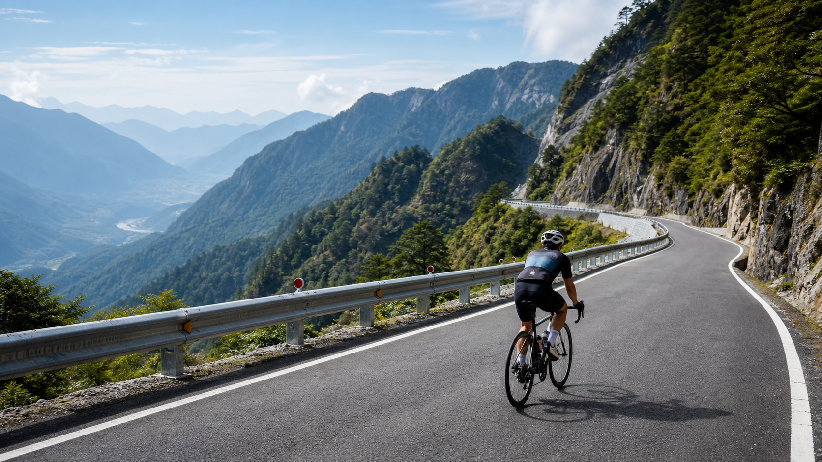
Reopening of the South Cross-Island Highway: Current Cycling Conditions on Provincial Highway 20
Introduction
The South Cross-Island Highway, commonly known as “Nanheng,” is the highest in elevation and most spectacular in scenery among Taiwan’s three cross-island highways. Provincial Highway 20 begins in Yujing, Tainan City, crosses Tianchi (2,722 meters), the highest point of the Central Mountain Range along the route, and finally arrives in Haiduan Township, Taitung County, covering a total of 172 kilometers.
In 2009, Typhoon Morakot (the 8/8 Flood) devastated the South Cross-Island Highway, causing severe landslides that shut the road down for more than a decade. After prolonged reconstruction work, the highway reopened in stages through late 2023, with cycling restrictions gradually lifted. This was major news for Taiwan’s cycling community — a sleeping mountain giant, closed for over ten years, was finally opening its arms to riders once again.
Current Road Conditions (as of 2024)
| Section | Status | Notes |
|---|---|---|
| Yujing, Tainan → Meishankou | Open | Some mountain sections still under repair, watch for falling rocks |
| Meishankou → Tianchi (Tainan section) | Open (time-restricted) | Daily control periods apply; check the latest announcements |
| Tianchi → Xiangyang (highest point section) | Open | High-altitude section with low temperatures, bring warm clothing |
| Xiangyang → Haiduan, Taitung | Fully open | Road surface repaired, riding is smoother |
Note: The South Cross-Island Highway’s mountain terrain is geologically sensitive, and traffic control rules may change depending on weather and road conditions. Always check the latest information from the Directorate General of Highways before setting out.
Route Sections
Tainan Section (Yujing → Tianchi)
Starting from Yujing in Tainan, the initial stretch passes through hilly terrain at the edge of the southern plains, with Hakka and Indigenous communities such as Liuying, Jiaxian, and Taoyuan scattered along the way. Once you enter the mountains, the gradient steepens progressively. Sections like Tianlong Bridge and Meishankou were among the areas hit hardest by Typhoon Morakot, and traces of the reconstruction work remain visible — a reminder of nature’s immense power.
Tianchi to Xiangyang (Highest Point Section)
At 2,722 meters, Tianchi is the spiritual summit of the South Cross-Island Highway and one of the high points among Taiwan’s roads. A mountain lodge near Tianchi offers accommodation, and the night skies here are dazzling, with the Milky Way clearly visible. Looking out from Tianchi, the Taiwan Strait lies to the west and the Pacific Ocean to the east — the feeling of standing on “the ridgeline roof of Taiwan” is truly unmatched.
Taitung Section (Xiangyang → Haiduan)
After crossing the watershed and entering the Taitung section, the landscape changes abruptly. The deep gorge of the Zhuokou River and Indigenous settlements along the Millennium Trail reveal the rugged beauty of Taiwan’s eastern mountains. The road surface in the Taitung section has been more thoroughly repaired, and the gradient is comparatively gentler than the Tainan side, which is why many riders choose to start from Taitung and ride the route in reverse.
Notable Cultural Sites
- Tengzhi Forest Recreation Area (Chiayi spur route): A branch off Provincial Highway 20 leads to Tengzhi, where well-preserved old-growth forests of Taiwan cypress and red cypress await riders seeking a taste of pristine high-mountain forest.
- Tianchi: A high-mountain sanctuary where a mountain lodge offers simple accommodation — the greatest spiritual landmark of the South Cross-Island Highway.
- Lidao Village: A major Bunun Indigenous settlement in the Taitung section, known for its millet farming and traditional hunting-ground culture, offering an authentic window into Taiwanese Indigenous life.
- Wulu Canyon: A geological marvel in the Taitung section — a gorge several hundred meters deep, often shrouded in morning mist, breathtaking to behold.
Memories of the Typhoon and the Spirit of Reconstruction
Riding across the South Cross-Island Highway, it’s impossible not to feel the historical traces left by Typhoon Morakot. Repaired retaining walls, rebuilt bridges, and stretches of terrain where landslide scars are still visible along the way prompt riders to reflect deeply on both the power of nature and humanity’s will to rebuild. The Indigenous communities along the South Cross-Island Highway rebuilt their homes with remarkable resilience after the disaster. Today’s reopened highway represents not just the restoration of a road, but the revival of an entire mountain community.
Practical Tips
- Route direction: It’s recommended to ride from Taitung to Tainan (east to west), starting the climb from Haiduan and gradually approaching the highest point at Tianchi, with most of the descent concentrated on the Tainan side — relatively safer overall.
- Checking road controls: Before every trip, check the Directorate General of Highways’ road control inquiry system to confirm the latest opening hours.
- High-altitude preparation: Temperatures at the Tianchi section can drop below 5°C, so warm clothing, gloves, and a rain jacket are essential.
- Supplies: Yujing, Taoyuan, and Wulu are the main resupply points. The Tianchi mountain lodge offers simple meals, but prices are relatively high, so it’s best to bring sufficient supplies of your own.
- Time planning: The full 172-kilometer route is best completed over two days, with an overnight stop at the Tianchi mountain lodge.
- Emergency preparedness: Mobile signal is weak in the mountains, so it’s advisable to carry a satellite communicator or mountaineering-grade emergency locator device.
Conclusion
The reopening of the South Cross-Island Highway is a major event in the history of mountain cycling in Taiwan. This high-mountain road, dormant for over a decade, carries the scars of the typhoon, the resilience of Indigenous communities, and the anticipation and dreams of countless riders. When you ride the South Cross-Island Highway, pedaling across pavement once broken and now stitched back together, you’re riding more than just a road — you’re pressing your wheels into Taiwan’s deep love for its own land and its unyielding refusal to give up. The South Cross-Island Highway has been waiting for you for a long time.
Related Reading
- First Ride After the South Cross-Island Highway Reopened: A Firsthand Account of Provincial Highway 20’s Historic Return
- Cycling the South Cross-Island Highway: Taiwan’s Most Magnificent Cross-Island Riding Experience
- Taiwan’s Long-Distance Cycling Routes: Exploring the Mountains of the South Cross-Island Highway
- The South Cross-Island Highway Cycling Challenge: An Epic Ride Across the Central Mountain Range
大武山20%魔王陡坡【JJSC南台灣遊騎Day2】!屁股真的要裂開了...凡士林抹滿也沒用?神秘金教堂還有超便宜夜市
3 個月前
#北橫 + #北進武嶺 最硬的員工旅遊 EP1 | #公路車 #拉拉山 | 明池 | 武嶺 | 武陵農場 | 雲海 | Taiwan Cycling Route Wulin
6 年前
高雄綠園道鐵路自行車道 / 外地人能輕鬆駕馭 還是整路崩潰? / 2025 全線開通 春節實地探索一次!(附GPS連結)/ 公路車 / CT Yeh
1 年前
微東進 太魯閣 蘇花 單車兩日遊 ! 颱風過後路況超刺激 行程大亂 | 最狂的鹹酥雞訂單 | CT Yeh | 4K 高畫質空拍絕景!
4 年前
半日 小台灣 極限單車路線挑戰實錄
7 年前
大武山後門26%歡樂陡坡!JJSC南台灣單車行Day2 / 被颱風追著跑 / 公路車 / CT Yeh
2 年前
2025 乘鞍 KOM 登山賽挑戰實錄 / 日本公路最高 ! 賽前探路篇 / 比富士山厲害,無敵絕景!/ 40週年 / 中文YT首發 / 公路車 / CT Yeh #乘鞍ヒルクライム
10 個月前
公路車 | 塔塔加驚險員工旅遊 | 還好手腳快沒被抓交替!
5 年前