First Ride After Nanheng Reopened: A Firsthand Witness to the Historic Return of Provincial Highway 20
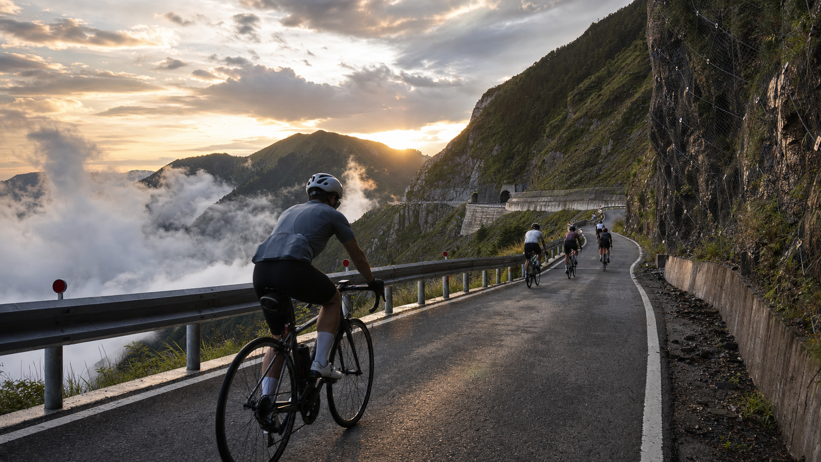
First Ride After the Southern Cross-Island Highway Reopened: A Firsthand Witness to the Historic Reopening of Provincial Highway 20
Introduction
Some roads are more than just roads; they carry the memories of an era. The Southern Cross-Island Highway (Provincial Highway 20) is exactly that. Once one of Taiwan’s most spectacular trans-island highways, it connects Jiasian in Tainan to Haiduan in Taitung, passing through breathtaking mountain regions such as Dawu Mountain, Tianchi, Xiangyang, and Lidao. In 2009, Typhoon Morakot devastated the Southern Cross-Island Highway, and some sections remained closed for over a decade.
When news broke that the Southern Cross-Island Highway had reopened to cyclists, I began planning almost immediately. Not because it was particularly fast, not because it held any race records, but because: this is a road that was lost and found again. Being able to ride this road is itself a historically significant event.
Geography and History of the Southern Cross-Island Highway
Provincial Highway 20 spans approximately 184 kilometers in total, with its highest point at the western entrance of the Guanshan Tunnel at an elevation of about 2,722 meters. It is one of the highest sections among Taiwan’s three major cross-island highways (Northern Cross-Island, Central Cross-Island, and Southern Cross-Island).
Key Points on the Southern Cross-Island Highway (Western Section, starting from Tainan):
| Location | Elevation | Highlights |
|---|---|---|
| Jiasian | 300m | Western starting point of the Southern Cross-Island Highway, famous taro-producing area |
| Taoyuan (Gaozhong) | 700m | Bunun tribe village, important supply point |
| Meishankou | 1,200m | Wide open views, representative scenery of the middle section |
| Xiangyang Farm | 2,300m | Highland vegetable farmers, one of Taiwan’s highest farming areas |
| Tianchi | 2,580m | Highland lake, the most famous scenic spot on the Southern Cross-Island Highway |
| Guanshan Tunnel | 2,722m | Highest point, descending to the eastern side after passing through |
| Lidao | 1,200m | Bunun tribe village on the eastern side |
| Haiduan | 400m | Eastern terminus |
Departure: Standing at the Starting Point of History
I chose to start from the western side (Jiasian), with the goal of riding to the Guanshan Tunnel, a total distance of about 75 kilometers with approximately 2,400 meters of elevation gain.
At 5 a.m., in front of a convenience store in Jiasian Township, a group of riders who had all come to be “among the first to ride the Southern Cross-Island Highway” got acquainted. Some had driven down specially from Taipei, others from Kaohsiung. One older gentleman said he had ridden the route many times before it was closed. “This road holds a very special place in my heart. It’s finally back.”
Those words made my nose tingle a little.
Along the Way: Scars and Rebirth
The Southern Cross-Island Highway after reopening cannot look exactly the same as before its closure. Along the way, the traces left by typhoons and mudslides are clearly visible:
- Some mountain walls still bear the scars of landslides, stabilized with protective netting and retaining walls
- Some sections have freshly laid asphalt, noticeably darker in color than the older sections
- In certain spots along the roadside, the foundations of old bridges destroyed by Typhoon Morakot are still visible
- Most bridges are post-disaster reconstructions, designed to be more robust
These traces are not a source of regret but an honest representation of memory. Riding through them, one cannot help but feel deep respect for the workers who rebuilt the road and the engineers who managed the restoration.
Bunun Tribe Village in Taoyuan:
Taoyuan (formerly known as Gaozhong, meaning “place of many streams” in the Bunun language) is the most important supply stop on the western section of the Southern Cross-Island Highway. The village has small grocery stores and simple eateries. I had a bowl of pork rib noodles at a small noodle stand. The owner was a Bunun auntie who spoke fluent Taiwanese, asking where I came from and where I planned to ride.
When I said, “I want to ride to the Guanshan Tunnel,” she nodded. “A lot of people used to ride here, then no one did. Now they’re back. That’s good.”
That “that’s good” was said casually, yet carried profound weight.
The Splendor and Solitude of the Xiangyang Section
Above 2,000 meters in elevation, the Southern Cross-Island Highway reveals its most magnificent face. The road winds through alpine grasslands and arrow bamboo forests, with clouds and mist occasionally rising from the valleys, obscuring the view ahead before quickly dispersing. The scenery here brings to mind the Hehuan Mountain peaks near Wuling, yet carries a distinctive heaviness unique to the southern mountain ranges.
At Xiangyang Farm, I met a farmer harvesting cabbages. His farm sits at an elevation of 2,300 meters, and he has to start work at dawn every day. I watched him pack cabbages one by one into crates, and suddenly I gained a new calibration for what “hard work” truly means.
Guanshan Tunnel: The Silence at the Finish
The moment I reached the Guanshan Tunnel, my cycling computer read: 75.3 kilometers, 4 hours 22 minutes, 2,412 meters of elevation gain.
The wind at the tunnel entrance was strong. The warm air blowing from the eastern side met the cold air from the western side, and standing at the tunnel entrance, you could feel both temperatures at once. I sat on the guardrail beside the tunnel entrance, drinking the last half bottle of water, gazing at the distant mountain ranges I had climbed from Jiasian.
Those ten silent minutes were the best gift the Southern Cross-Island Highway gave me.
Practical Tips
- The Southern Cross-Island Highway currently has (periodic annual) access time restrictions; be sure to check the latest announcements before departing
- Supply stops are scarce along the entire route; departing from Jiasian requires carrying ample food and water (at least 2.5 liters)
- Roads in Bunun tribe villages may be subject to traffic controls during small festivals; confirm in advance
- Mountain weather changes rapidly; pack rain gear
- A round trip in a single day is not recommended; consider staying overnight in Lidao on the eastern side or in Chishang
Conclusion
Riding the Southern Cross-Island Highway is not just cycling; it is a reconnection with the road itself. It disappeared for over a decade, taking many people’s memories with it, and then returned. Riding on it, you can feel the emotions of those who waited for its return during the years of closure.
Some roads are worth waiting for, and the Southern Cross-Island Highway is one of them.
Related Reading
- Southern Cross-Island Highway Reopens: Current Cycling Conditions on Provincial Highway 20 After Restoration
- A Cycling Journey on the Southern Cross-Island Highway: Riding Experience on Taiwan’s Most Spectacular Cross-Island Route
- Taiwan Long-Distance Cycling Routes: Mountain Exploration on the Southern Cross-Island Highway
- Southern Cross-Island Highway Cycling Challenge: An Epic Ride Across the Central Mountain Range
大武山20%魔王陡坡【JJSC南台灣遊騎Day2】!屁股真的要裂開了...凡士林抹滿也沒用?神秘金教堂還有超便宜夜市
3 個月前
#北橫 + #北進武嶺 最硬的員工旅遊 EP1 | #公路車 #拉拉山 | 明池 | 武嶺 | 武陵農場 | 雲海 | Taiwan Cycling Route Wulin
6 年前
高雄綠園道鐵路自行車道 / 外地人能輕鬆駕馭 還是整路崩潰? / 2025 全線開通 春節實地探索一次!(附GPS連結)/ 公路車 / CT Yeh
1 年前
日本公路最高登山賽,台灣首位YT挑戰實錄,乘鞍登山賽40週年,賽前篇完整版,請到我的YT收看 #公路車 #cycling
11 個月前
嘉義大埔、阿婆灣挑戰賽,美到以為在日本!ft. 環騎5 Cool 西拉雅188 / 公路車 / CT Yeh
7 個月前
2025 乘鞍 KOM 登山賽挑戰實錄 / 日本公路最高 ! 賽前探路篇 / 比富士山厲害,無敵絕景!/ 40週年 / 中文YT首發 / 公路車 / CT Yeh #乘鞍ヒルクライム
11 個月前
超激烈!2025 南庄仙山KOM 賽事精華 / 男菁英A x 女菁英A / 公路車 / CT Yeh
9 個月前
公路車 | 塔塔加驚險員工旅遊 | 還好手腳快沒被抓交替!
5 年前