Six Kilometers of Rolling Hills, the Gateway to Alishan
6269.9 meters, with an average gradient of 5.1%. That is the entirety of this route at Fanlu Puwei in numerical terms. But for me, this rolling road of just over six kilometers carries far more than those few numbers—it is a stretch I always ride before heading to the Alishan Highway (Provincial Highway 18), like a ritualistic threshold, reminding myself: you are about to leave the rhythm of flatland life and enter a completely different geographical and psychological space.
Fanlu Township is a name familiar to Taiwan’s cycling community. It sits close to Chukou and Xiding, making it one of the most important gateway townships in the Alishan Highway system. Departing from Chiayi City and heading east along Provincial Highway 18, Fanlu Township is a place nearly every rider preparing to challenge Alishan must pass through. And the Puwei route lies quietly within this rolling hill country—unassuming, yet it solidly tests everyone who passes through it.
I still remember the image that came to mind when I first heard the name “Puwei”—the edge of an open plain. In Taiwan’s place-name conventions, “Pu” (埔) often refers to flat or open wasteland or grassy plains, while “Wei” (尾) suggests the end or boundary of a geographical area. This logic of place-naming, bearing traces of Taiwan’s early reclamation history, can be seen throughout township names across the island. These names were rarely planned administrative designations; rather, they were the most intuitive descriptions of terrain passed down by early settlers as they cultivated the land. Riding along Puwei, thinking about the ancient stories of reclamation and naming that this place-name might carry, adds a layer of dialogue with the land’s history to what would otherwise be pure physical training. Each pedal stroke feels like a faint, time-spanning connection with the generations of people who lived on this land before us.
The Chiayi hill country stretches eastward from the city, with terrain rising gradually before eventually connecting to the core of the Alishan mountain range. This topographic staircase has created a series of distinctive townships along Provincial Highway 18, and Fanlu Township occupies a key position on this staircase closest to the plains—it retains the agricultural lifestyle of the flatlands while already displaying the undulating contours characteristic of hilly terrain. This dual character of a transitional zone is, to some extent, reflected in the gradient data of the Puwei route: a 5.1% average gradient is not particularly steep, yet it is by no means a gentle flatland slope—fittingly embodying Fanlu Township’s own geographical identity of “situated between the plains and the mountains.”
The Start: A Final Buffer Before Saying Goodbye to the Flatlands
My first impression of Puwei was a sense of “transition.” Riding out of Chiayi City, the scenery along the roadside gradually shifts from rows of townhouses and convenience stores to scattered farmhouses and orchards, and the temperature and humidity in the air change accordingly. Because of its location at the boundary between hills and plains, the Fanlu area has long been known for growing persimmons and longan—autumn is persimmon season, and early winter brings the longan harvest. This agricultural landscape, following the rhythm of the seasons, constitutes one of Fanlu Township’s most distinctive local characteristics.
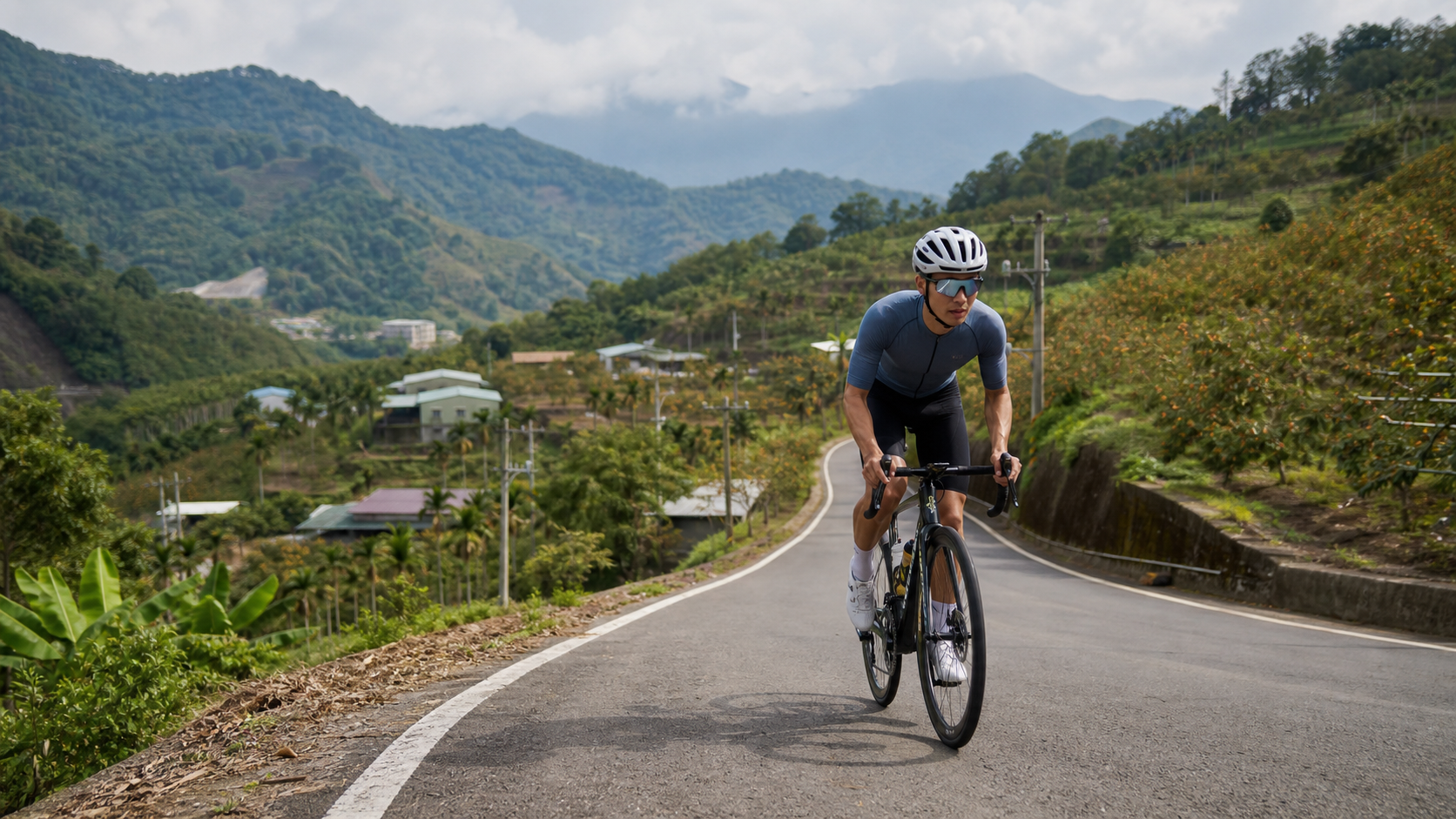
As I turn my handlebars into the entrance of the Puwei route, the gradient is still gentle. Occasionally, fruit trees laden with branches appear on both sides—depending on the season, they may be green persimmons or longan not yet fully ripe, hanging heavily by the roadside. The scene woven from agricultural landscape and rolling terrain carries a beauty that is rustic yet full of vitality—it is not deliberately crafted like a tourist attraction, but a genuine scene of farmers’ lives. As you ride past, you briefly borrow their perspective, seeing the traces of year-round hard work on this land.
By the roadside, you can occasionally see simple orchard trellises built with bamboo poles and netting—a common farming method to keep birds from pecking at the fruit. In the morning light, the outlines of these trellises stretch long, casting shadows across the asphalt in a regular, quiet geometric pattern. I slow down to give myself more time to observe these details of local agricultural life—this slowing is not entirely a physical consideration, but more a choice of mindset: Puwei may be short, but if you only focus on chasing the fastest completion time, you will miss what truly makes this stretch captivating. There is always a trade-off between speed and scenery, and I have gradually learned to make different choices in different riding contexts.
As I go deeper, the fruit trees on both sides are gradually replaced by more primitive secondary forest. Dappled light begins to fall across the road through the canopy, and the temperature is noticeably cooler than when I started. This transition from cultivated orchard landscapes to relatively natural mountain vegetation is a subtle ecological gradient along the Puwei route—one that is hard to truly appreciate unless you are moving by bicycle, at a relatively slow pace close to the ground, feeling the fine layers of vegetation change with elevation and terrain.
The Middle Section: Gradient Increases, Thoughts Clear
As the route progresses into its middle section, the gradient noticeably stiffens. The 5.1% average gradient is somewhat gentler than Wangfengting’s 6.4%, but a sustained climb of over six kilometers still brings that familiar burning sensation to the thighs. I adjust my breathing rhythm, drawing my attention away from the surrounding scenery and back to my own body—each pedal stroke, each heartbeat becomes the only thing that matters at that moment.
What makes the Puwei route interesting is that, unlike the deep-mountain climbs enclosed by dense forest with limited views, it maintains a semi-open terrain—you can continuously see the layered contours of distant mountain ranges, and occasionally catch glimpses of settlements shrinking below. This ever-shifting, partially revealed vista keeps the climb from feeling monotonous; instead, it unfolds like a progressive unveiling of scenery. Midway through the route, I encounter an elderly local resident riding an electric-assist bicycle. He slowly passes me, turns back with a smile, and says, “Keep going—Alishan is still far away.” That kind of teasing yet warm greeting, so characteristic of rural Taiwan, quietly replenishes a bit of psychological energy at the hardest point of the climb.
Chukou, as a well-known ecological and geological site within Fanlu Township, is famous for its distinctive terrain and rich natural ecology, and is a stopover many people visit along their journey to the Alishan Highway. Although the Puwei route itself does not pass directly through Chukou’s core scenic area, riding on these roads within the same Fanlu hill country, you can clearly feel the mountain forest drawing nearer—humidity in the air rises, surrounding vegetation grows denser, as if your body is being gradually welcomed into the mountains, preparing for the deeper mountain journey ahead.
The gradient maintains a steady yet unrelenting intensity through the latter half of this section. I can feel my heartbeat growing clearer in my ears—the sensation of blood flowing faster, core body temperature slowly rising, combined with the increasingly lush greenery around me, creates a nearly meditative state of focus. At this point, stray thoughts naturally fade away, replaced by heightened awareness of breathing rhythm, cadence, and the undulations of the road ahead. I often think the most precious thing about climbing is that it forces you to live in the present moment—past worries and future plans lose their power to intrude on your attention under this sustained physical load.
Puwei’s Role in the Alishan Highway: A Dual Threshold, Physical and Psychological
To me, the most special thing about the Puwei route is its role as a “threshold.” Physiologically, Puwei provides a warm-up section of moderate length and gradient, allowing the body to gradually adapt from flatland riding rhythm to the climbing intensity of hilly terrain. By the time you truly enter the steeper, longer challenges of the Alishan Highway main line, your body has already made preliminary preparations, so you are not overwhelmed from the start.
But more importantly, it is the psychological threshold that matters. Every time I ride through Puwei, I perform a small ritual in my mind—telling myself that the rhythm of flatland life, work worries, and daily trivialities are all left behind at the foot of the mountain. Puwei’s six kilometers serve as a buffer zone, allowing me to slowly shift from an urbanite’s mental state into the mindset of a rider ready to embrace the mountains, ready to focus on breath and cadence. After finishing Puwei, looking back at the plain scenery now stretched out behind you, then looking ahead at the even more imposing mountain terrain—that sense of psychological readiness and anticipation is something no equipment upgrade or physical training can directly provide.
I know several veteran riders who have long ridden the Alishan Highway, and they all independently mention that Puwei, though short, serves as a simple indicator for assessing “how good their condition is today”—if riding Puwei feels particularly easy and breathing is well managed, it usually means their physical and mental state is above par, suitable for pushing deeper into the Alishan Highway; conversely, if even these short six kilometers of Puwei feel especially taxing, perhaps the body is signaling that today calls for tempering ambition—maybe turning back early or setting a goal at a lower elevation section. This way of using Puwei as a “physical sensation thermometer” echoes its functional role as a threshold—it is not merely a passage to greater challenges, but an honest mirror that lets you see your true current state before committing to a more arduous journey.
Once, after finishing Puwei, I sat on a roadside guardrail to rest, watching the layered mountain ridges glow in varying shades of green under the afternoon sun, and suddenly recalled how green I was when I first rode this route—back then, even a moderate six-kilometer gradient left me gasping for air, forcing me to stop and walk my bike several times to catch my breath. Now, returning again, my body has gained considerable familiarity and mastery over this gradient. That sense of composure accumulated through repeated practice is perhaps the gentlest gift this route offers to long-term riders: it will not let you reach the summit in one leap, but as long as you are willing to keep coming back, it will honestly witness every bit of your progress.
Fanlu’s Produce and People: Persimmons, Longan, and Hill-Country Life
The agricultural landscape of Fanlu Township is an indispensable part of this route’s human story. The hilly terrain and climate conditions here are well suited to growing fruit trees like persimmons and longan, and over the years, Fanlu Township has carved out its own place in Chiayi’s agricultural map. Every autumn, when persimmon season arrives, orchards along the way hang heavy with orange-yellow fruit—one of the most iconic seasonal scenes of the Fanlu hill country. And while the longan season comes somewhat earlier, it brings another layer of harvest scenery to this land.
Riding along Puwei, if timing and season align, you have a good chance of seeing farmers harvesting in their orchards, or encountering the occasional roadside stall selling homegrown produce (actual stalls and opening hours depend on on-site conditions; they are not guaranteed on every visit). This life scene, closely tied to the land’s production cycle, makes the Puwei route more than just training data—it is like a window, allowing riders to briefly glimpse how Fanlu Township residents live in rhythm with the four seasons. I particularly enjoy visiting this route during persimmon season, watching the orange-red fruit gleaming in the sunlight on fully laden trees. That visual impact of abundance, combined with the physical fatigue of climbing, adds an especially rich emotional layer to the entire ride.
In Taiwan’s hill-country agriculture, persimmons have always carried a distinctive cultural imagery—astringent persimmons, after the de-astringency process, turn sweet and delicious. This transformation from astringent to sweet is, in some ways, remarkably like climbing itself: the soreness in leg muscles at the start of a ride, through sustained effort and the passage of time, ultimately transforms into the sweet sense of accomplishment after completing the challenge. This association may be a bit overly poetic, but every time I ride past Fanlu’s persimmon orchards, I cannot help but make this comparison—the logic of crop growth on this land and the logic of training our bodies on a bicycle share a subtle resonance.
Longan trees, by contrast, present a completely different bearing—with lush foliage and a stout, full canopy, they hang with clusters of round fruit in late summer and early autumn. Compared to the relatively orderly, uniform planting of persimmon orchards, longan groves often carry more of a natural, untamed charm, with gnarled branches stretching outward in all directions, forming dense expanses of shade. Riding through sections shaded by longan trees, even on a blazing afternoon, you can feel a noticeable cooling effect. That riding experience, enveloped in greenery, is a comfort unique to the Fanlu hill country—something only truly appreciable by actually riding through it.
Chukou’s Natural Ecology: Another Calling Card of Fanlu Township
Although the specific Strava route of Puwei does not pass directly through the core of the Chukou scenic area, as an important ecological site within Fanlu Township, Chukou has long attracted hikers, nature enthusiasts, and cycling travelers with its distinctive geological formations and rich natural ecology. For riders using Puwei as the starting point of their itinerary, Chukou naturally makes its way onto the list of places to visit along the way—whether as a warm-up stroll before riding or as a relaxing activity after completing the Puwei climb, the trails and natural scenery around Chukou offer a completely different, more leisurely and tranquil rhythm compared to the climbing just completed.
I once stopped by the Chukou area after finishing the Puwei climb. That shift from high-intensity cardiovascular exertion to slow walking and carefully observing the surrounding vegetation and geological textures was a wonderful balance for both body and mind—as if the energy fiercely burned on Puwei found a space in Chukou to settle and be digested.
During that walk around Chukou, I encountered a group of fellow riders who had also cycled there. We naturally gathered to chat, with topics ranging from our equipment and training insights to our evaluations of various sections of the Alishan Highway system. One veteran rider said half-jokingly that Puwei, though unremarkable, was in his mind “the most honest stretch of road”—unlike certain routes that seem ostentatious due to over-packaged tourism marketing, Puwei simply and quietly tests every rider who passes through with its own gradient and length—no more, no less, just right. I have kept that remark in my heart, and it has gradually become my most fitting description of this route.
What This Stretch Has Taught Me
Looking back, this route of just over six kilometers at Fanlu Puwei has taught me far more than its length suggests. It has helped me understand that the value of a route never needs to be measured by the size of its distance or elevation gain—an estimated climb of roughly 320 meters (rather than the misleading figure of 0 that sometimes appears in certain database fields), combined with a just-right gradient and length, creates a training rhythm and psychological transition that many long-haul routes of twenty or thirty kilometers simply cannot replicate.
It has also made me rethink the meaning of the term “warm-up section.” Puwei is often regarded by local riders as a warm-up for the Alishan Highway, but this way of framing it easily leads to underestimating its own value—in fact, Puwei itself is a complete route worthy of serious attention and repeated riding. It has its own agricultural landscape story, its own gradient character, its own warmth of human connection. It is not merely a prelude to greater challenges; it deserves to be remembered and appreciated on its own terms, rather than living in the enormous shadow of the Alishan Highway.
Every time before heading to the Alishan Highway to take on more demanding sections, I still choose to warm up starting from Puwei. Not only because it allows the body to adapt to climbing intensity in advance, but because within those six kilometers lie Fanlu Township’s fruit trees, the朴实 greetings of local residents, and the faint, elusive mountain-forest atmosphere of Chukou. If you are also planning to ride the Alishan Highway, consider treating Puwei as the first chapter of your journey’s true beginning—ride it slowly, feel it fully, and you will discover that this stretch, seemingly just a “prelude,” has long been a landscape unto itself, worthy of savoring.
As I write this, I think again of that remark that “Puwei is honest,” and of that elderly rider’s words shouted to me on the road—“Alishan is still far away.” That was not merely a joking reminder of distance; it was more like a kind-hearted reminder: the six kilometers ahead are only the beginning; the true journey awaits you farther and higher up. Perhaps it is precisely this unadorned honesty that keeps its place in my heart never inferior to those famous heavy routes with elevation gains in the thousands of meters. It has no staggering numbers, no distances requiring half a day to complete. It simply sits quietly on the hills of Fanlu Township, year after year, greeting every rider willing to step on the pedals and shed sweat with the same 5.1% gradient and the same length of just over six kilometers. And every time I complete it—whether as a warm-up for the Alishan Highway or as a standalone challenge of the route itself—that grounded sense of satisfaction never diminishes with familiarity. Perhaps that is the most captivating quality of a great route: it does not need exaggerated difficulty to prove its worth; it only needs to exist honestly, waiting for you to return again and again, to rediscover yourself, and to rediscover this rolling land that nurtures persimmons and longan, connecting the plains to Alishan.
Related Reading
- Fanlu Puwei Practical Guide: Data and Tactical Breakdown of the Best Warm-Up Section on the Alishan Highway
- Riding Toward the Sacred Mountain in the Clouds: The Geography, History, and a Journey of Self-Conquest on the Alishan Highway
- Alishan Highway Climbing Race Guide: Full 42-Kilometer Route Analysis from Chiayi to Alishan
- Alishan Highway (Provincial Highway 18) Riding Guide: The Pilgrimage Road from Chiayi to Alishan
嘉義大埔、阿婆灣挑戰賽,美到以為在日本!ft. 環騎5 Cool 西拉雅188 / 公路車 / CT Yeh
7 個月前
阿里山塔塔加 兩倍特濃版!全新隧道開通! 進喔!公路車 | CT Yeh
3 年前
一定要騎一次!阿里山最深處:里佳部落!單車旅行 | 2800m爬升 | 深度部落體驗:嗨翻晚會、螢火蟲、銀河 | feat. JJSC & 廢物伙伴 | 公路車 CT Yeh
10 個月前
梅山36彎 奮起湖 單車挑戰 下集 #公路車
6 年前
半日 小台灣 極限單車路線挑戰實錄
7 年前
台北闊瀨陡坡 騎旅 / 日本單車雜誌編輯車友臨時加入!/ 髮香才是最強的 / feat. 北迴歸線小隊 / 公路車 CT Yeh
6 個月前
藤枝二集團 單車行 Day1 | 南部小武嶺 | 爬坡爬到罵罵叫 | JJSC | 公路車 | CT Yeh
3 年前
大武山20%魔王陡坡【JJSC南台灣遊騎Day2】!屁股真的要裂開了...凡士林抹滿也沒用?神秘金教堂還有超便宜夜市
3 個月前