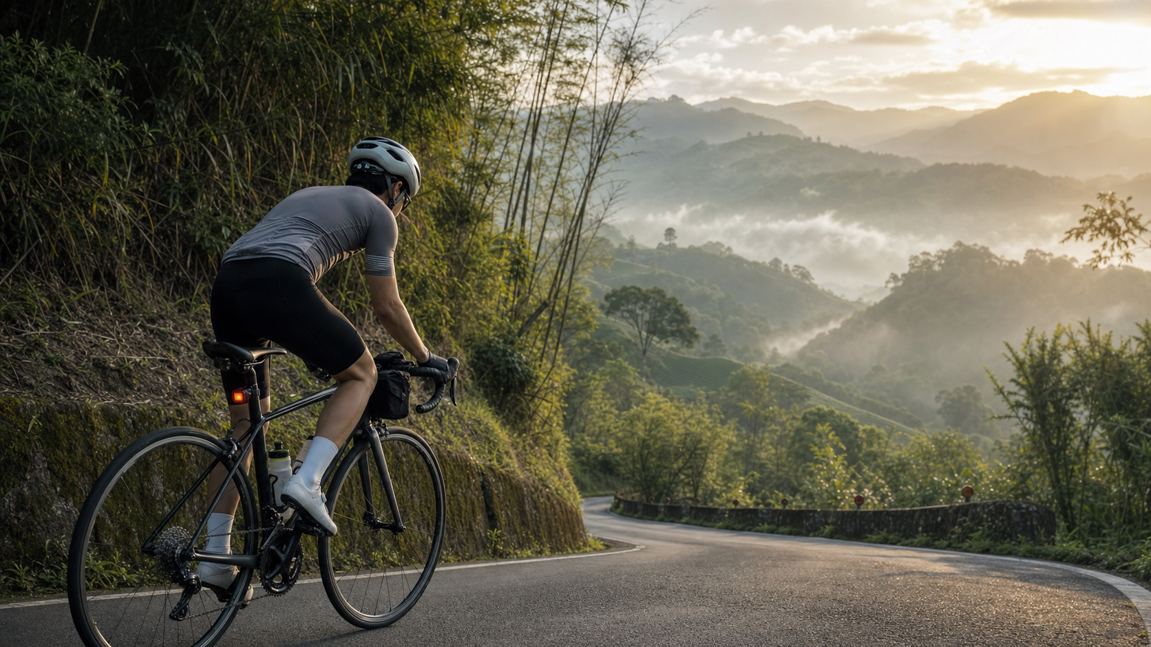
First Attempt on Alishan Highway: A 74km Climb from Zero to the Summit
Introduction
When it comes to road climbs in Taiwan, most people think of Wuling. But Alishan Highway (Provincial Highway 18) is the “home mountain” for many cyclists in central and southern Taiwan. Starting from Chiayi City, the road winds upward along Provincial Highway 18 for 74 kilometers, ending at the Alishan National Forest Recreation Area at an elevation of 2,216 meters, with a total elevation gain of approximately 2,200 meters.
Unlike Wuling’s high altitude and thin air, the challenge of Alishan Highway lies in its “length” and “consistency of gradient”—there is almost no true flat ground. From 20 kilometers after leaving Chiayi, the gradient steadily holds at 5–8%, testing endurance rather than explosive power.
Preparation Before Departure
Alishan Highway was my second “100km-class climb” (the first was Taipingshan), but it is longer and more sustained, requiring more meticulous preparation:
Equipment Checklist:
| Equipment Item | Specification/Brand | Reason for Choice |
|---|---|---|
| Road bike gearing | 50/34 chainrings, 11-32T cassette | Ensures I won’t be unable to turn the pedals at low speeds due to too-large gear ratios |
| Feed bag | Three-compartment top tube bag | Convenient access to supplies without interrupting pedaling |
| Front and rear lights | 600 lumens front, red rear light | Sections in the mountains are dim, especially inside tunnels |
| Clothing | Windbreaker jacket + short-sleeve jersey | Summit temperature may be 15 degrees lower than at the start |
| Spare items | 2 spare tubes, patch kit, tool set | Repair shops are far away in the mountains |
Training Foundation:
Two months before departure, I completed:
- A weekly long climb training session on Guanyinshan (northern Taiwan) to build climbing endurance
- A simulation ride on Taipingshan to master the fueling rhythm for long-distance climbs
- Core strength training to address lower back fatigue from prolonged bent-over riding
Departure: Early Morning in Chiayi City
I chose to start from Chiayi Railway Station—the most traditional starting point and the reference point for calculating the “full 74km.” At 5:30 in the morning, just as dawn broke, the morning market vendors in Chiayi City were preparing to open. At a soy milk shop, I ate rice porridge with youtiao, topped up on carbohydrates, and set off.
First Section (0–25km, Chiayi City to Zhuqi):
This section is mostly flat, passing through Chiayi County’s agricultural areas, with rice paddies and bamboo groves along the way. I deliberately kept my power low, holding my heart rate below 135bpm, and made my first refueling stop in Zhuqi Township.
Zhuqi is the last full resupply point before entering the mountains. Here I topped up water, bananas, and energy bars, and also adjusted my saddle height (I had been a bit nervous setting off in the morning and forgot to check it before leaving).
Middle Section (25–50km, Zhuqi to Shizhuo):
This is the section of the entire ride that feels most like “climbing.” The gradient holds steady at 6–8%, with the road alternating between cliff faces and river valleys. Occasional short descents give the legs a breather, but it quickly returns to climbing.
At Fenchihu (around the 40km mark), I made the longest stop of the entire ride. Fenchihu is a famous resupply point on Alishan Highway, known for its railway bento boxes and various snacks, and it also serves as a “psychological waypoint” for many cyclists. I ate a bento box, replenished with electrolyte drinks, and rested my legs for 20 minutes.
Final Section (50–74km, Shizhuo to Alishan):
The final 24 kilometers are the toughest part of the entire ride. The average gradient rises to 8–10%, and with increasing altitude and slightly thinner air, every pedal stroke demands more willpower.
On this section, I hit my first “wall.” Around the 62km mark, my legs suddenly felt numb, and the power in my pedaling seemed to “disappear.” This was a sign of glycogen depletion. I immediately stopped, ate an energy gel, and waited in place for about 8 minutes to let the sugar enter my bloodstream before continuing.
How to Handle Hitting the Wall:
- Stop immediately; don’t try to push through
- Quickly consume high-GI carbohydrates (gel, banana, sugar water)
- Wait 5–10 minutes for energy to recover
- Lower target power by 10–15% and finish the remaining distance at a more conservative pace
Reaching the Summit: The Calm of Alishan
The moment I entered the Alishan National Forest Recreation Area, I had been on the bike for nearly seven hours. Mist drifted through the forest, and the air was damp and cool—a world apart from the heat of the Chiayi plains.
I stopped my bike in front of the entrance plaza. There was no special ceremony—I just quietly drank a bottle of water and felt the weight in my legs. That fatigue was sweet—not because I was particularly fast, but because I had truly, completely finished.
Practical Tips
- Alishan admission tickets must be purchased separately (there are discounts for cyclists; check online)
- Temperatures drop sharply after ascending; warm clothing is essential
- Some sections of Provincial Highway 18 see frequent tour bus traffic; ride on the right and stay safe
- For the descent, taking the shuttle bus is recommended—long continuous downhill sections put enormous stress on rim brakes
- Fenchihu’s railway bento box is a local specialty; a stop there is highly recommended
Conclusion
The 74 kilometers of Alishan Highway is a journey that teaches you “humility.” No matter how hard you try, the mountain simply sits there quietly waiting for you. All you can do is be the best version of yourself and accept every imperfection along the way.
The version of me who hit the wall at the 62km mark and stopped on the mountainside to wait for my strength to return—that version isn’t embarrassing. That is the truest face of climbing.
Related Reading
- Alishan Highway Cycling Challenge: Climbing Guide from Chiayi to Alishan
- Alishan Highway (Provincial Highway 18) Riding Guide: The Pilgrimage Road from Chiayi to Alishan
- Chiayi Alishan Highway (Provincial Highway 18): The Climbing Challenge from the Plains to the Clouds
- Alishan Highway Challenge Plan: 11% Average Gradient Training from Chiayi to Alishan
梅山36彎 奮起湖 單車挑戰 下集 #公路車
6 年前
公路車 | 塔塔加驚險員工旅遊 | 還好手腳快沒被抓交替!
5 年前
一定要騎一次!阿里山最深處:里佳部落!單車旅行 | 2800m爬升 | 深度部落體驗:嗨翻晚會、螢火蟲、銀河 | feat. JJSC & 廢物伙伴 | 公路車 CT Yeh
10 個月前
半日 小台灣 極限單車路線挑戰實錄
7 年前
阿里山塔塔加 兩倍特濃版!全新隧道開通! 進喔!公路車 | CT Yeh
3 年前
梅山36彎 奮起湖 #公路車 之旅 2400m
6 年前
那瑪夏x茶山 阿里山系深山單車行 Day2 累積爬升6000M | 🥶超陡連續下坡 整路看隊友刷 | 爬升一座西進武嶺 | JJSC | 公路車 | CT Yeh
3 年前
太平山單車員工旅遊 | 這樣玩CP值最高!| 公路車
5 年前