Reaching the Highest Point on Taiwan’s Roads
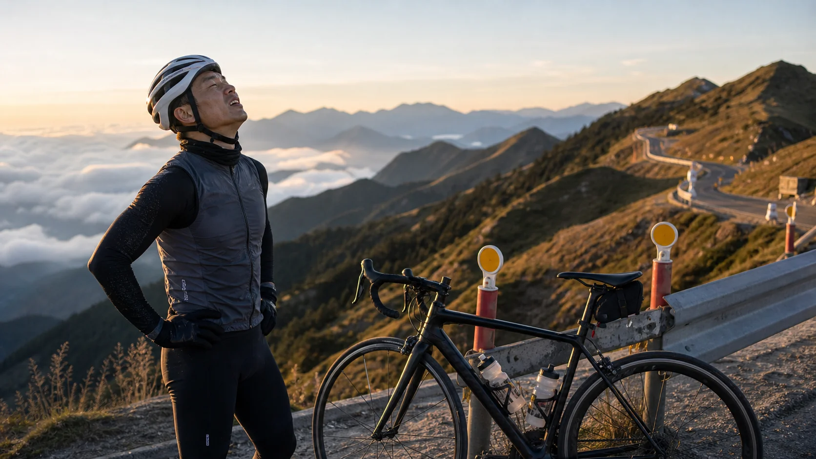
Wuling, at 3,275 meters above sea level, is the highest point reachable by road in Taiwan, and a pilgrimage site in the hearts of countless road cyclists. I first heard about the Wuling climb challenge while chatting with veteran riders at a bike shop. At the time, I had only been cycling for six months, and the moment I heard that number, only one thought crossed my mind: “I’ll probably never be able to do this in my lifetime.”
However, once a seed is planted, it’s hard to keep it from sprouting.
Three Months of Preparation: From Flatland Rider to Climbing Novice
After deciding to take on Wuling, I began systematically adjusting my training. My original training focused on flat cruising, averaging two to three rides per week, each about 50 to 80 kilometers. To tackle Wuling’s nearly 2,700 meters of cumulative climbing, I had to shift my focus to climbing training.
For the first two months, I moved my riding routes to the mountains of New Taipei City, repeatedly practicing routes from Tucheng to Sanxia’s Dabao River and Wulai’s Xiaoyi. I scheduled at least two climbing sessions per week, progressing from aerobic climbing (Z2) to near-anaerobic sprint efforts (Z4/Z5). I also began logging power data, trying to identify my critical power during climbs.
In the third month, I took the high-speed rail south and rode the Alishan Highway as a simulation. Although the gradient differed slightly from Wuling, that roughly 3,000-meter climb gave me a more realistic sense of long-distance climbing. On the way back, I was both exhausted and exhilarated—turns out the body can endure these sustained two-plus-hour climbs.
Gear Adjustments: Weight Reduction and Gearing Considerations
Besides fitness, the most direct preparation for climbing Wuling is equipment. I swapped my rear cassette from 11-28 to 11-32, giving me easier gears for climbing. A friend suggested I borrow a carbon fiber climbing bike, but I decided to stick with my usual aluminum bike because I wanted to know my true condition rather than relying on equipment to get me through.
I also planned my supplies in detail:
- Two bottle cages, each carrying 750ml of electrolyte drink
- A backpack with three energy bars, two packs of salt tablets, and a lightweight windbreaker
- Offline maps downloaded on my phone for the Wuling section
Departure Day: The Agony from Puli to Yuanfeng
At 4:30 AM on challenge day, I set off from Puli. In the darkness, the streetlights cast a dim glow, and there was almost no traffic on the road. Two riding buddies and I started together, planning to climb at a steady aerobic pace—not seeking speed, only completion.
The initial section of Provincial Highway 14A had a gentle gradient and rode smoothly. After passing Cingjing Farm, the gradient began to steepen, and the scenery gradually shifted from resort clusters to alpine grasslands. Sunrise happened to cast golden light across the emerald slopes at just that moment, making me forget the burning sensation in my legs.
After Kunyang, the elevation exceeded 3,000 meters, and the air began to thin. I could clearly feel my breathing wasn’t as smooth as at lower altitudes, and my pedaling power was being consumed faster than expected. That’s when the little voice in my head started: “How about stopping here? Kunyang counts as high mountain too, right?”
I chose to ignore it and kept pedaling.
Reaching the Summit: Tears Welled Up
The moment the Wuling archway appeared in my sight, I almost thought I was dreaming.
The entire climb took about three hours and twenty minutes. My legs were shaking, but I still jumped off the bike and ran toward the stone monument engraved with “Wuling,” holding my handlebars with both hands as a companion snapped a photo. In the picture, I’m smiling awkwardly with red-rimmed eyes, but it’s one of the proudest smiles of my life.
Standing at 3,275 meters, surrounded by layered mountain ridges, the wind howled fiercely and the temperature was only 12 degrees Celsius, but I didn’t feel cold at all. That tangible sense of “I really did it” surged from the soles of my feet up to my chest—indescribable.
A Few Tips for First-Time Wuling Challengers
- Don’t underestimate the elevation gain: Wuling’s challenge isn’t any single section’s gradient, but the cumulative toll sustained over four to five hours.
- Take altitude sickness seriously: Some people experience dizziness and nausea above 3,000 meters; it’s recommended to stay overnight in Cingjing the day before to acclimatize.
- Be proactive with fueling: Don’t wait until you’re hungry to eat; replenish every 45 minutes to maintain steady energy.
- The descent is more dangerous than the climb: Descending from Wuling can easily exceed 60 km/h; make sure your brakes are in good condition and wear protective gear.
Wuling changed how I see myself. It’s not just a mountain—it’s a mirror, reflecting how much I’m willing to give for the things I believe in.
Related Reading
- First Wuling Challenge: A Transformative Journey from Sea Level to 3,275 Meters
- First Wuling Challenge: The Complete Mental Journey from Shaking Legs to Standing on Taiwan’s Rooftop
- First Wuling Challenge: A Beginner’s Race Preparation Journey and On-Site Report
- Wuling Climbing Guide: Challenge Strategies and Fueling Plans for Taiwan’s Highest Highway
#北橫 + #北進武嶺 最硬的員工旅遊 EP1 | #公路車 #拉拉山 | 明池 | 武嶺 | 武陵農場 | 雲海 | Taiwan Cycling Route Wulin
6 年前
FTL 與 SYB 車隊專訪 西進武嶺 實用攻略分享! 2小時 如何練?!你不知道的眉角!新手準備武嶺必看 EP1 | 實力派女車友 | 精華版 | 公路車 | CTYeh
4 年前
大禹嶺 到 武嶺牌樓 全程前後實況錄影 | 北進武嶺 | 東進武嶺 | KOM | 訓練台 | 坡度分析 | Taiwan KOM Last 10 km HARD | 公路車
6 年前
#公路車 #西進武嶺 配速配瓦實驗 坡度分析 四小時內攻略 建大盃 NeverStop #西進武嶺攻略
6 年前
西進武嶺 世界紀錄挑戰!破2:30 ?!一群人推著一個夢上山 直播精華版 / ft. 張翰允 & 台視主播魏于恬 & KPLUS / #cycling 公路車 CT Yeh
2 個月前
日本公路最高登山賽,台灣首位YT挑戰實錄,乘鞍登山賽40週年,賽前篇完整版,請到我的YT收看 #公路車 #cycling
10 個月前
台灣登山王之路 KOM 全程參賽4K臨空錄影 PART1 穿越峽谷地形! #東進武嶺 太魯閣 / 燕子口 / 天祥 / 西寶 PART1 (公路車 / CT Yeh)
3 年前
風櫃嘴時間 預測西進武嶺時間?13000名車友統計數據分析告訴你 !
5 年前